Ireland Map with Counties
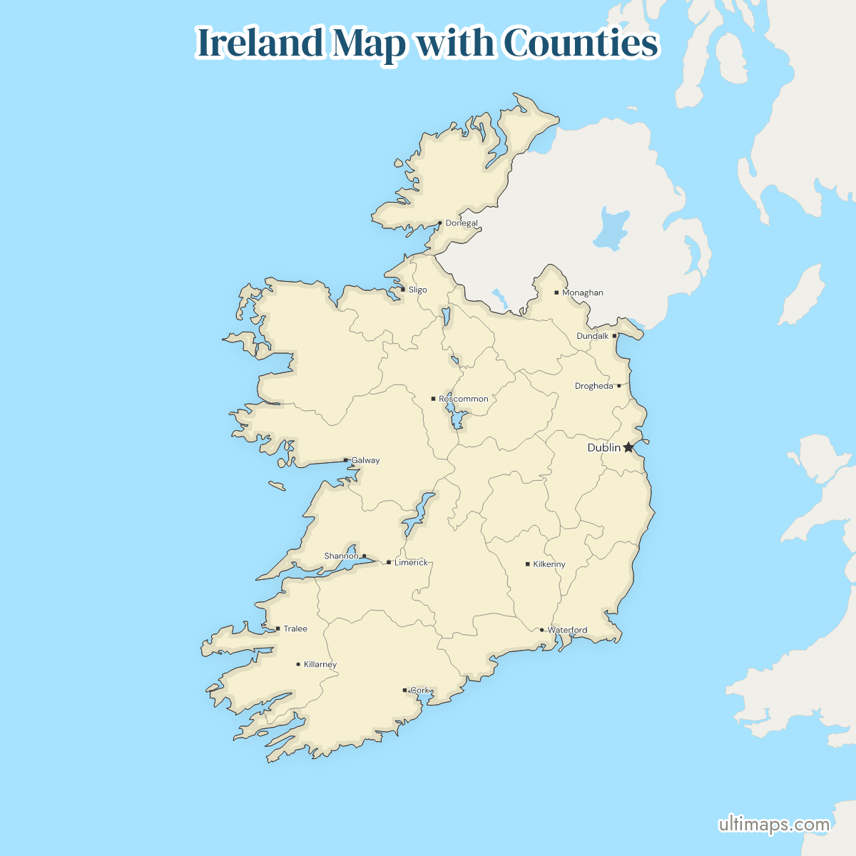
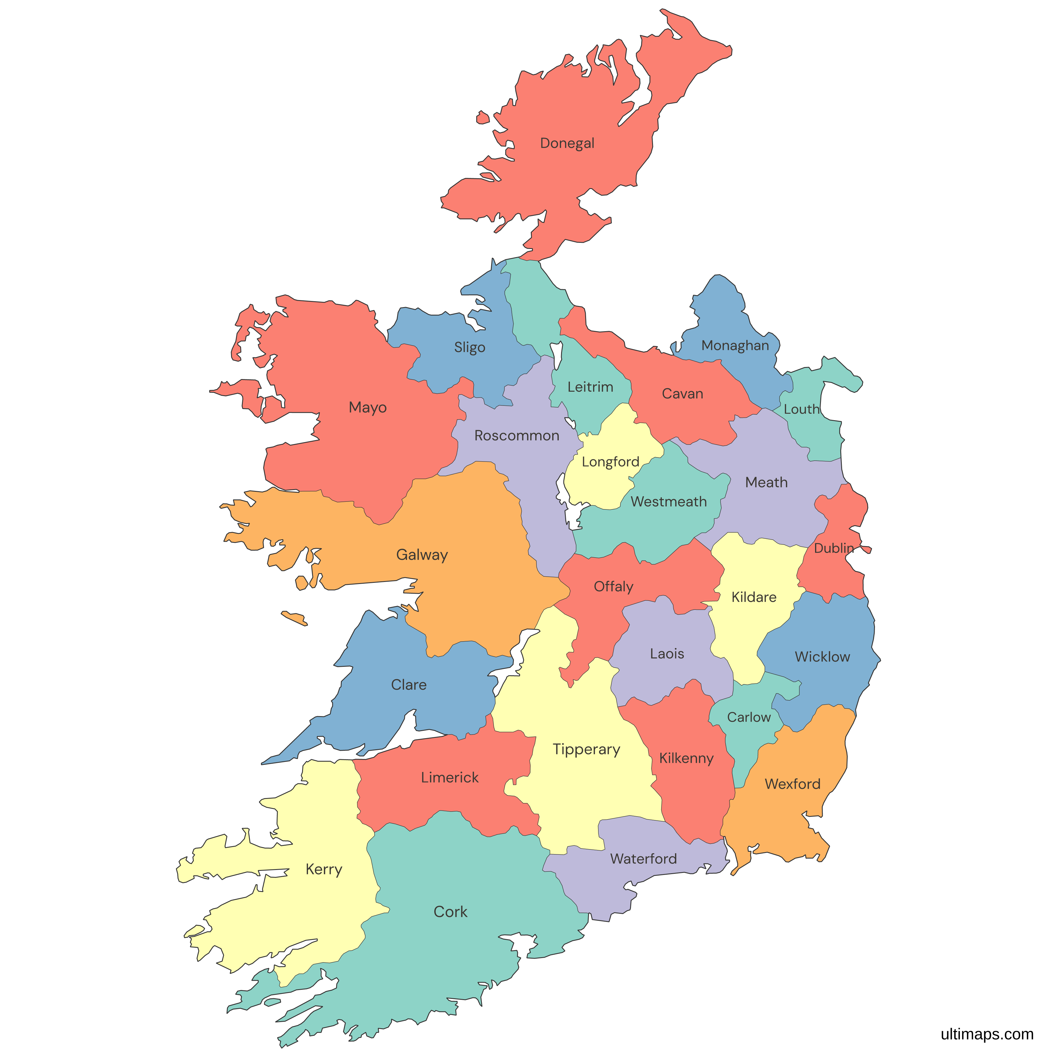
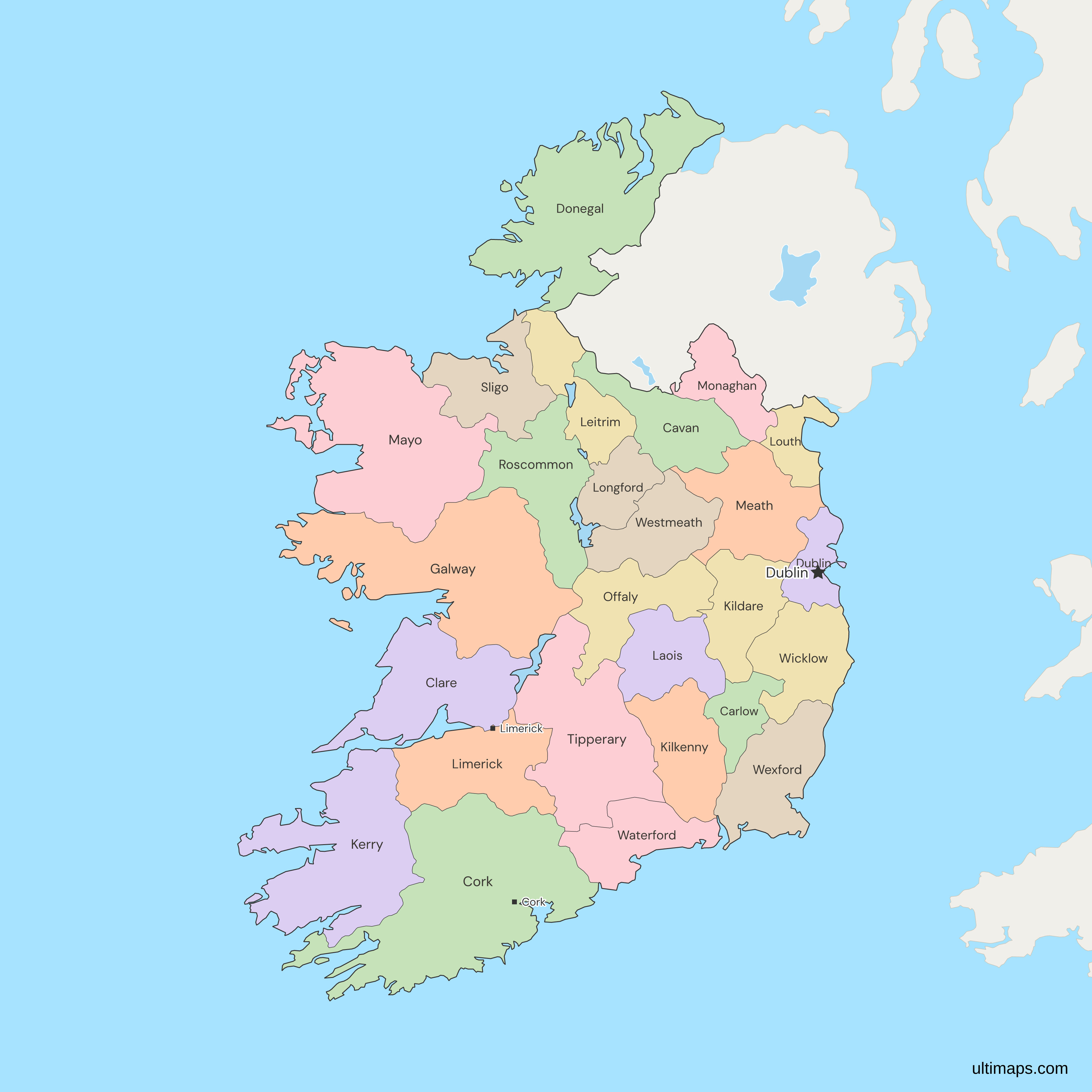
This map of Ireland shows all 26 counties, which together make up the Republic of Ireland. The island's other six counties, Antrim, Armagh, Down, Fermanagh, Londonderry and Tyrone, form Northern Ireland, which is part of the United Kingdom and appears here as one gray area.
The map follows the counties, not the 31 councils that have run local government since the Local Government Reform Act 2014. Four of those councils, Dublin City, Fingal, South Dublin and Dún Laoghaire–Rathdown, share County Dublin, which the map draws as one unit. The county had 1,458,154 people at the 2022 census (CSO), and its city, Dublin, is the national capital.
Open the map in the free Ultimaps editor to make your own custom map of Ireland. You can color the counties by your data, add pins and labels, and share or embed the finished map.
Interactive Ireland Map with Counties
List of Counties (26)
| # | County | Capital | Population (2022) | Area (km², 2022) |
|---|---|---|---|---|
| 1 | Carlow | Carlow | 61,968 | 896 |
| 2 | Cavan | Cavan | 81,704 | 1,931.20 |
| 3 | Clare | Ennis | 127,938 | 3,448.60 |
| 4 | Cork | Cork | 584,156 | 7,501 |
| 5 | Donegal | Lifford | 167,084 | 4,861.40 |
| 6 | Dublin | Dublin | 1,458,154 | 925.60 |
| 7 | Galway | Galway | 277,737 | 6,148.80 |
| 8 | Kerry | Tralee | 156,458 | 4,805.40 |
| 9 | Kildare | Naas | 247,774 | 1,694.40 |
| 10 | Kilkenny | Kilkenny | 104,160 | 2,071.30 |
| 11 | Laois | Portlaoise | 91,877 | 1719 |
| 12 | Leitrim | Carrick-on-Shannon | 35,199 | 1,587.70 |
| 13 | Limerick | Limerick | 209,536 | 2,755.20 |
| 14 | Longford | Longford | 46,751 | 1091 |
| 15 | Louth | Dundalk | 139,703 | 826.70 |
| 16 | Mayo | Castlebar | 137,970 | 5,587.60 |
| 17 | Meath | Navan | 220,826 | 2,342.10 |
| 18 | Monaghan | Monaghan | 65,288 | 1,293.80 |
| 19 | Offaly | Tullamore | 83,150 | 2000 |
| 20 | Roscommon | Roscommon | 70,259 | 2,546.70 |
| 21 | Sligo | Sligo | 70,198 | 1,836.40 |
| 22 | Tipperary | Clonmel and Nenagh | 167,895 | 4,303.30 |
| 23 | Waterford | Waterford | 127,363 | 1,857.80 |
| 24 | Westmeath | Mullingar | 96,221 | 1,838.10 |
| 25 | Wexford | Wexford | 163,919 | 2,369.80 |
| 26 | Wicklow | Wicklow | 155,851 | 2,025.50 |
Data sources:
- Capital: Electoral Commission (Ireland), Local Authority Contact Details (February 2024). License: facts compiled by Ultimaps, CC BY 4.0.
- Population: CSO, Census of Population 2022, table F1001. License: CC BY 4.0.
- Area: CSO, Census of Population 2022, table F1011 (electoral divisions summed to counties by Ultimaps). License: CC BY 4.0.
Ireland Counties: Key Facts
- Number of counties: 26, all of them traditional counties of the Republic of Ireland. The island of Ireland has 32, and the other 6 are in Northern Ireland.
- Capital: Dublin, in County Dublin, the most populous county.
- Largest and smallest by area: Cork is the largest at 7,501 km², ahead of Galway (6,149 km²) and Mayo (5,588 km²). At the other end, Louth has 827 km², Carlow 896 km² and Dublin 926 km². These are CSO areas from Census 2022.
- Most and least populous: at the April 2022 census Dublin had 1,458,154 people and Cork 584,156 (CSO). Leitrim, with 35,199, and Longford, with 46,751, have the smallest populations. Together the 26 counties had 5,149,139 people.
- Borders: Ireland's only land border is with the United Kingdom, at Northern Ireland. Five counties touch it: Donegal, Leitrim, Cavan, Monaghan and Louth.
- Coast: 14 counties face the open sea, and Leitrim and Meath have the shortest coasts. Limerick and Kilkenny border the tidal Shannon and Suir and have no exposed coast. The other 10 counties have no coast: Carlow, Cavan, Kildare, Laois, Longford, Monaghan, Offaly, Roscommon, Tipperary and Westmeath.
- Lakes and rivers: inside the 26 counties, the map shows one river, the Shannon, and four of its lakes. Lough Derg touches Clare, Galway and Tipperary. Lough Ree touches Longford, Roscommon and Westmeath. Lough Allen lies mostly in Leitrim, and the smaller Loughs Boderg and Bofin, drawn as one lake, are on the Leitrim–Roscommon line.
- Provinces: the counties belong to 4 traditional provinces: Leinster (12 counties), Munster (6), Connacht (5) and Ulster (3 on this map, of its 9).
- Local government: the Local Government Reform Act 2014 merged North and South Tipperary and the city and county councils of Limerick and Waterford, and abolished the town and borough councils, leaving 31 councils. There are 26 county councils, 3 city councils (Dublin, Cork and Galway) and 2 city and county councils (Limerick and Waterford), and each lies inside one county.
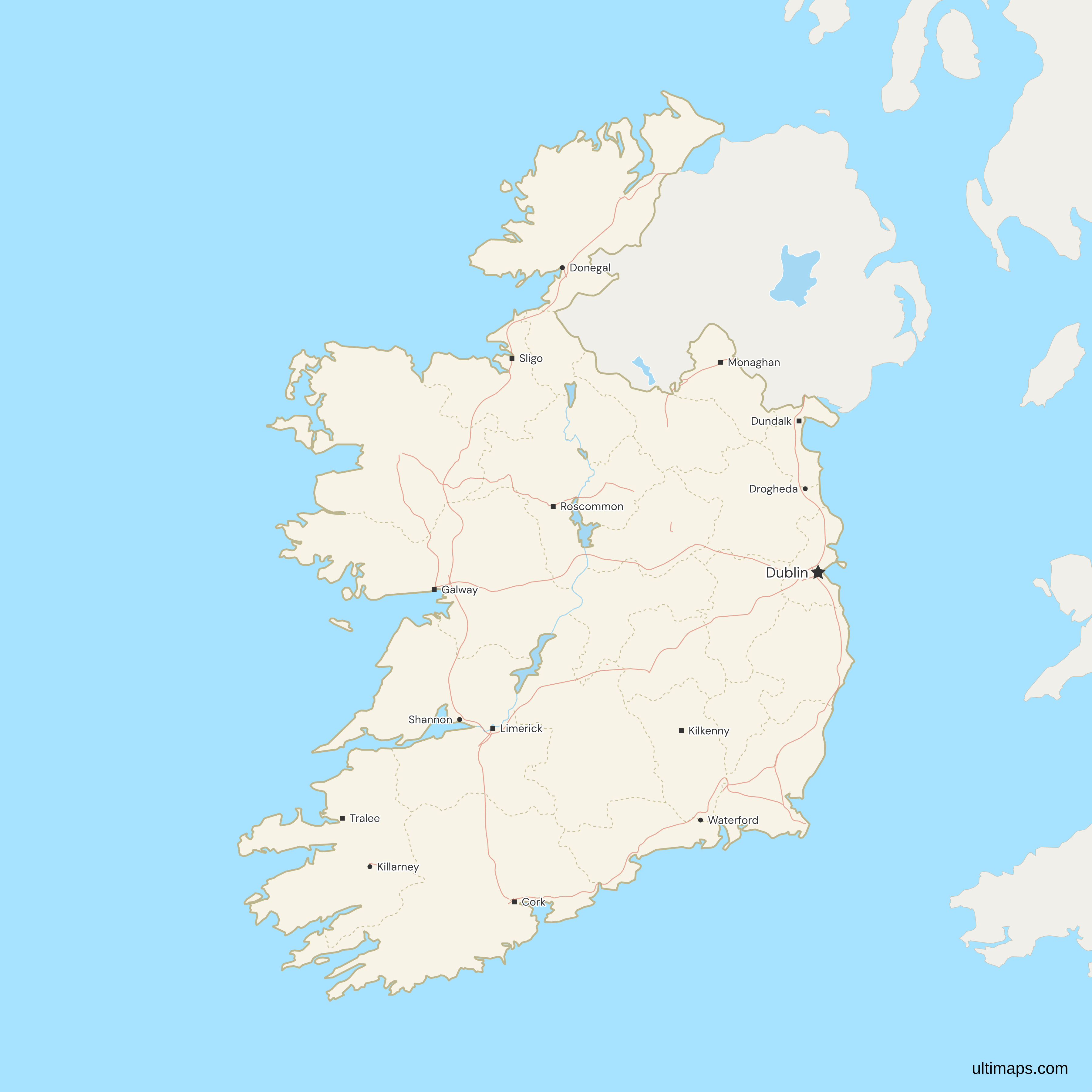
- County towns: most county councils are based in the county town, such as Ennis (Clare), Castlebar (Mayo) and Lifford (Donegal, although Letterkenny is larger). Tipperary's council is split between Clonmel and Nenagh. The map marks 15 towns: Dublin, with a star, and Cork, Limerick, Galway, Waterford, Dundalk, Drogheda, Tralee, Kilkenny, Sligo, Killarney, Shannon, Monaghan, Roscommon and Donegal town.
- Last boundary change: January 1977, when part of Drogheda's urban area that lay in Meath, south of the Boyne, was transferred to Louth. The 2014 Act, the boundary reviews of 2016–17 and the 2019 extension of Cork City left every county line where it was.
- Codes: ISO 3166-2:IE builds each county's code from letters of its name, such as IE-KY for Kerry and IE-WX for Wexford. Dublin is IE-D and Galway IE-G. Cork moved from IE-C to IE-CO in 2011, and IE-C now stands for Connacht.
Interesting Facts
- Tipperary: North Tipperary and South Tipperary had separate county councils until 2014. The map draws one Tipperary, the traditional county that both councils covered.
- Drogheda: the map's simplified Louth–Meath line follows the Boyne, so the map draws about 6 km² of Louth in Meath. That piece, south of the river, is part of Drogheda and is in Louth. The town's marker sits in it.
- Islands: six offshore islands are drawn: Achill (Mayo), Inis Mór and Gorumna (Galway), Valentia (Kerry), Arranmore (Donegal) and Bere Island (Cork).
- Names: Irish names match, most with or without the síneadh fada (Corcaigh, Dún na nGall), and so do the old names Queen's County (Laois) and King's County (Offaly). The map's name list leaves out council names such as Fingal.
Free Downloads
Free for personal and commercial use with a credit to Ultimaps. See the license terms for details.
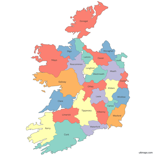 Colored Ireland Map with Countiespng665 KB
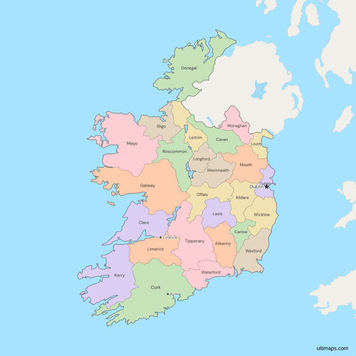 Political Map of Ireland with Countiespng727 KB
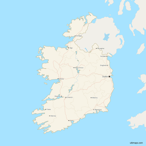 Map of Ireland with Cities and Roadspng748 KB
Need it without colors? The blank version of this map comes as a print-ready PDF (A4 and US Letter), a PNG and an editable SVG.
Custom Map Features
This map supports labels.
This map supports surrounding areas, roads, rivers and cities. New
This map is divided into 26 counties.
Updates
Nov 5, 2026:
- Added map of Ireland counties
Frequently Asked Questions
The Republic of Ireland has 26 counties. On the island as a whole there are 32: these 26 and the six counties of Northern Ireland, in the United Kingdom. The split into 26 and 6 dates from partition. Northern Ireland was formed from the six in 1921, and the other 26 became the Irish Free State in 1922, the forerunner of today's Republic. In alphabetical order, the 26 on this map are Carlow, Cavan, Clare, Cork, Donegal, Dublin, Galway, Kerry, Kildare, Kilkenny, Laois, Leitrim, Limerick, Longford, Louth, Mayo, Meath, Monaghan, Offaly, Roscommon, Sligo, Tipperary, Waterford, Westmeath, Wexford and Wicklow.
The four provinces of Ireland are Leinster, Munster, Connacht and Ulster. They are a traditional grouping with no administrative role, and the map draws no separate province boundaries. To make a provinces map, color each county by its province. Leinster has 12 counties: Carlow, Dublin, Kildare, Kilkenny, Laois, Longford, Louth, Meath, Offaly, Westmeath, Wexford and Wicklow. Munster has 6: Clare, Cork, Kerry, Limerick, Tipperary and Waterford. Connacht has 5: Galway, Leitrim, Mayo, Roscommon and Sligo. Ulster crosses the border. Of its nine counties, only Cavan, Donegal and Monaghan are on this map, and the other six make up Northern Ireland.
Yes, but only as one gray area with no internal lines, because Northern Ireland is part of the United Kingdom. The map's 26 counties are all in the Republic of Ireland. Northern Ireland's own six counties are Antrim, Armagh, Down, Fermanagh, Londonderry (Derry) and Tyrone, but the UK county maps divide it by districts instead. The UK counties map divides Northern Ireland into its district council areas from before 2015. The UK counties and Crown Dependencies map uses the 11 districts in place since 2015. The British Isles map draws Ireland as one unit beside Northern Ireland, Great Britain's nations and the Crown Dependencies.
No, the Republic of Ireland has no states. It is divided into 26 counties, the units on this map, and the counties are grouped into four traditional provinces, Leinster, Munster, Connacht and Ulster, which have no administrative role. Ireland's official regions, used for planning and EU statistics, are Northern and Western, Southern, and Eastern and Midland. Each is made up of whole counties and has a regional assembly. The three assemblies date from 1 January 2015, and they took over the work of eight regional authorities abolished in 2014.
Cork is the largest county in Ireland, with an area of 7,501 km² (CSO, Census 2022). Galway, at 6,149 km², and Mayo, at 5,588 km², come next. Every county in Northern Ireland is less than half Cork's size, so the answer is the same for the island's 32 counties. Cork is also the second most populous county, with 584,156 people in 2022, after Dublin. On this map County Cork is one unit, Cork city included, although two councils share it.
Louth is the smallest county in Ireland, with an area of 827 km² (CSO, Census 2022). Carlow is the next smallest, at 896 km². Louth is also the smallest of the island's 32 counties, because Armagh, the smallest in Northern Ireland, is larger. Louth had 139,703 people in 2022, 12th of the 26 counties by population. At about 169 people per km², it is the most densely populated county after Dublin. In January 1977 it took over part of Drogheda's urban area south of the Boyne from Meath, and no county boundary in the Republic has moved since.
Dublin is the most populous county in Ireland, with 1,458,154 people at the census of 3 April 2022 (CSO). Its share of the State's 5,149,139 people is 28%. Dublin alone had more people than the next four counties put together: Cork, Galway, Kildare and Meath had 1,330,493 between them. By area it ranks 24th of the 26 counties, at 926 km², the third smallest. Dublin had about 41 times as many people as Leitrim, whose 35,199 was the smallest county population in 2022. Longford was second lowest, with 46,751.
Dublin is one county on this map because the map draws Ireland's 26 traditional counties, not its local councils. County Dublin has four councils: Dublin City, Fingal, South Dublin and Dún Laoghaire–Rathdown. The map does not split them, and its name list leaves out their names, because each covers only part of the county and its figures would otherwise be assigned to all of Dublin. To map council figures, add the four Dublin counts into one county total first. Rates and averages have to be worked out again from the totals, not added. The same applies in Cork and Galway, which each have a city council and a county council.
You can create a custom map of Ireland in the free Ultimaps editor, and you don't need an account to start. Open this map and color the 26 counties by hand, or import a table with a column of county names and a column of values. Names match in English or Irish and in forms such as Co. Kerry. You can also add pins and labels, then share the map by link or embed it on a website. Saving and publishing need a free account. A free export is a standard PNG with a small Ultimaps credit. High-resolution PNG, SVG and PDF exports come with Ultimaps Pro.