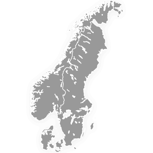
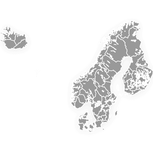
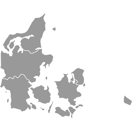
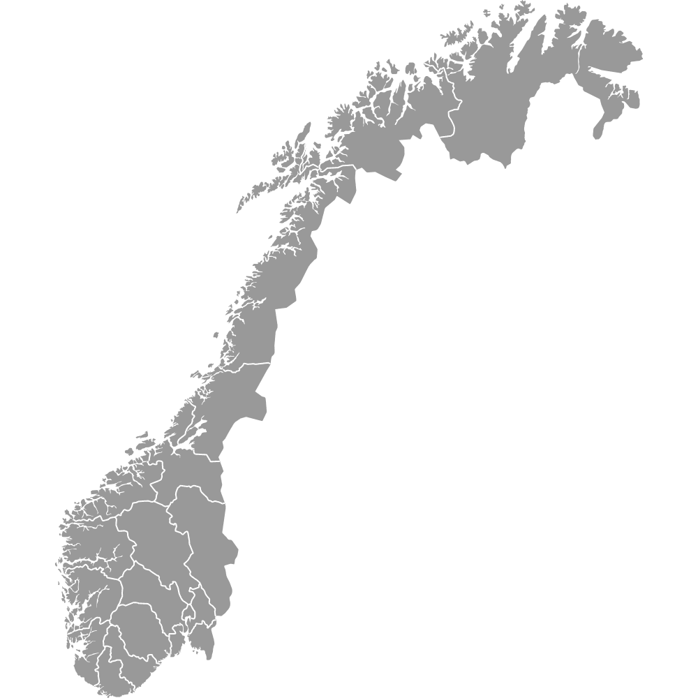
Scandinavia Map with Regions and Counties
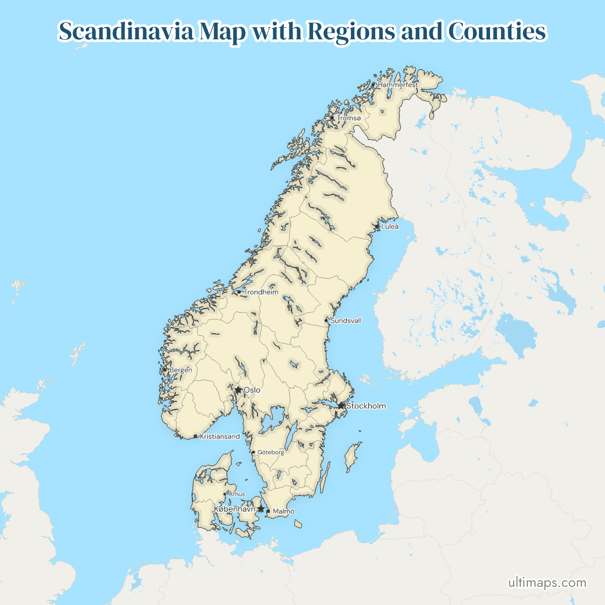
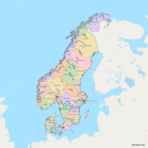
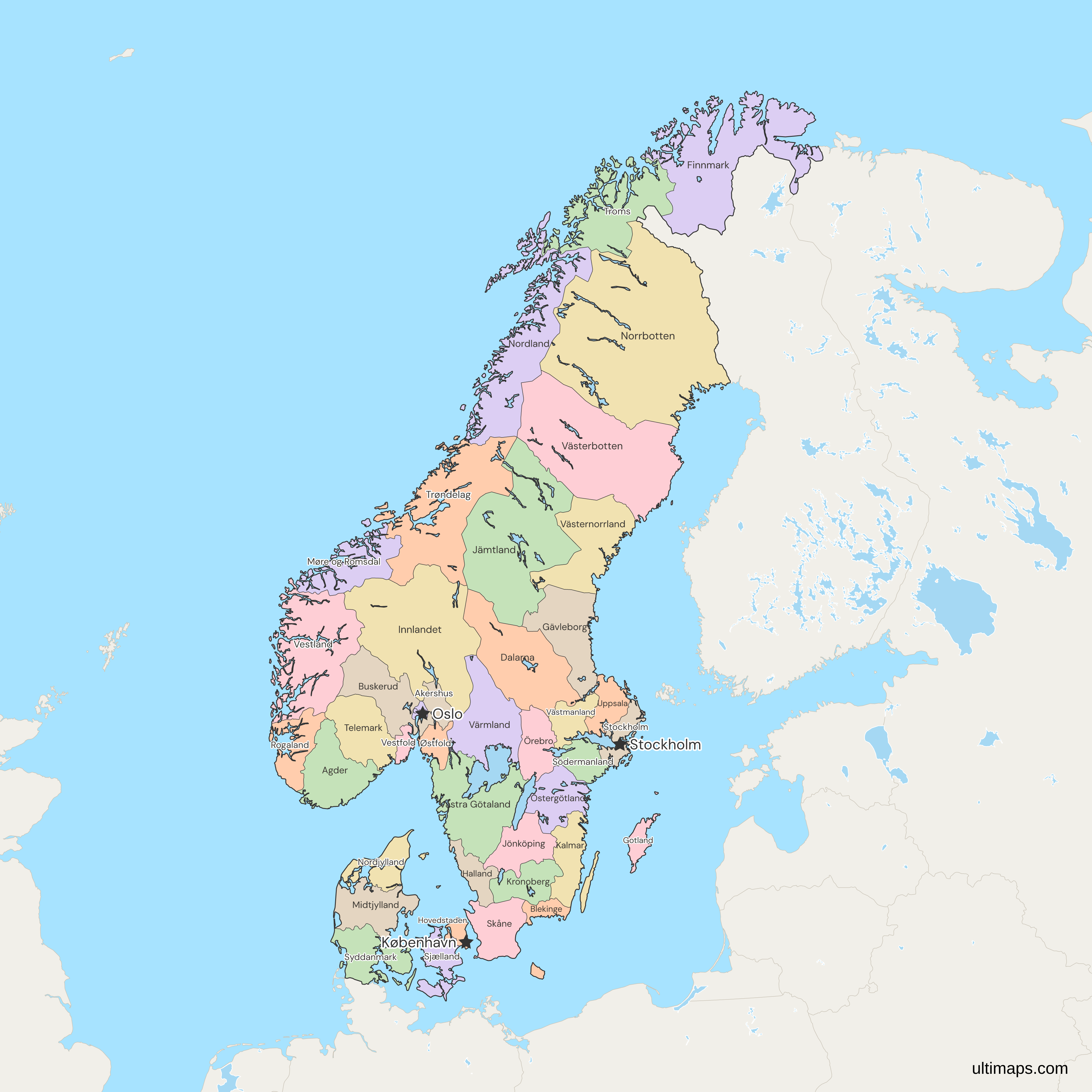
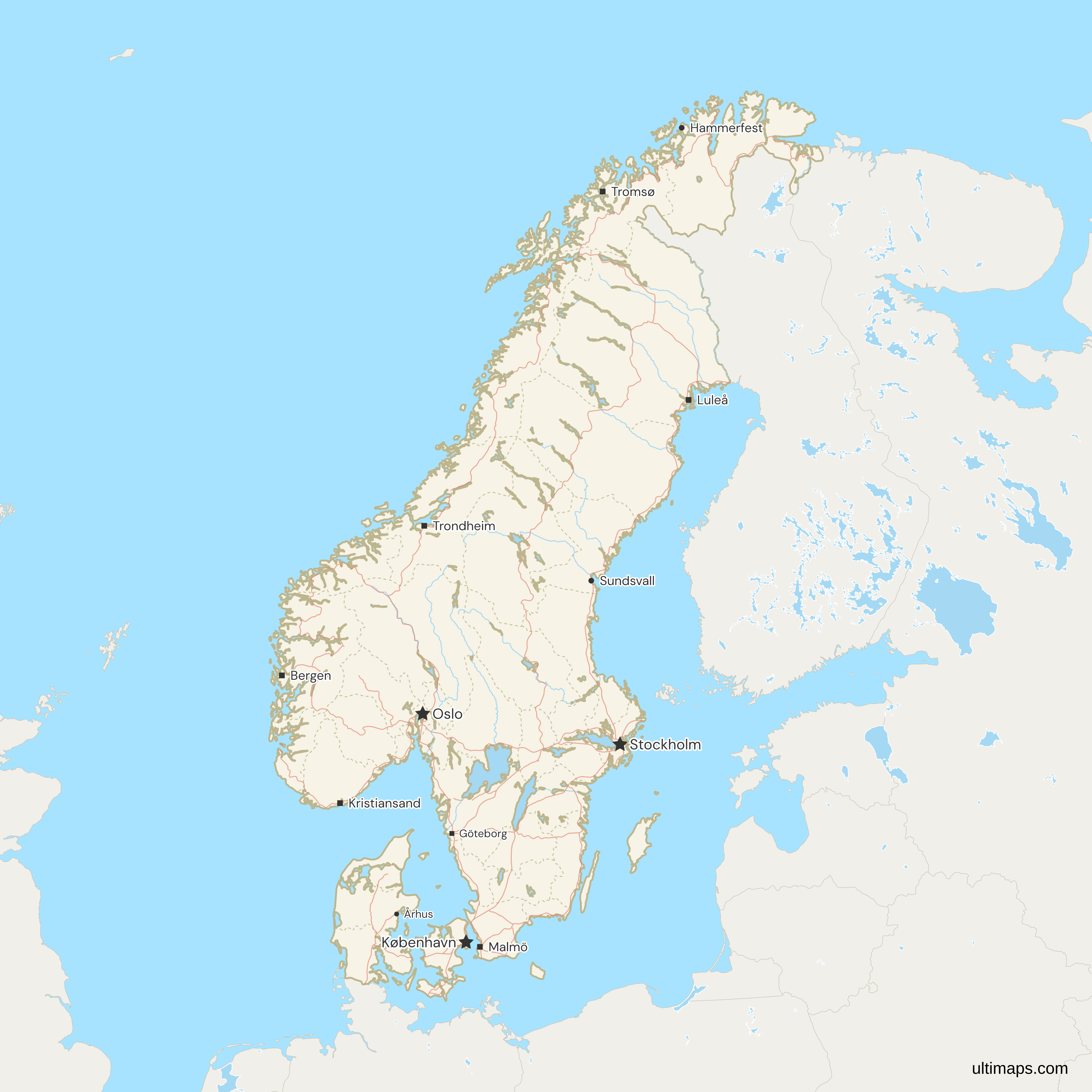
This map of Scandinavia shows all 41 regions and counties: 5 Danish regions, 15 Norwegian counties and 21 Swedish counties. The local names are regioner in Denmark, fylker in Norway and län in Sweden. Danish regions are much bigger than Norwegian or Swedish counties, with about 1.2 million people on average against 375,000 and 505,000 (national statistics offices, 2026). Finland, Iceland and the Faroe Islands appear only as grey context.
Click a unit to color it, or paste a table with one row per unit. Share the map by link or embed it.
Interactive Scandinavia Map with Regions and Counties
List of Regions/Counties (41)
| # | Region/County | Capital | Population (2026) | Land area (km²) |
|---|---|---|---|---|
| 1 | Agder | Kristiansand | 323,930 | 14,980.36 |
| 2 | Akershus | Oslo | 749,207 | 5,472.96 |
| 3 | Blekinge | Karlskrona | 156,616 | 2,942.90 |
| 4 | Buskerud | Drammen | 272,981 | 13,566.60 |
| 5 | Dalarna | Falun | 286,043 | 28,172.33 |
| 6 | Finnmark | Vadsø | 75,288 | 45,756.62 |
| 7 | Gävleborg | Gävle | 283,452 | 18,207.77 |
| 8 | Gotland | Visby | 60,852 | 3,150.20 |
| 9 | Halland | Halmstad | 346,090 | 5,450.85 |
| 10 | Hovedstaden | Hillerød | 1,947,212 | 2,435 |
| 11 | Innlandet | Hamar | 379,488 | 49,386.23 |
| 12 | Jämtland | Östersund | 132,736 | 49,205.47 |
| 13 | Jönköping | Jönköping | 369,722 | 10,480.23 |
| 14 | Kalmar | Kalmar | 245,477 | 11,206 |
| 15 | Kronoberg | Växjö | 203,121 | 8,457.96 |
| 16 | Midtjylland | Viborg | 1,383,261 | 12,767 |
| 17 | Møre og Romsdal | Molde | 273,169 | 13,837.26 |
| 18 | Nordjylland | Aalborg | 593,114 | 7,718 |
| 19 | Nordland | Bodø | 243,272 | 35,757.06 |
| 20 | Norrbotten | Luleå | 248,927 | 97,972.73 |
| 21 | Örebro | Örebro | 308,357 | 8,542.73 |
| 22 | Oslo | Oslo | 728,714 | 426.40 |
| 23 | Östergötland | Linköping | 472,529 | 10,603.05 |
| 24 | Østfold | Sarpsborg | 316,448 | 3,728.22 |
| 25 | Rogaland | Stavanger | 508,922 | 8,572.19 |
| 26 | Sjælland | Sorø | 858,102 | 7,077 |
| 27 | Skåne | Malmö | 1,433,083 | 11,006.76 |
| 28 | Södermanland | Nyköping | 300,440 | 6,096.70 |
| 29 | Stockholm | Stockholm | 2,486,251 | 6,547.93 |
| 30 | Syddanmark | Vejle | 1,243,914 | 11,990 |
| 31 | Telemark | Skien | 177,923 | 13,832.32 |
| 32 | Troms | Tromsø | 171,218 | 25,166.37 |
| 33 | Trøndelag | Steinkjer | 489,166 | 39,492.89 |
| 34 | Uppsala | Uppsala | 410,575 | 8,230.52 |
| 35 | Värmland | Karlstad | 283,037 | 17,613.35 |
| 36 | Västerbotten | Umeå | 279,028 | 55,012.96 |
| 37 | Västernorrland | Härnösand | 240,640 | 21,673.60 |
| 38 | Västmanland | Västerås | 280,756 | 5,141.05 |
| 39 | Västra Götaland | Göteborg | 1,777,803 | 23,914.09 |
| 40 | Vestfold | Tønsberg | 259,332 | 2,092.36 |
| 41 | Vestland | Bergen | 658,342 | 31,966.53 |
Data sources:
- Capital: Ultimaps, compiled from Regionsloven (DK), Enhetsregisteret (NO) and the Swedish county administrative boards. License: facts compiled by Ultimaps, CC BY 4.0.
- Population: Statistics Denmark (FOLK1A), Statistics Norway (07459) and Statistics Sweden (TAB5557), population at 1 January 2026. License: CC BY 4.0.
- Land area: Statistics Norway (09280), Statistics Sweden (MI0802) and Eurostat (reg_area3, Denmark's regions), land area. License: CC BY 4.0.
Scandinavia Regions and Counties: Key Facts
- Units per country: Denmark has 5 regions (Denmark regions map), Norway 15 counties (Norway counties map) and Sweden 21 counties (Sweden counties map). The total is 41.
- Norway's lines: The 15 counties are those of 1 January 2024, but the shapes follow older county lines in two places. Jevnaker and Lunner, in Akershus since 2024, still draw in Innlandet, and the former Hurum and Røyken, now part of Asker in Akershus, still draw in Buskerud. Join Akershus, Buskerud and Innlandet figures with that in mind.
- Largest by land area: Norrbotten in Sweden, with 97,973 km² (Statistics Sweden, 2026). Västerbotten in Sweden is second with 55,013 km², and Innlandet is the largest in Norway with 49,386 km² (Statistics Norway, 2026).
- Smallest by land area: Oslo in Norway, with 426.4 km² (Statistics Norway, 2026). Hovedstaden is the smallest Danish region with 2,435 km² (Eurostat, 2026).
- Most and least people: Stockholm in Sweden has 2,486,251 (Statistics Sweden, 2026) and Gotland in Sweden has 60,852 (Statistics Sweden, 2026). Hovedstaden is the largest Danish region with 1,947,212 (Statistics Denmark, 2026), and Finnmark is the least populous Norwegian county with 75,288 (Statistics Norway, 2026).
- Capitals: Stockholm lies in Stockholm county, Copenhagen in Hovedstaden and Oslo in Oslo, which is a county of its own. Stars mark the three capitals on the map.
- Borders: Syddanmark holds Denmark's only land border, with Germany. In the north, Troms and Finnmark in Norway and Norrbotten in Sweden face Finland, and Finnmark also faces Russia. The Norway-Sweden border is drawn like any county line.
- Lakes: Sixty-one large lakes are cut out of the shapes, so drawn county areas run up to 15% smaller than on the single-country maps, as for Västra Götaland. A value joined to a county is not affected.
- Pending change: On 1 January 2027 Denmark's regions drop from 5 to 4, and the map from 41 to 40 units. The FAQ below gives the detail.
Interesting Facts
- Norrbotten has about 2.5 people per km² of land and Stockholm county about 380 (Statistics Sweden, 2026).
- Denmark's five regions date from 2007 and Sweden's 21 counties from 1998, while Norway's 15 counties restore the pre-2020 split of Viken, Vestfold og Telemark and Troms og Finnmark.
- The codes of seven Norwegian counties are Statistics Norway numbers that ISO 3166-2 has not adopted, so a table joined on names is the safer match.
Free Downloads
Free for personal and commercial use with a credit to Ultimaps. See the license terms for details.
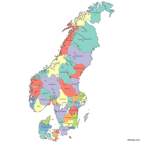 Colored Scandinavia Map with Regions and Countiespng1056 KB
 Political Map of Scandinavia with Regions and Countiespng1534 KB
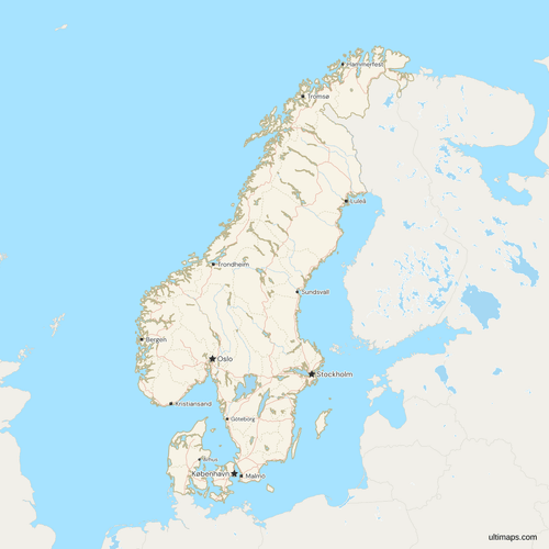 Map of Scandinavia with Cities and Roadspng1485 KB
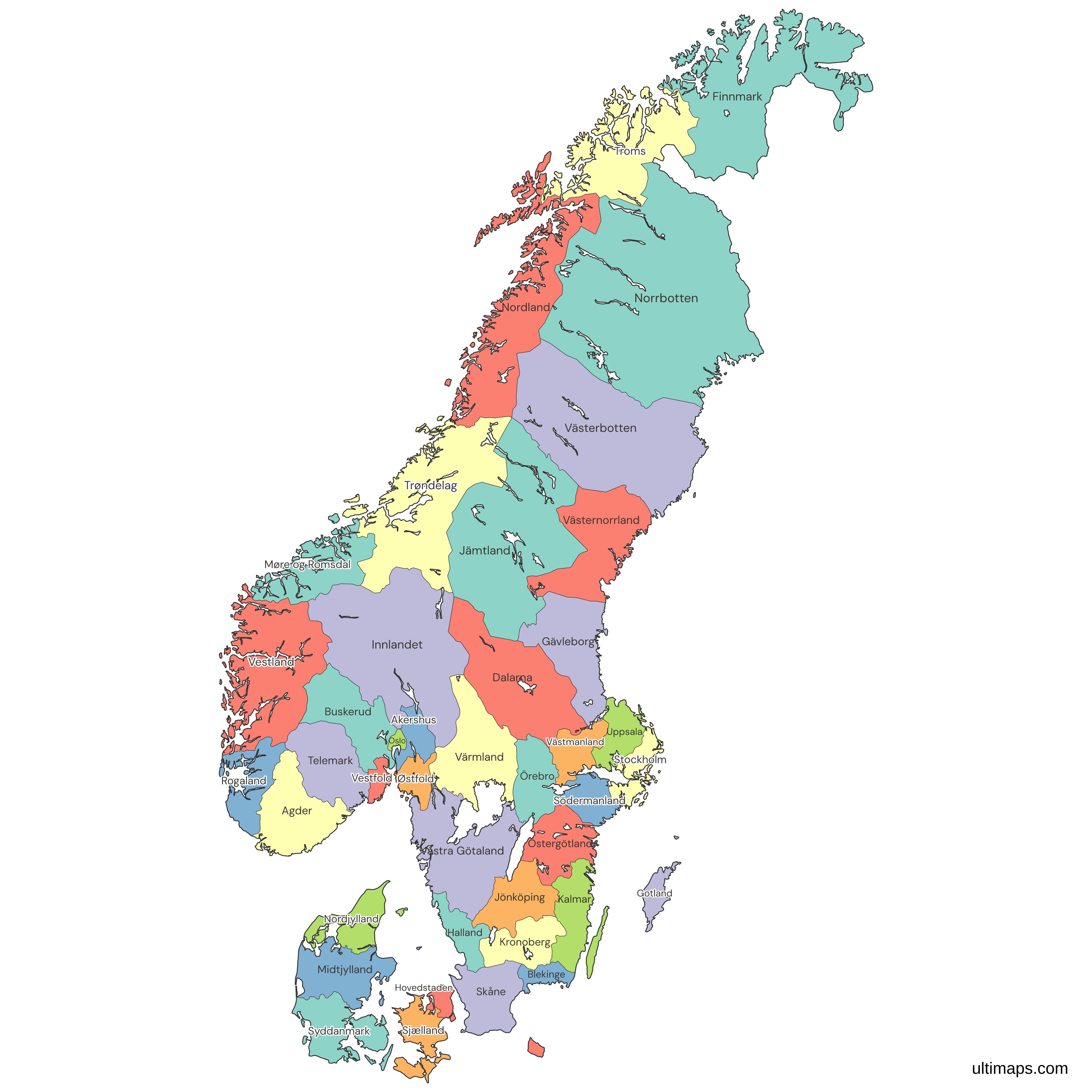
Need it without colors? The blank version of this map comes as a print-ready PDF (A4 and US Letter), a PNG and an editable SVG.
Custom Map Features
This map supports labels.
This map supports surrounding areas, roads, rivers and cities. New
This map is divided into 41 regions/counties.
Updates
Nov 5, 2026:
- Added map of Scandinavia with regions and counties
Frequently Asked Questions
The map of Scandinavia shows 41 regions and counties. Denmark has 5 regions, Norway has 15 counties and Sweden has 21 counties. Denmark's 11 provinces (landsdele) are statistical groupings inside the 5 regions, so they are not drawn. Oslo is a county of its own and counts as one of the 15 Norwegian units. Together the 41 hold 22.3 million people (national statistics offices, 2026), of whom 10.6 million live in Sweden, 6.0 million in Denmark and 5.6 million in Norway.
By land area, Norrbotten in Sweden is the largest of the 41 units with 97,973 km² (Statistics Sweden, 2026), and Oslo in Norway is the smallest with 426.4 km² (Statistics Norway, 2026). By population, Stockholm in Sweden is the largest with 2,486,251 people (Statistics Sweden, 2026), and Gotland in Sweden is the smallest with 60,852 (Statistics Sweden, 2026). Sweden holds both population extremes, while the area extremes come from different countries. Land area here means land only, without inland water.
Sweden has two overlapping layers: 21 counties (län), each with a county administrative board, and 25 historical provinces (landskap) with no administrative role. The map draws the counties. Many counties cover parts of more than one province, so a province cannot be rebuilt by adding counties together. Västra Götaland has 1,777,803 people (Statistics Sweden, 2026) and Skåne has 1,433,083 (Statistics Sweden, 2026), while Gotland, the island county in the Baltic, is the least populous. For Sweden alone, open the Sweden counties map.
Norway's five traditional regions, Nord-Norge, Trøndelag, Vestlandet, Sørlandet and Østlandet, are informal groupings and not administrative units, so they are not drawn. The map shows the 15 counties (fylker) of 1 January 2024 instead, with the two older boundary lines described in Key Facts. Akershus is the most populous county with 749,207 people (Statistics Norway, 2026), ahead of Oslo with 728,714 and Vestland with 658,342. Searches for Norwegian provinces lead to these same counties, and the Norway counties map shows them without Denmark and Sweden.
Not directly, because they are different kinds of unit. Denmark's 5 regions are NUTS 2 units in the European statistical system, while Sweden's 21 counties are NUTS 3, so the two sit on different statistical levels. A Danish region has 1.2 million people on average, about three times a Norwegian county with 375,000 and more than twice a Swedish one with 505,000 (national statistics offices, 2026). Hovedstaden alone has 1,947,212 people (Statistics Denmark, 2026), well above Akershus, Norway's most populous county, at 749,207 (Statistics Norway, 2026).
Yes, by one unit on the map. Hovedstaden and Sjælland merge into Eastern Denmark (Region Østdanmark) on 1 January 2027, which takes Denmark from 5 regions to 4 and the map of Scandinavia from 41 units to 40. Until then the map draws the five regions in force. Hovedstaden has 1,947,212 people and Sjælland has 858,102 (Statistics Denmark, 2026), so the merged region would hold about 2.8 million. Norway's change came earlier, on 1 January 2024, when its counties were split again.
No. Svalbard and Jan Mayen are Norwegian territory but lie outside the frame, so no unit stands for them, and Finland, Iceland and the Faroe Islands are not units on this map. For Denmark, Norway and Sweden as three single units, use the Scandinavia map. For the wider region, use the Nordic countries map with regions and counties, which draws these same 41 units and adds Finland's 19 regions, Iceland's 8 and the Faroe Islands as one unit, 69 in all.
No account is needed to start. Open the map in the free Ultimaps editor, then click a unit to color it, or upload a table with one row per unit and its value. Match the rows by region name, since seven Norwegian county codes are not ISO ones. Oslo is a county of its own, so it takes a row of its own. Add pins and labels, then share the finished map by link or embed it on a website. A free export is a standard PNG with a small Ultimaps credit. High-resolution PNG, SVG and PDF export are Pro features.