Cyprus Map with Districts
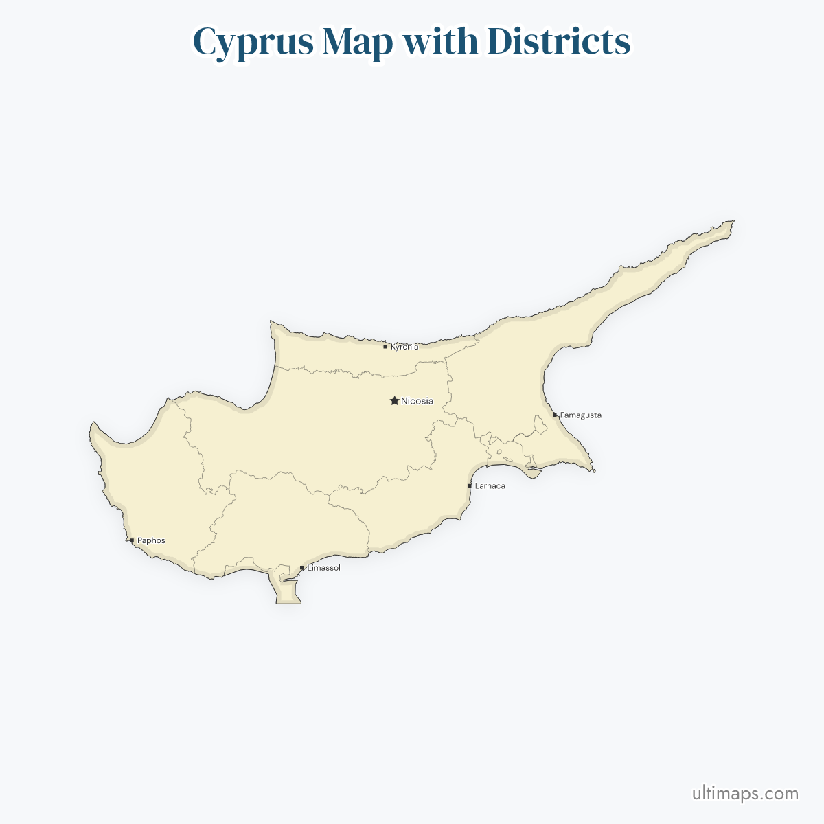
The 6 districts of the Republic of Cyprus and the 2 British Sovereign Base Areas, Akrotiri and Dhekelia, make up the 8 shapes on this map of Cyprus. Each district is named after its main town. The capital is Nicosia, and its district is both the largest and the most populous of the six. The districts are drawn at their full de jure extent across the island, which covers 9,251 km² (3,572 sq mi).
The Treaty of Establishment of 1960 kept Akrotiri, about 123 km² (47 sq mi), and Dhekelia, about 131 km² (51 sq mi), under UK sovereignty. The 2 base areas are not districts. In the 2021 Census of Population and Housing, the Statistical Service of Cyprus (CYSTAT) counted 923,272 people in the areas under the Republic's effective control. Kyrenia district and most of Famagusta district have been outside that control since 1974, so the census has no figure for Kyrenia. You can color the districts and base areas from your own data in the free editor, with no account.
Interactive Cyprus Map with Districts
List of Regions (8)
Cyprus Districts: Key Facts
- Total number of districts: 6, with ISO 3166-2 codes CY-01 to CY-06. The map also draws the 2 British Sovereign Base Areas, for 8 shapes in total. The base areas have no ISO 3166-2 code.
- District codes: Nicosia CY-01, Limassol CY-02, Larnaca CY-03, Famagusta CY-04, Paphos CY-05, Kyrenia CY-06
- Greek and Turkish names: the map labels each district in English, and data keyed on Lefkosia/Lefkoşa, Lemesos, Larnaka, Ammochostos/Gazimağusa, Pafos/Baf or Keryneia/Girne still matches the right district.
- Most populous district: Nicosia, 350,824 people (2021 Census, CYSTAT). This counts the government-controlled part of the district, not the whole district.
- Least populous district: Kyrenia has no 2021 Census figure because it lies entirely in the north. Among the districts CYSTAT counted, Famagusta has the fewest people, 54,282 (2021 Census), and that figure also covers the government-controlled part alone.
- Largest district by area: Nicosia, 2,710 km² (1,046 sq mi), measured over the whole district, north included. The published district areas add up to about the whole island, so they include the land of the 2 base areas.
- Smallest district by area: Kyrenia, 644 km² (249 sq mi)
- Island area: 9,251 km² (3,572 sq mi), including the base areas
- Capital: Nicosia, in the center of the island and in Nicosia district
- Major urban centers: Nicosia (Nicosia district), Limassol (Limassol district), Larnaca (Larnaca district), Paphos (Paphos district), Famagusta (Famagusta district), Kyrenia (Kyrenia district)
- Borders: none on land. Over the eastern Mediterranean the island faces Turkey to the north, Syria and Lebanon to the east, Israel and Egypt to the south-east and south, and Greece to the west. Akrotiri sits on the peninsula south-west of Limassol, and Dhekelia lies between Larnaca and Famagusta.
- Time zone: Eastern European Time (EET, UTC+2), and Eastern European Summer Time (EEST, UTC+3) during daylight saving time
- Historical note: Cyprus became independent on 16 August 1960, and the 1960 Treaty of Establishment created the base areas. The northern part of the island has been outside the Republic's effective control since 1974.
Interesting Facts
- The villages of Ormidhia and Xylotymbou belong to Larnaca district but sit as enclaves inside Dhekelia. The map draws them as part of Larnaca.
- Akrotiri and Dhekelia together cover about 254 km² (98 sq mi), close to 3% of the island's 9,251 km².
- Each district takes the name of its main town, so each of the 6 district names is also the name of a city.
- The Turkish Cypriot administration in the north uses its own 6 districts, and their boundaries do not match the 6 districts on this map.
Free Downloads
Free for personal and commercial use with a credit to Ultimaps. See the license terms for details.
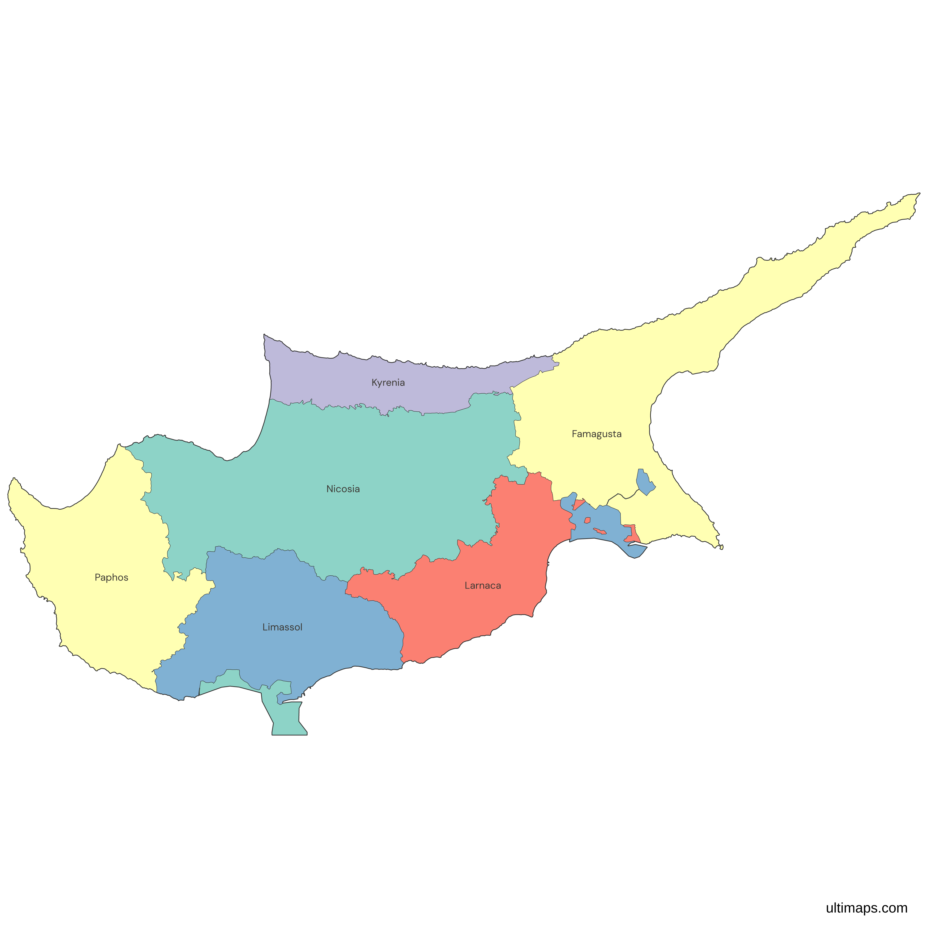
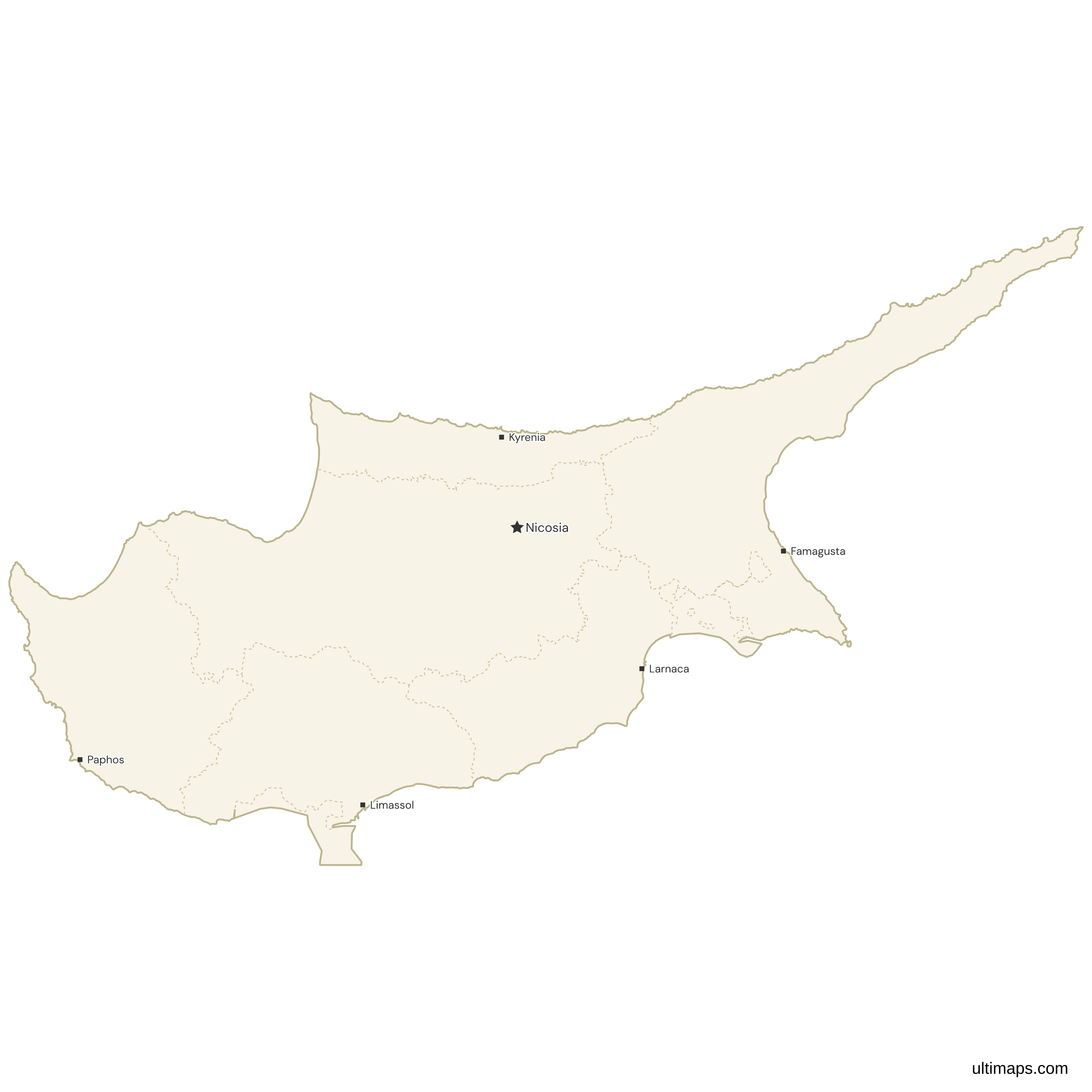
Need it without colors? The blank version of this map comes as a print-ready PDF (A4 and US Letter), a PNG and an editable SVG.
Custom Map Features
This map supports labels.
This map is divided into 8 regions.
Frequently Asked Questions
Cyprus has 6 districts: Nicosia, Limassol, Larnaca, Famagusta, Paphos and Kyrenia, with ISO 3166-2 codes CY-01 to CY-06. Each one is named after its main town, and Nicosia is the national capital. The 2 British Sovereign Base Areas, Akrotiri and Dhekelia, also appear on this map, each as its own shape beside the 6 districts, which are drawn at their full de jure extent. The base areas are UK sovereign territory under the 1960 Treaty of Establishment. They are not districts of Cyprus and have no ISO code. When you count units for a report, use 6 for the districts and treat the 2 base areas separately.
Akrotiri and Dhekelia are the 2 British Sovereign Base Areas on Cyprus. They remained UK sovereign territory under the Treaty of Establishment, signed when Cyprus became independent in 1960. Akrotiri, the Western SBA, covers about 123 km² (47 sq mi) on the peninsula south-west of Limassol. Dhekelia, the Eastern SBA, covers about 131 km² (51 sq mi) between Larnaca and Famagusta. Together they cover about 254 km² (98 sq mi), close to 3% of the island's 9,251 km². The villages of Ormidhia and Xylotymbou are enclaves of Larnaca district inside Dhekelia. On this map each base area is its own shape, so you can color it apart from the 6 districts.
This Cyprus map covers the whole island, but it follows the 6 de jure districts that ISO 3166-2 uses and that are recognized internationally. Since 1974 the northern part of the island has been outside the effective control of the Government of the Republic of Cyprus. The Turkish Republic of Northern Cyprus was declared in 1983, and Turkey is the one state that recognizes it. All of Kyrenia district, most of Famagusta district, the northern part of Nicosia district and a small part of Larnaca district lie in the north. The map does not draw the UN buffer zone (Green Line) or the 6 districts used by the Turkish Cypriot administration. Data published for those districts will not match these shapes.
The six districts of Cyprus are named after their main towns. Nicosia district (CY-01) has Nicosia, the national capital. Limassol district (CY-02) has the port city of Limassol. Larnaca district (CY-03) has Larnaca, on the south-east coast. Famagusta district (CY-04) has Famagusta, on the east coast. Paphos district (CY-05) has Paphos, on the west coast. Kyrenia district (CY-06) has Kyrenia, also written Girne, on the north coast. Famagusta and Kyrenia towns are in the northern part of the island. Resort towns such as Ayia Napa and Paralimni are in the government-controlled part of Famagusta district.
By area, the districts of Cyprus rank Nicosia 2,710 km² (1,046 sq mi), Famagusta 1,985 km² (766 sq mi), Limassol 1,393 km² (538 sq mi), Paphos 1,390 km² (537 sq mi), Larnaca 1,120 km² (432 sq mi) and Kyrenia 644 km² (249 sq mi). The Nicosia figure covers the whole district, including the northern part outside the Republic's effective control. These six published areas add up to about 9,240 km², close to the island's 9,251 km² (3,572 sq mi), so they include the land of the 2 British base areas. This map draws Akrotiri and Dhekelia as separate shapes, which makes the district shapes around them a little smaller than their published areas.
The 2021 Census of Population and Housing counted 923,272 people in the areas under the effective control of the Republic of Cyprus, and Nicosia district accounts for 350,824 of them, about 38%. The other CYSTAT counts are Limassol 262,238, Larnaca 155,753, Paphos 100,175 and Famagusta 54,282 (2021 Census). The census did not cover the north. The Nicosia and Famagusta figures therefore describe only the government-controlled parts of those districts, and Kyrenia district has no 2021 figure. When you color this map of Cyprus by population, Kyrenia will have no value and Famagusta will look smaller than the whole district is.
The Cyprus districts have English, Greek and Turkish names, and ISO 3166-2:CY lists each district in both Greek and Turkish. Nicosia is Lefkosia in Greek and Lefkoşa in Turkish. Limassol is Lemesos, and Larnaca is Larnaka. Famagusta is Ammochostos in Greek and Mağusa or Gazimağusa in Turkish. Paphos is Pafos in Greek and Baf in Turkish. Kyrenia is Keryneia in Greek and Girne in Turkish. This map lists the English names. Rows labeled Lefkosia, Lemesos, Girne or any of the other forms above are recognized on import, with no renaming needed.
The Cyprus map at the top of this page opens in the Ultimaps editor, which is free to use without an account. To show groups, pick a fill color for each shape, for example one color for the 6 districts and another for Akrotiri and Dhekelia. To show a statistic, enter one number per district, such as the 2021 census counts from CYSTAT. A color scale and a legend are then applied to the districts. Markers can go on places like Ayia Napa or Polis, and the colors and label style are adjustable. A free export is a standard PNG with a small Ultimaps credit. High-resolution PNG, SVG and PDF export are Pro features.