Malta Map with Local Councils
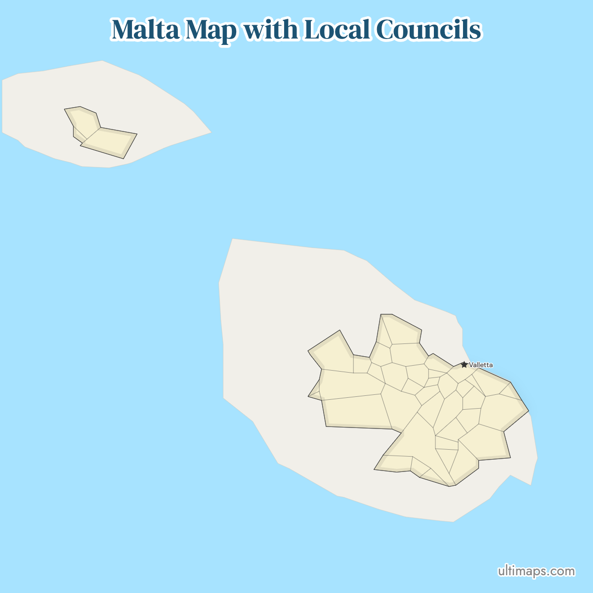
Malta is split into 68 local councils: 54 on the main island and 14 across Gozo and Comino. They are the country's basic tier of local government, and they double as LAU statistical localities, so census and EU datasets are usually published against these same 68 names. The system dates from 30 June 1993; a 2019 reform of Chapter 363, now the Local Government Act, reorganized the regional tier above the councils while leaving the 68 councils themselves unchanged. Valletta, the capital, is one council among the 68 and holds no special rank over Mosta or Naxxar. Zoom the map below to separate the harbor councils, where boundaries run only a few streets apart. The plain map downloads for free; with a figure for every locality, the 68 shapes are shaded stepwise from low to high.
Interactive Malta Map with Local Councils
List of Local Councils (68)
| # | Local Council |
|---|---|
| 1 | Attard |
| 2 | Balzan |
| 3 | Birgu |
| 4 | Birkirkara |
| 5 | Birżebbuġa |
| 6 | Cospicua |
| 7 | Dingli |
| 8 | Fgura |
| 9 | Floriana |
| 10 | Fontana |
| 11 | Għajnsielem |
| 12 | Għarb |
| 13 | Għargħur |
| 14 | Għasri |
| 15 | Għaxaq |
| 16 | Gudja |
| 17 | Gżira |
| 18 | Ħamrun |
| 19 | Iklin |
| 20 | Isla |
| 21 | Kalkara |
| 22 | Kerċem |
| 23 | Kirkop |
| 24 | Lija |
| 25 | Luqa |
| 26 | Marsa |
| 27 | Marsaskala |
| 28 | Marsaxlokk |
| 29 | Mdina |
| 30 | Mellieħa |
| 31 | Mġarr |
| 32 | Mosta |
| 33 | Mqabba |
| 34 | Msida |
| 35 | Mtarfa |
| 36 | Munxar |
| 37 | Nadur |
| 38 | Naxxar |
| 39 | Paola |
| 40 | Pembroke |
| 41 | Pietà |
| 42 | Qala |
| 43 | Qormi |
| 44 | Qrendi |
| 45 | Rabat |
| 46 | Safi |
| 47 | San Giljan |
| 48 | San Ġwann |
| 49 | San Lawrenz |
| 50 | San Pawl il-Baħar |
| 51 | Sannat |
| 52 | Santa Luċija |
| 53 | Santa Venera |
| 54 | Siġġiewi |
| 55 | Sliema |
| 56 | Swieqi |
| 57 | Ta' Xbiex |
| 58 | Tarxien |
| 59 | Valletta |
| 60 | Victoria |
| 61 | Xagħra |
| 62 | Xewkija |
| 63 | Xgħajra |
| 64 | Żabbar |
| 65 | Żebbuġ |
| 66 | Żebbuġ, Gozo |
| 67 | Żejtun |
| 68 | Żurrieq |
Malta Local Councils: Key Facts
- Total number of local councils: 68, of which 54 are on the island of Malta and 14 on Gozo and Comino. The Ultimaps map draws all 68, matching the official count.
- Most populous local council: St. Paul's Bay, 32,042 residents (2021 census), ahead of Birkirkara at 25,807 (2021 census).
- Least populous local council: Mdina, 193 residents (2021 census), the fortified former capital.
- Largest council by area: Rabat, about 26.6 km² (10.3 sq mi), the locality surrounding the old capital Mdina.
- Smallest council by area: Senglea (L-Isla), about 0.2 km² (0.08 sq mi), one of the Three Cities on Grand Harbour.
- Councils containing major urban centers: Valletta, Birkirkara, Sliema, Qormi, Mosta, Naxxar, Msida, Paola, Żabbar, Żejtun, and Victoria on Gozo.
- Capital: Valletta, which is a local council in its own right, with Floriana immediately outside its walls as a separate council.
- Borders: none by land. Malta is surrounded by the Mediterranean Sea, and the nearest foreign territory is Sicily, part of Italy, roughly 80 km (50 mi) north. Tunisia and Libya lie to the west and south across open water.
- Time zone: CET (UTC+1), moving to CEST (UTC+2) between late March and late October.
- Historical note: local councils were established on 30 June 1993. Act No. XIV of 2019 renamed Chapter 363 the Local Government Act and reorganized the regional tier into six regional councils; the 68 local councils themselves were retained.
Interesting Facts
- For a country with several thousand years of settlement history, elected local government is young: the council tier is only three decades old, created in 1993.
- Mdina, the island's former capital, is a walled town of 193 residents (2021 census) and still holds council status alongside localities over 150 times its population.
- Birgu (Vittoriosa) and Bormla (Cospicua) are separate councils within the Three Cities area on Grand Harbour, which is why the map looks so densely subdivided around Valletta.
- Comino has no council of its own and is administered within the 14 councils counted under Gozo and Comino.
- Official council data is published with both Maltese and Latin-alphabet English forms of each locality name, so datasets may list either Żejtun or Zejtun for the same shape.
Free Downloads
Free for personal and commercial use with a credit to Ultimaps. See the license terms for details.
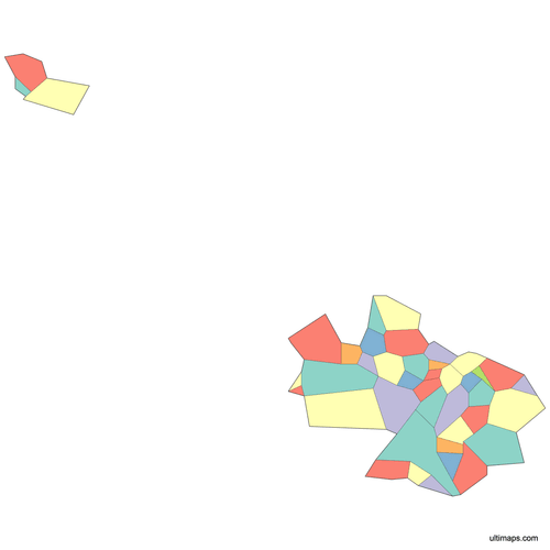 Colored Malta Map with Local Councilspng289 KB
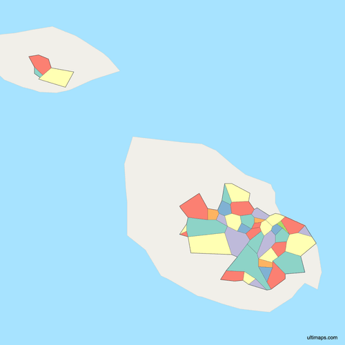 Political Map of Malta with Local Councilspng346 KB
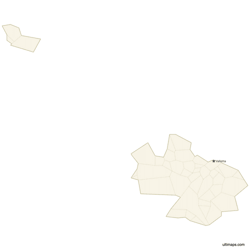 Map of Malta with Citiespng268 KB
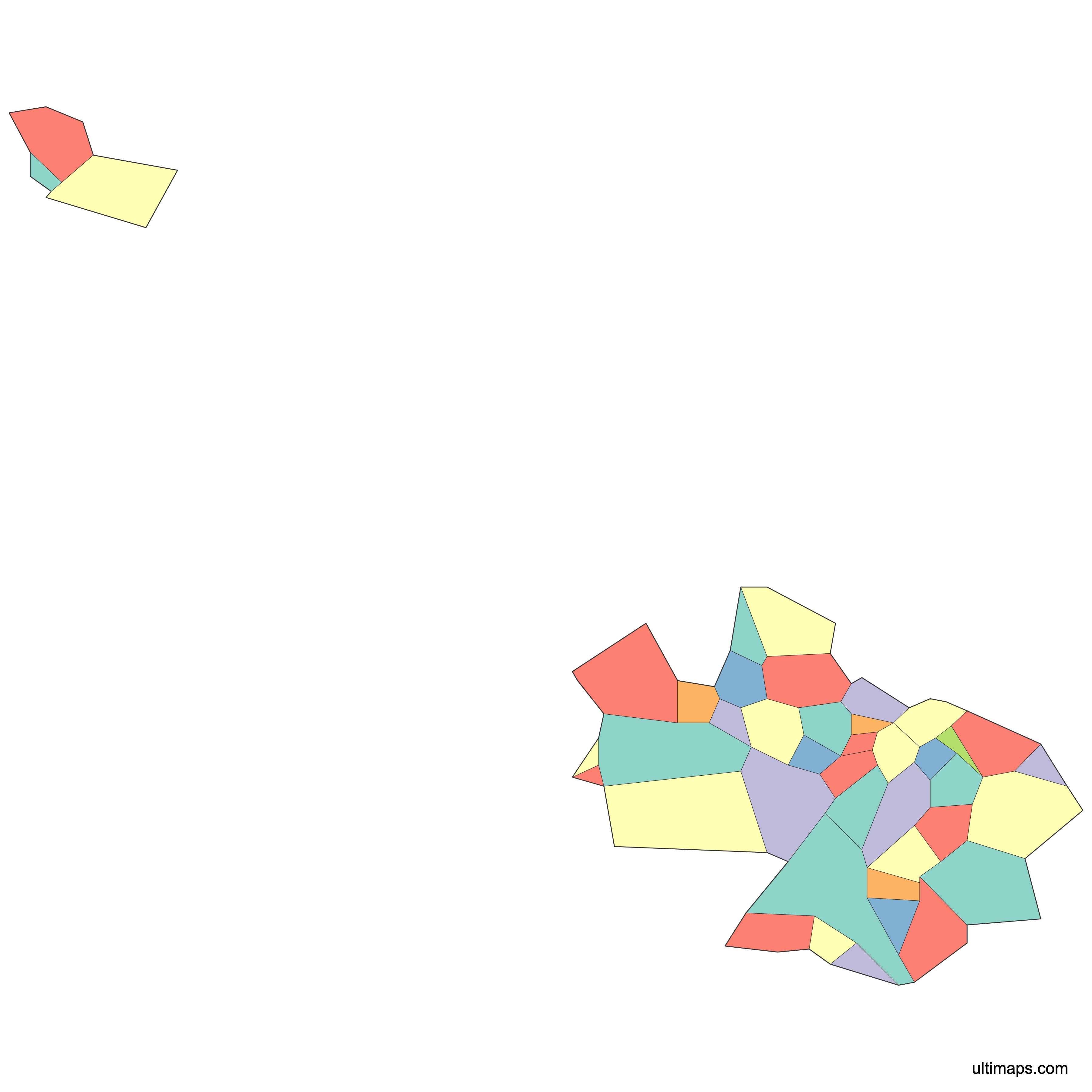
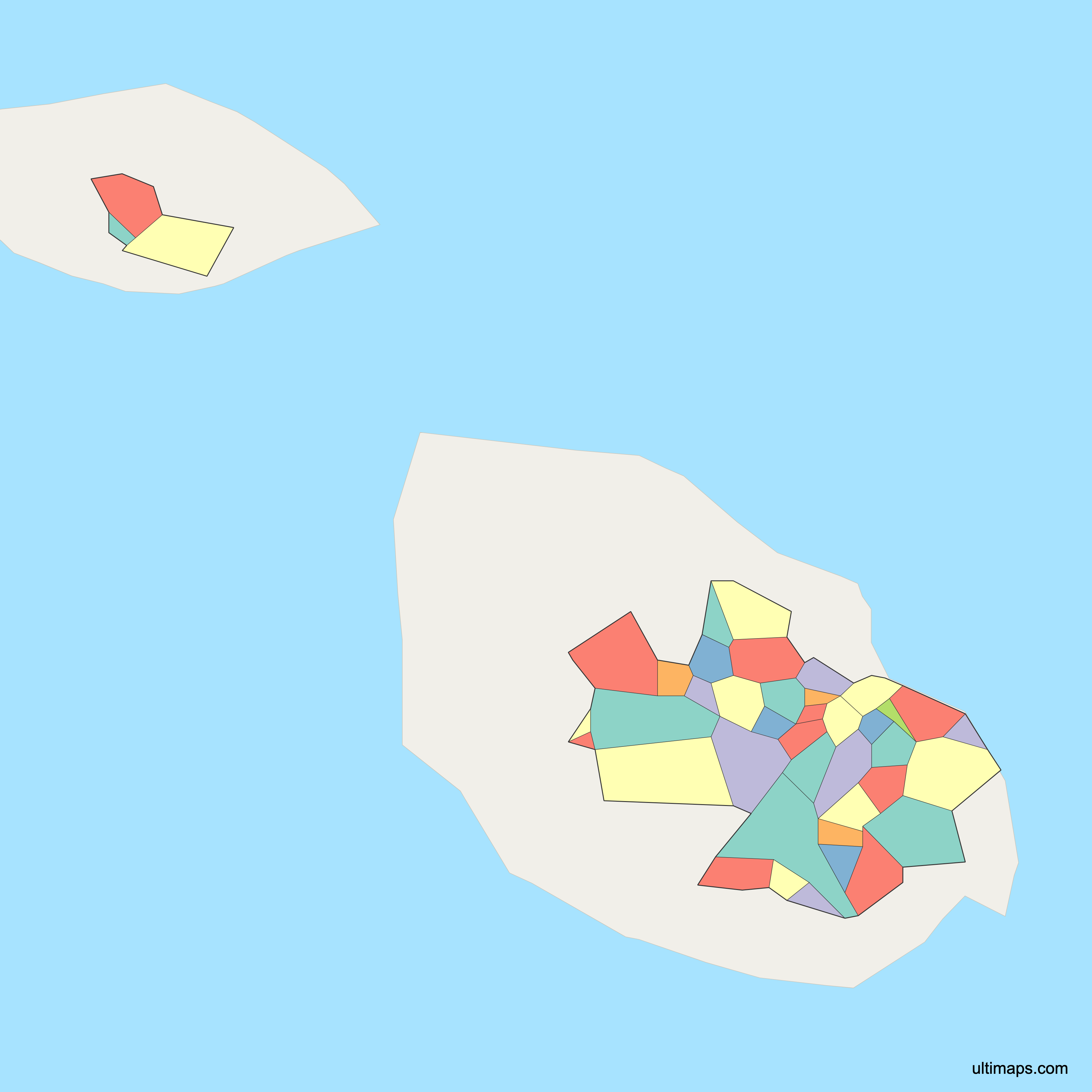
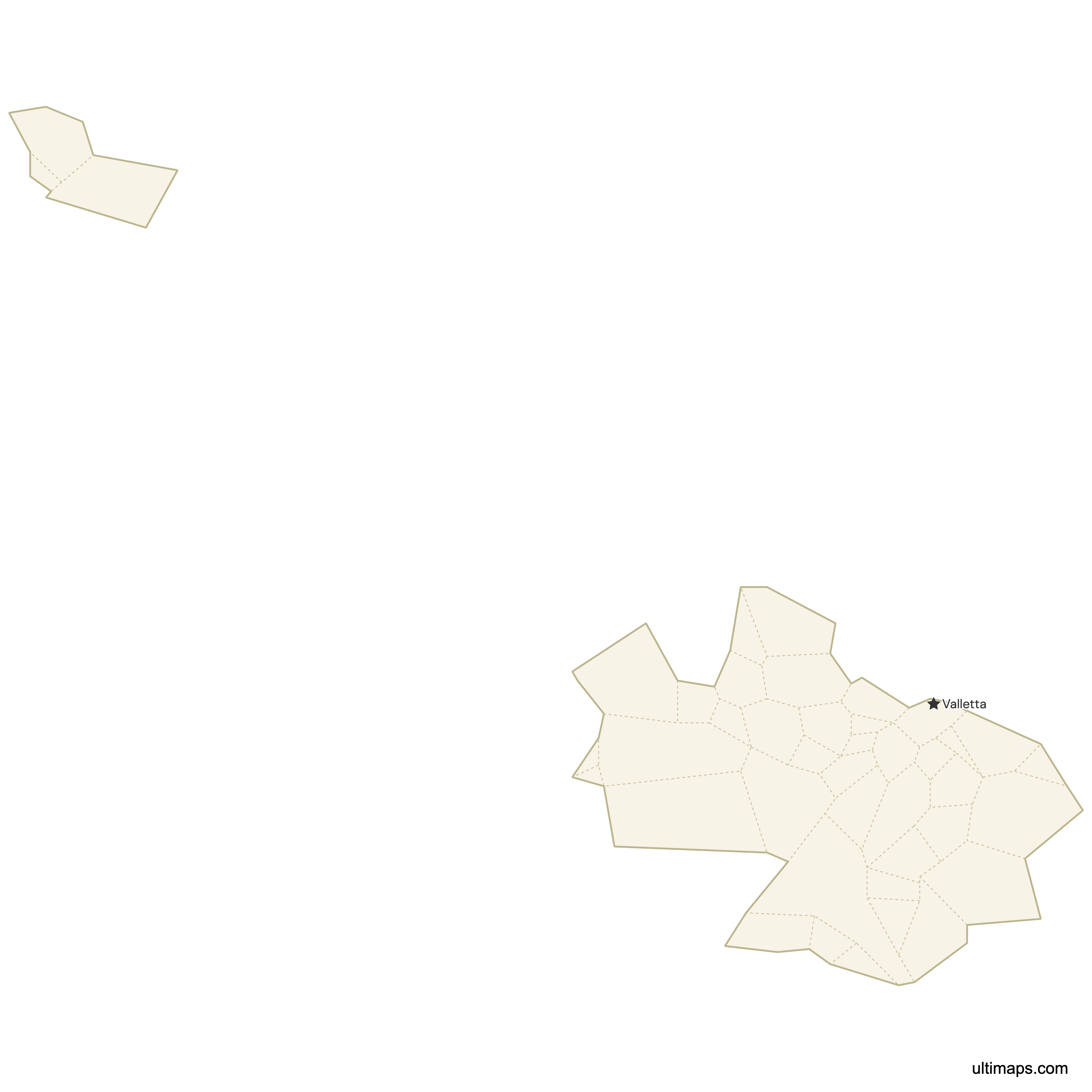
Need it without colors? The blank version of this map comes as a print-ready PDF (A4 and US Letter), a PNG and an editable SVG.
Custom Map Features
This map supports surrounding areas and cities. New
This map is divided into 68 local councils.
Updates
May 14, 2026:
- Added map of Malta Local Councils with surrounding countries and cities
Frequently Asked Questions
Malta has 68 local councils: 54 on the island of Malta and 14 covering Gozo and Comino. They make up the country's basic tier of local government and are classified as LAU (formerly LAU 2) localities in European statistics, which means most population and economic data for Malta is reported against these 68 units. The Ultimaps map shows all 68 shapes. The system was set up on 30 June 1993. A 2019 reform of Chapter 363, now the Local Government Act, reorganized the regional tier above the councils; the 68 councils themselves were retained.
Malta's local councils were established on 30 June 1993, when the country introduced an elected tier of local government for the first time in its modern history. Before that, administration ran centrally from Valletta. The 1993 framework set out the 68 localities across Malta, Gozo and Comino. In 2019, Act No. XIV amended Chapter 363, renaming it the Local Government Act and reorganizing the councils' regional tier into six regional councils; the 68 councils themselves carried on unchanged.
The 2019 reform of Chapter 363 of the Laws of Malta, enacted as Act No. XIV of 2019, renamed the law the Local Government Act and restructured the tier above the councils, replacing the five regional committees with six regional councils, a change phased in from late 2021. The 68 local councils and their boundaries carried over intact, so the shapes on this map were not redrawn by the reform. The practical effect for mapping is on regional groupings: figures aggregated by region before and after the reform cover different sets of councils. If your dataset is grouped by region rather than by locality, check whether it predates the six-region arrangement before joining it to a current map.
Rabat is the largest local council in Malta by area, at about 26.6 km² (10.3 sq mi), covering the countryside around the fortified former capital Mdina on the island's western side. Mellieħa in the far north is next at roughly 22.6 km² (8.7 sq mi). At the other extreme, Senglea (L-Isla), one of the Three Cities on Grand Harbour, occupies only about 0.2 km² (0.08 sq mi), the smallest locality in the country — the entire council fits on one fortified peninsula. Area and population rank differently in Malta: St. Paul's Bay, at 14.47 km² (5.59 sq mi), holds the largest population with 32,042 residents (2021 census).
St. Paul's Bay is the most populated local council in Malta, with 32,042 residents recorded in the 2021 census. Birkirkara, an inland urban locality in the central conurbation, comes next at 25,807 (2021 census). Both far exceed the smaller harbor councils: Birgu recorded 2,261 residents in the same census, and the least populous of all 68 is Mdina at 193 (2021 census). St. Paul's Bay grew heavily through coastal and tourism development in the north of the island, while Birkirkara's population sits within the continuous built-up area that stretches from Valletta outwards through Msida, Qormi and Mosta.
Yes. Valletta is Malta's capital city and also one of the 68 local councils, with the same legal status as any other locality on the map. It holds no administrative rank above its neighbors. Floriana, just outside Valletta's landward fortifications, is a separate council, as are Birgu, Bormla and the other harbor localities across the water. On Gozo, Victoria serves as the island's main urban center and is likewise a single local council among the 14 counted for Gozo and Comino.
Yes. Of Malta's 68 local councils, 14 fall under Gozo and Comino, with the remaining 54 on the island of Malta. Gozo's councils include Victoria, the island's main town and commercial center. Comino, the small island between Malta and Gozo, has no council of its own and is administered within the Gozo grouping, so it appears on the map without a separate label of its own. Any dataset built on Malta's LAU2 localities therefore covers the whole archipelago, not just the main island.
Ultimaps builds Malta council maps inside a browser window, and the free tier does not ask you to register. Data does the coloring fastest: upload a sheet listing localities with one number each and the 68 shapes are shaded in proportion. Individual councils — Mosta, say, or Sliema — can also be recolored one by one. From there you can switch the palette, change the background, retype any label, pick a different font, and make council outlines thinner or heavier. Markers go wherever needed — Valletta, Victoria in Gozo, or any coordinate pair — with captions included when you want them. When the design is finished, it saves out as a PNG, PDF or SVG file.