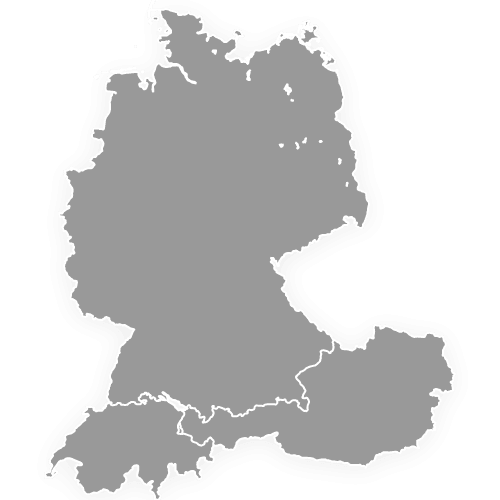
DACH Map with States and Cantons
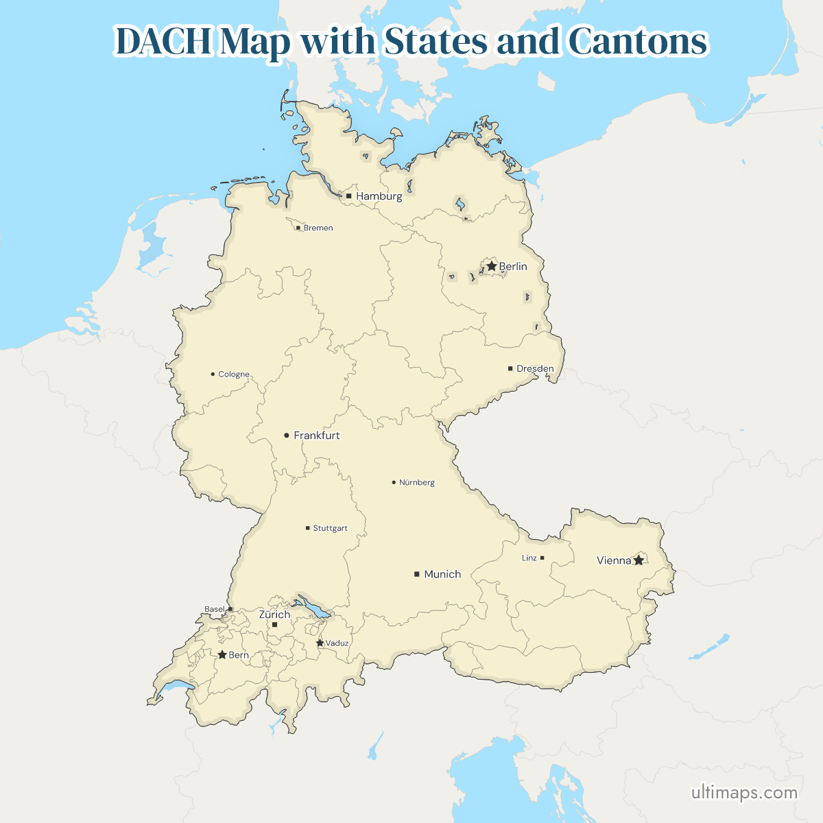
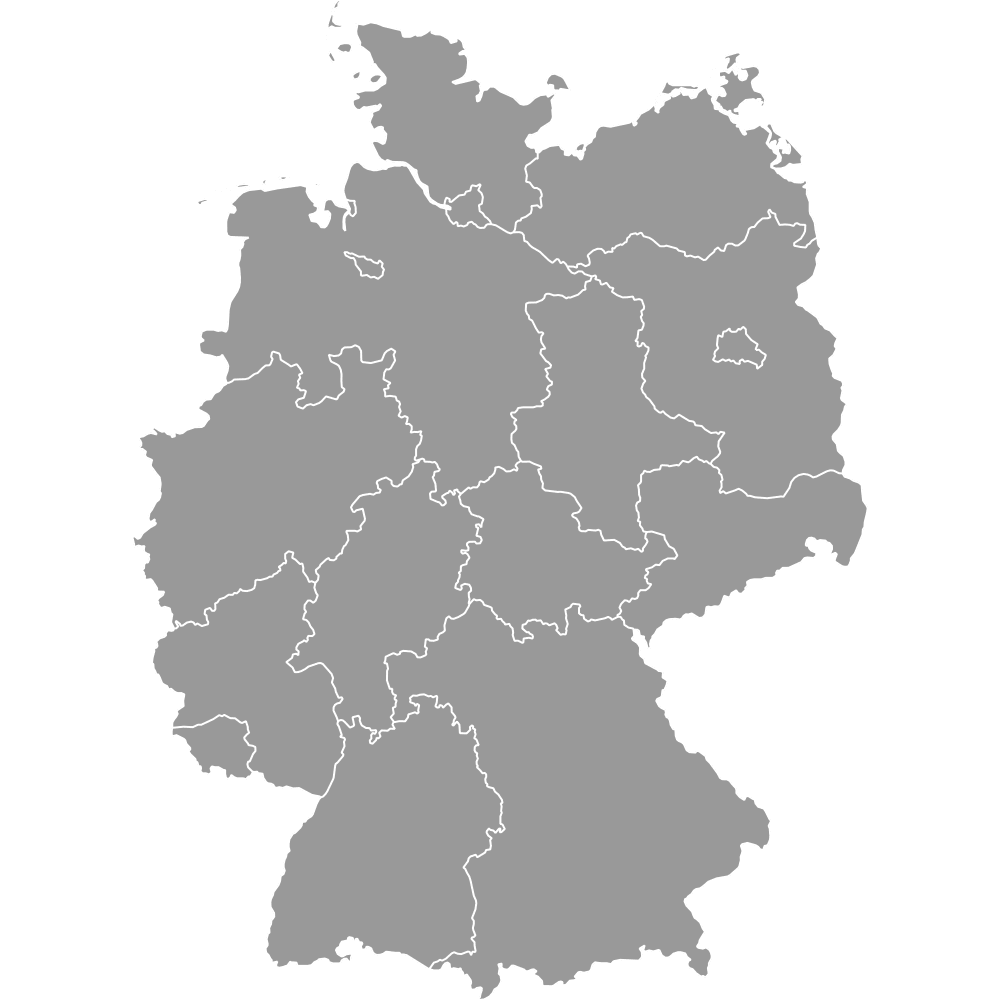
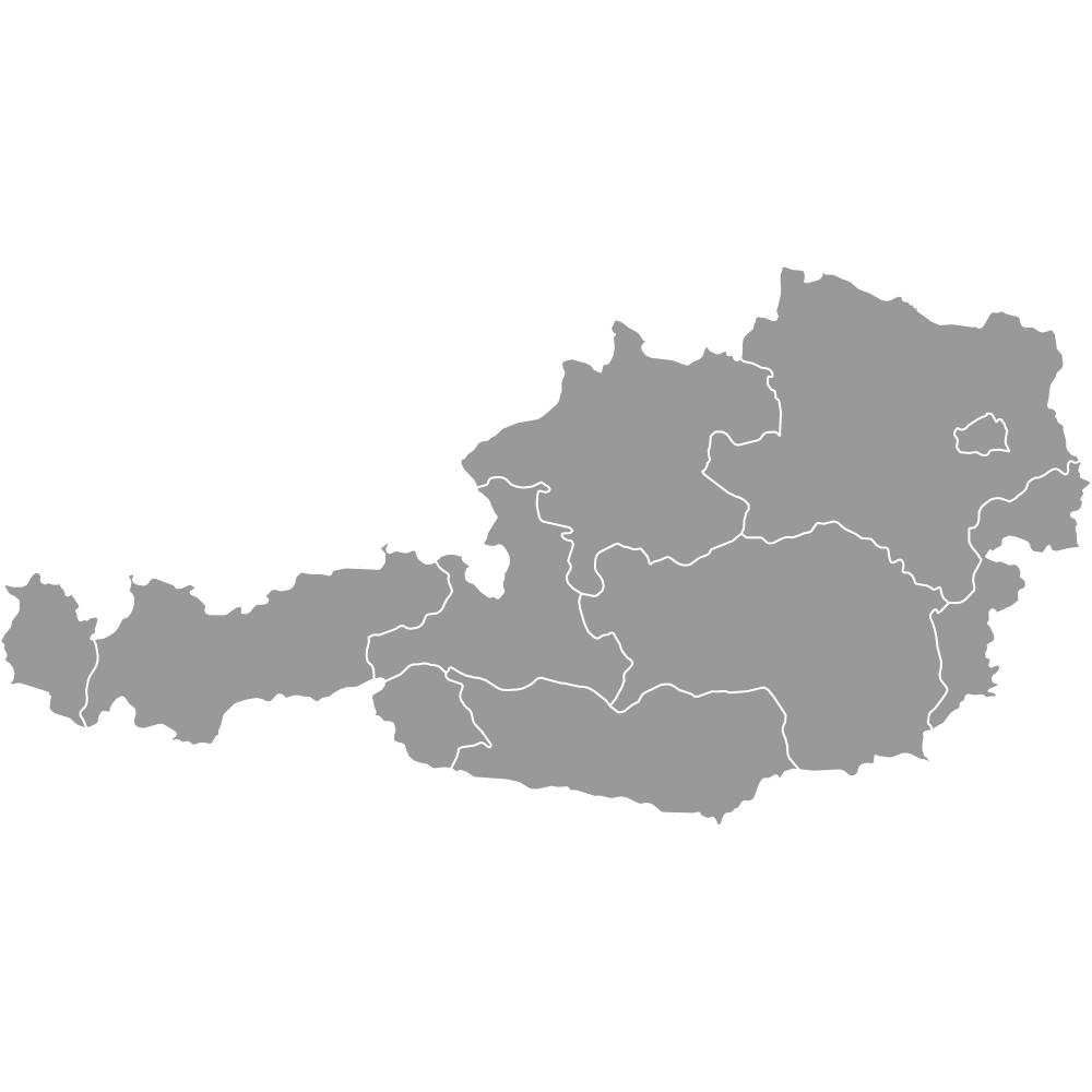
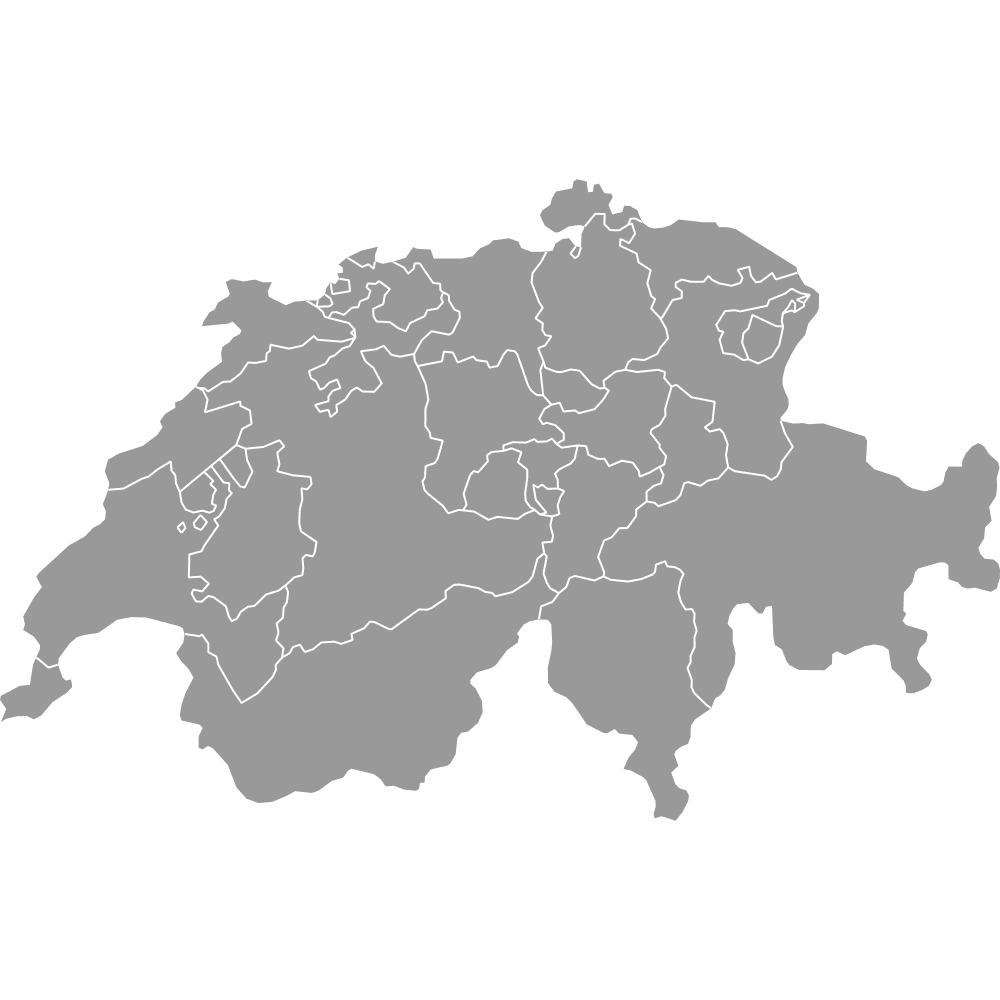
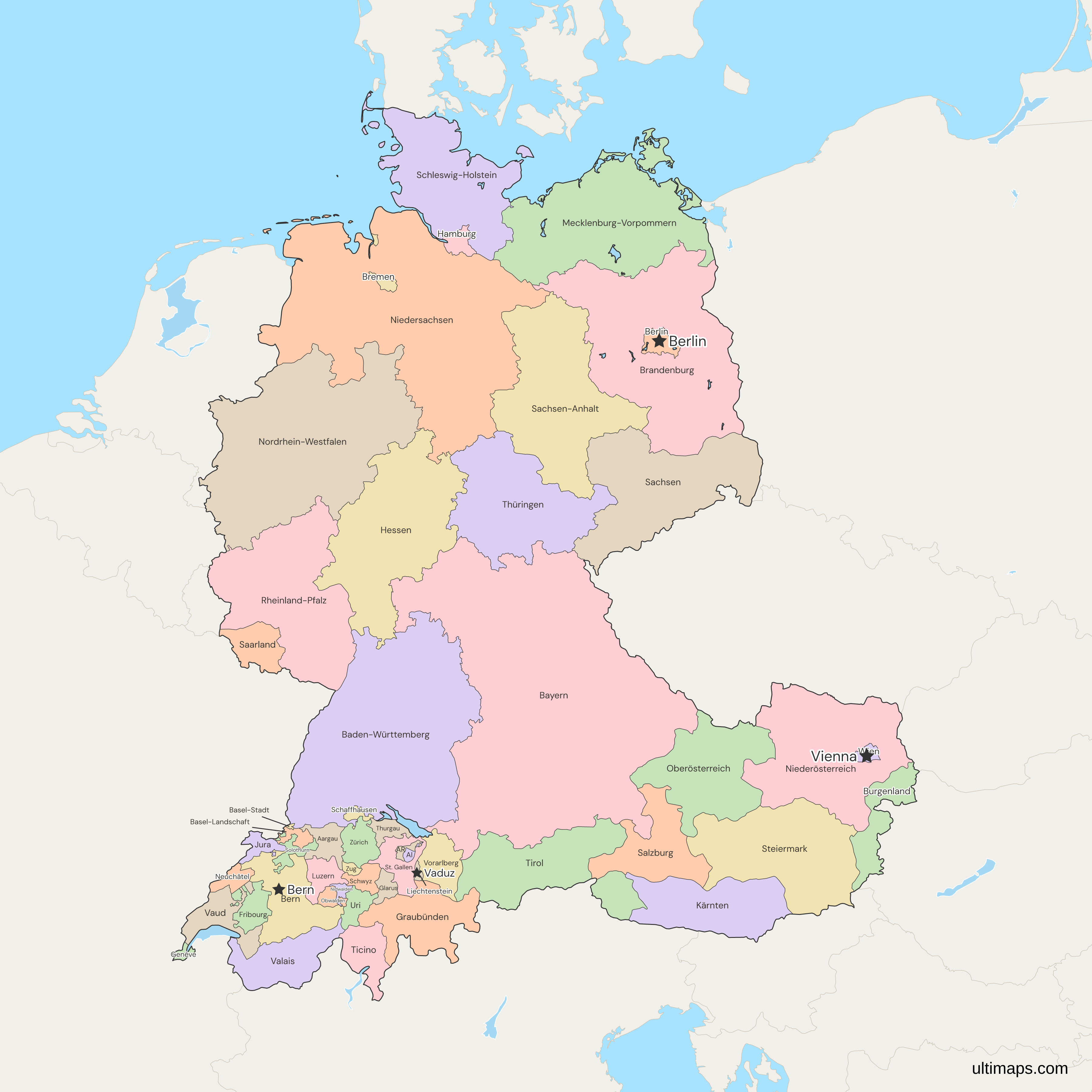
This map of the DACH region shows all 52 states and cantons: 16 German states, 9 Austrian states, 26 Swiss cantons and Liechtenstein as one unit. DACH stands for Germany (D), Austria (A) and Switzerland (CH), and this map adds Liechtenstein. In German, the states are Länder or Bundesländer and the cantons Kantone, and in English Austria's states are also called provinces. A German state averages about 5.2 million residents and a Swiss canton 351,000, so Eurostat's statistics put Germany's states at level 1, Austria's at level 2 and the cantons at level 3. About 101.9 million people lived in the 52 units at the end of 2025 (national statistics offices).
Open the map in the free Ultimaps editor to make your own custom map of the DACH region. You can color the states and cantons by your data, add pins and labels, and share or embed the finished map.
Interactive DACH Map with States and Cantons
List of States/Cantons (52)
| # | State/Canton | Capital | Population (2025) | Area (km²) |
|---|---|---|---|---|
| 1 | Aargau | Aarau | 743,768 | 1,403.80 |
| 2 | Appenzell Ausserrhoden | Herisau | 57,221 | 242.84 |
| 3 | Appenzell Innerrhoden | Appenzell | 16,890 | 172.48 |
| 4 | Baden-Württemberg | Stuttgart | 11,238,761 | 35,747.85 |
| 5 | Basel-Landschaft | Liestal | 303,872 | 517.67 |
| 6 | Basel-Stadt | Basel | 204,157 | 36.95 |
| 7 | Bayern | München | 13,245,503 | 70,541.77 |
| 8 | Berlin | Berlin | 3,700,577 | 891.12 |
| 9 | Bern | Bern | 1,069,074 | 5,938.89 |
| 10 | Brandenburg | Potsdam | 2,551,889 | 29,654.36 |
| 11 | Bremen | Bremen | 706,915 | 419.61 |
| 12 | Burgenland | Eisenstadt | 301,695 | 3,965.21 |
| 13 | Fribourg | Fribourg | 350,918 | 1,672.43 |
| 14 | Genève | Genève | 537,084 | 282.49 |
| 15 | Glarus | Glarus | 42,451 | 685.31 |
| 16 | Graubünden | Chur | 207,400 | 7,105.30 |
| 17 | Hamburg | Hamburg | 1,869,473 | 755.09 |
| 18 | Hessen | Wiesbaden | 6,278,594 | 21,115.64 |
| 19 | Jura | Delémont | 82,231 | 858.13 |
| 20 | Kärnten | Klagenfurt am Wörthersee | 569,990 | 9,537.01 |
| 21 | Liechtenstein | Vaduz | 41,228 | 160.50 |
| 22 | Luzern | Luzern | 441,500 | 1,493.52 |
| 23 | Mecklenburg-Vorpommern | Schwerin | 1,573,685 | 23,294.83 |
| 24 | Neuchâtel | Neuchâtel | 180,365 | 802.16 |
| 25 | Nidwalden | Stans | 45,664 | 275.84 |
| 26 | Niederösterreich | St. Pölten | 1,729,541 | 19,180.10 |
| 27 | Niedersachsen | Hannover | 8,000,826 | 47,709.90 |
| 28 | Nordrhein-Westfalen | Düsseldorf | 17,986,214 | 34,112.65 |
| 29 | Oberösterreich | Linz | 1,537,159 | 11,982.97 |
| 30 | Obwalden | Sarnen | 39,879 | 490.58 |
| 31 | Rheinland-Pfalz | Mainz | 4,123,022 | 19,857.96 |
| 32 | Saarland | Saarbrücken | 1,007,342 | 2,572.01 |
| 33 | Sachsen | Dresden | 4,026,599 | 18,449.89 |
| 34 | Sachsen-Anhalt | Magdeburg | 2,120,252 | 20,554.84 |
| 35 | Salzburg | Salzburg | 573,526 | 7,154.52 |
| 36 | Schaffhausen | Schaffhausen | 90,087 | 298.42 |
| 37 | Schleswig-Holstein | Kiel | 2,958,519 | 15,804.31 |
| 38 | Schwyz | Schwyz | 170,072 | 907.88 |
| 39 | Solothurn | Solothurn | 291,583 | 790.46 |
| 40 | St. Gallen | St. Gallen | 544,040 | 2,028.20 |
| 41 | Steiermark | Graz | 1,271,764 | 16,400.10 |
| 42 | Thurgau | Frauenfeld | 302,806 | 994.33 |
| 43 | Thüringen | Erfurt | 2,078,946 | 16,202.39 |
| 44 | Ticino | Bellinzona | 359,783 | 2,812.15 |
| 45 | Tirol | Innsbruck | 779,060 | 12,648.52 |
| 46 | Uri | Altdorf | 38,581 | 1,076.53 |
| 47 | Valais | Sion | 376,113 | 5,224.64 |
| 48 | Vaud | Lausanne | 863,650 | 3,212.02 |
| 49 | Vorarlberg | Bregenz | 412,307 | 2,601.68 |
| 50 | Wien | Wien | 2,040,914 | 414.82 |
| 51 | Zug | Zug | 135,018 | 238.73 |
| 52 | Zürich | Zürich | 1,632,918 | 1,728.94 |
Data sources:
- Capital: Ultimaps, compiled from Destatis, BFS, the Austrian Landeshauptstädte and the Liechtenstein Office of Statistics. License: facts compiled by Ultimaps, CC BY 4.0.
- Population: Destatis, Statistik Austria, BFS STATPOP and Liechtenstein Office of Statistics, population at the end of 2025. License: each office's open terms, credit required.
- Area: Destatis (GV-ISys), BEV Regionalinformation (Austria's Länder summed by Ultimaps), BFS and Liechtenstein Office of Statistics, total area. License: each office's open terms, credit required.
DACH States and Cantons: Key Facts
- Units per country: Germany has 16 states (Länder), Austria 9 states (Bundesländer) and Switzerland 26 cantons (Kantone). Liechtenstein counts once, as a whole country, and its 11 municipalities are on the Liechtenstein map.
- Largest and smallest by area: Bavaria in Germany, 70,541.77 km² (Destatis, 2024), and Basel-Stadt in Switzerland, 36.95 km² (BFS, 2026). These are total areas, lakes included.
- Most and fewest people: North Rhine-Westphalia (Nordrhein-Westfalen) in Germany, 17,986,214 at the end of 2025 (Destatis), and Appenzell Innerrhoden in Switzerland, 16,890 (BFS).
- Capitals and city-states: each German city-state (Berlin, Hamburg, Bremen) forms one unit on the map, as does Vienna (Wien), a city that is also an Austrian state. The state of Bremen consists of two cities that do not touch, Bremen and Bremerhaven, so its unit has two separate parts. Berlin and Vienna are also the national capitals. Bern, seat of the Swiss federal government, is called the federal city rather than the capital and lies in the canton of Bern. Vaduz is Liechtenstein's capital.
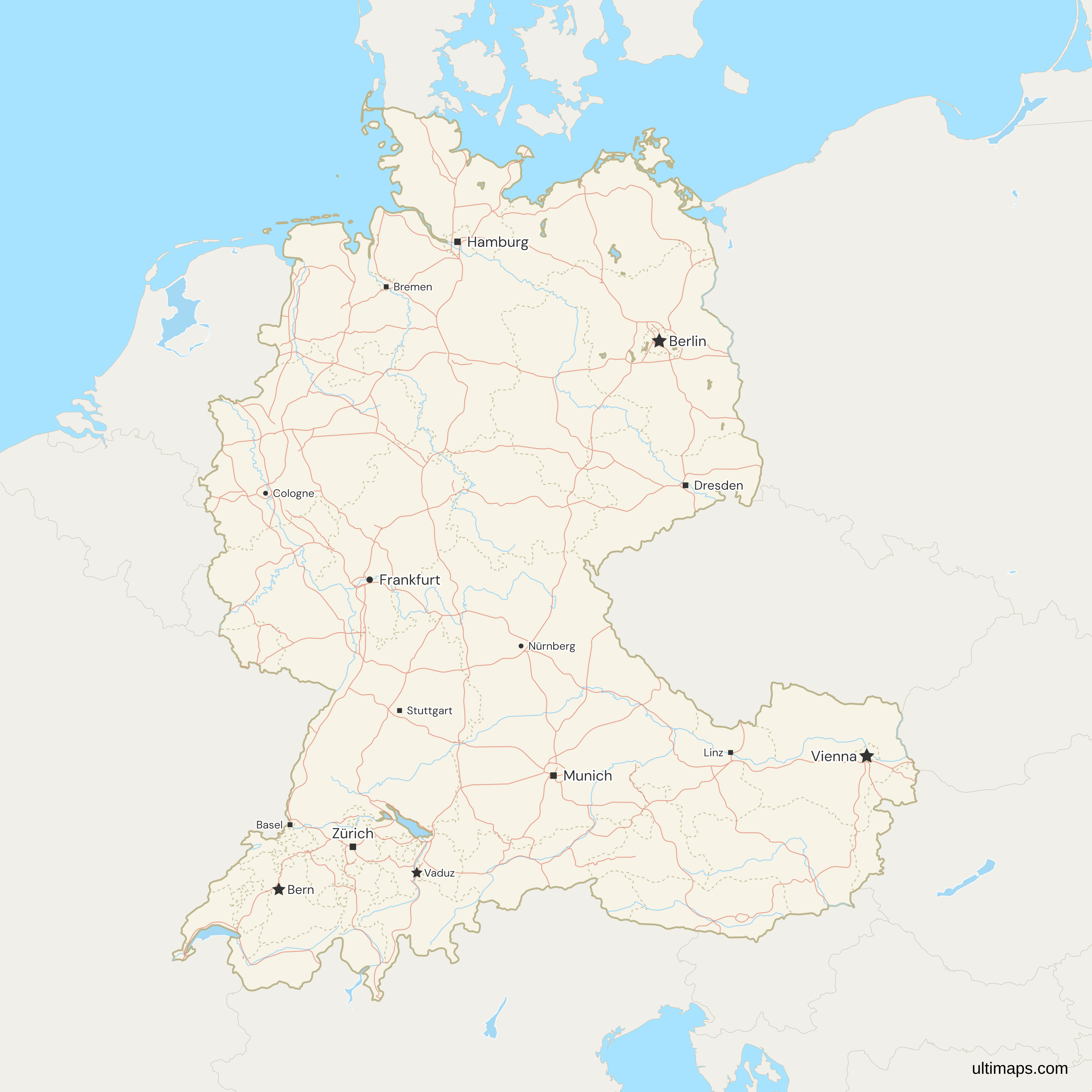
- State and cantonal capitals: the region table gives one for each of the 52 units, among them Düsseldorf for North Rhine-Westphalia, St. Pölten for Lower Austria and Bellinzona for Ticino. Most are not among the 15 cities marked on the map, but pins can add them.
- Changes: the newest line on the map is the boundary between Bern and Jura around Moutier, in force since 1 January 2026. Before that, Lower Austria and Vienna were divided into two states in 1922, part of Bern became the canton of Jura in 1979, and reunification gave Germany its 16 states on 3 October 1990.
- Borders: the 11 bordering countries are drawn in gray, as are the other countries in the frame. Two units border three of them, more than any other state or canton: Rhineland-Palatinate (Rheinland-Pfalz) touches France, Luxembourg and Belgium, and Burgenland touches Hungary, Slovakia and Slovenia. Five units reach the sea, all of them German: Schleswig-Holstein, Mecklenburg-Vorpommern, Lower Saxony, Bremen (at Bremerhaven) and Hamburg.
- Not drawn: Büsingen am Hochrhein, a German exclave in Switzerland, and Campione d'Italia, an Italian exclave in Ticino, are missing from the Natural Earth outlines the map uses, so their land falls in Schaffhausen and Ticino. Islands under 1 km² are left out: Heligoland is drawn, but not the smaller Düne beside it.
- Lakes: Lake Constance, Lake Geneva, Lake Zurich and the other large lakes are drawn as water. Germany and Switzerland fixed their border in the Untersee by treaty, but no border has been agreed on the main basin of Lake Constance, the Obersee. On this map the whole lake belongs to no state or canton.
Interesting Facts
- Bern touches 11 other cantons, more neighbors than any other unit on the map.
- Obwalden, Uri and Appenzell Innerrhoden each have fewer residents than Liechtenstein, which had 41,228 at the end of 2025 (Liechtenstein Office of Statistics).
Free Downloads
Free for personal and commercial use with a credit to Ultimaps. See the license terms for details.
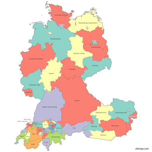 Colored DACH Map with States and Cantonspng813 KB
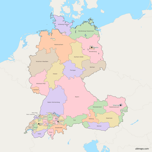 Political Map of the DACH region with States and Cantonspng1013 KB
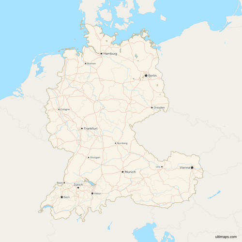 Map of the DACH region with Cities and Roadspng1296 KB
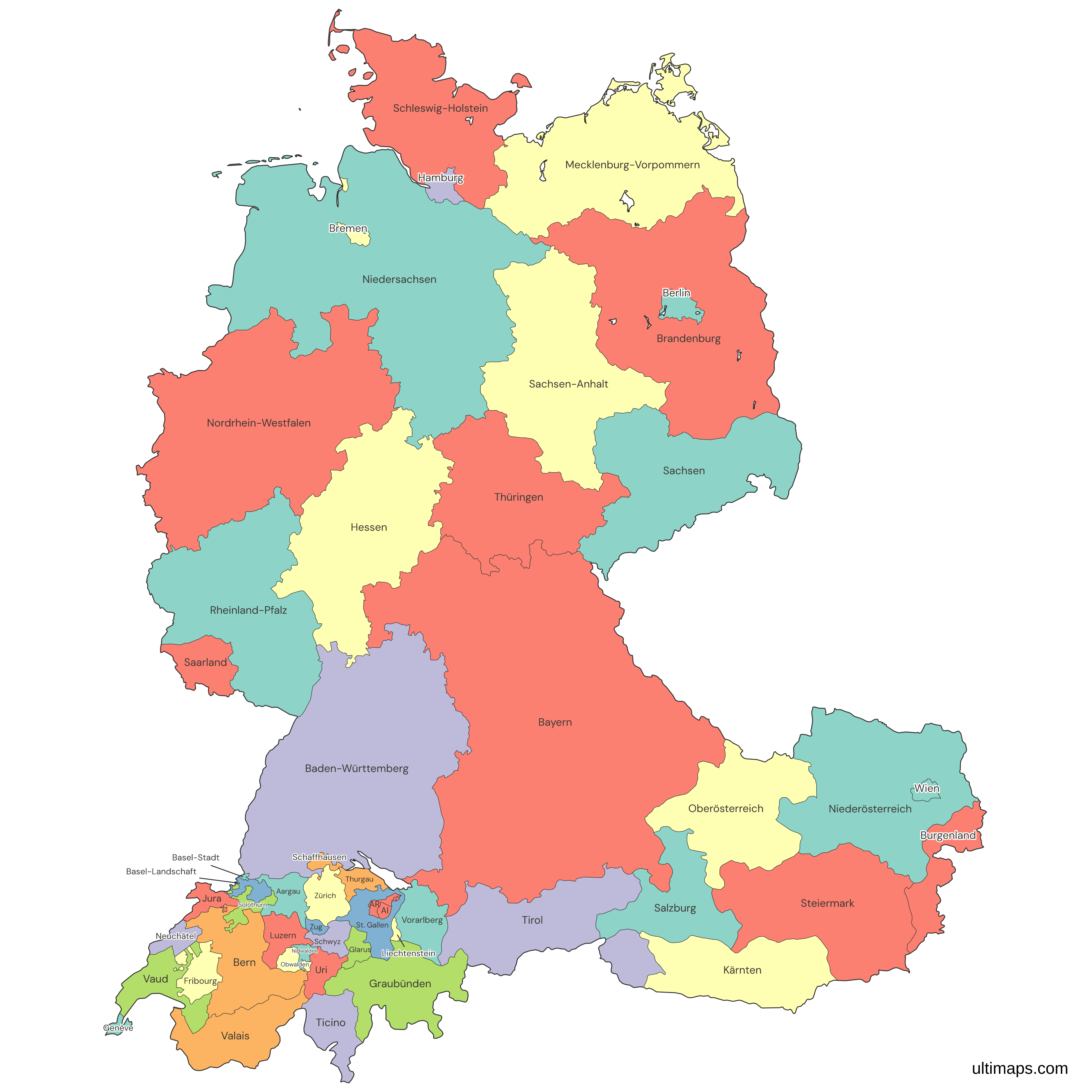
Need it without colors? The blank version of this map comes as a print-ready PDF (A4 and US Letter), a PNG and an editable SVG.
Custom Map Features
This map supports labels.
This map supports surrounding areas, roads, rivers and cities. New
This map is divided into 52 states/cantons.
Updates
Nov 5, 2026:
- Added map of DACH states and cantons
Frequently Asked Questions
The DACH map has 52 units: Germany's 16 states, Austria's 9 states, Switzerland's 26 cantons and Liechtenstein as a single unit. On the map, the borders between the four countries look the same as the state and canton borders. Of the 101.9 million people on the map at the end of 2025, about 83.5 million lived in Germany's states, 9.2 million in Austria's and 9.1 million in Switzerland's cantons (national statistics offices). For sales territories, a column that names each state's or canton's territory colors the map by category, one color per territory. Germany's states, Austria's states and Switzerland's cantons each have a separate map too, and the DACH countries map shows the four as whole countries.
Germany has the largest of the 52 states and cantons on the DACH map and Switzerland the smallest, by area and by population alike. By area, Bavaria (Bayern) covers 70,541.77 km² (Destatis, 2024) against 36.95 km² for Basel-Stadt (BFS, 2026). By population, North Rhine-Westphalia had 17,986,214 residents at the end of 2025 (Destatis) and Appenzell Innerrhoden 16,890 (BFS). Germany's smallest state is Bremen: 419.61 km² (Destatis, 2024) and 706,915 residents at the end of 2025 (Destatis). Switzerland's largest canton is Graubünden, 7,105.3 km² (BFS, 2026), and Zürich has the most residents, 1,632,918 (BFS). Within Austria, the top units are Lower Austria (Niederösterreich) by area, 19,180.1 km² (BEV, 2025), and Vienna by population, 2,040,914 on 1 January 2026 (Statistik Austria).
The German and Austrian states and the Swiss cantons are the same tier of government, the first below the federal level, but not the same size. At the end of 2025 the average was about 5.2 million residents per German state, about 1 million per Austrian state and about 351,000 per Swiss canton. In Eurostat's regional statistics, Germany's 16 states are NUTS 1 regions, and Austria's 9 states are NUTS 2, below three NUTS 1 groups. Switzerland is not in the EU and has no NUTS regions, but Eurostat's equivalent for it puts the 26 cantons at level 3, below seven large regions at level 2. Liechtenstein is one region at every level.
Switzerland has 26 cantons, which make up half of the 52 states and cantons on the DACH map. The six former half-cantons come in pairs: Basel-Stadt and Basel-Landschaft, Appenzell Ausserrhoden and Appenzell Innerrhoden, and Obwalden and Nidwalden. In federal politics the six still count for less than the other 20 cantons, with one Council of States seat and half a cantonal vote each under the 1999 Federal Constitution. All six rank among the 12 smallest units on the map by area, and the largest of them, Basel-Landschaft, covers 517.67 km² (BFS, 2026).
Yes, Moutier is part of the canton of Jura on this map. The town's transfer from the canton of Bern took effect on 1 January 2026, after a referendum there in March 2021. Moutier's boundary comes from swisstopo, the Swiss federal mapping office. The areas on this page follow the new line: Jura covers 858.13 km² and Bern 5,938.89 km² (BFS, 2026). In the region table, Jura's 82,231 residents at the end of 2025 include Moutier's 7,053, which the BFS canton totals for 2025 still count in Bern.
To make a custom map of the DACH region, put all 52 units in one table and paste or import it into the free Ultimaps editor. No account is needed. The map names each unit in its local language, such as Bayern, Wien and Genève. German states match only on those names or codes such as DE-BY. English names such as Bavaria go to the import's correction step, so check them in the review. Austrian and Swiss units also match English forms such as Vienna and Geneva. Saving and publishing the map need a free account. Any map exports for free as a standard PNG with a small Ultimaps credit, and Pro subscribers also get high-resolution PNG, SVG and PDF.