Benelux Map with Provinces and Cantons
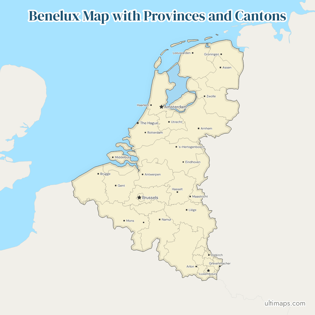
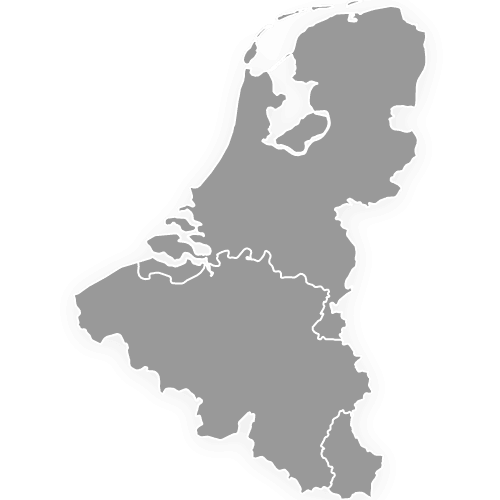
This map of the Benelux shows all 35 provinces and cantons, 10 Belgian provinces, the Brussels-Capital Region, 12 Dutch provinces (provincies) and 12 Luxembourg cantons. Brussels is a region and belongs to no province. The units differ widely in size, from Gelderland with 4,956.06 km² of land (CBS) down to the canton of Vianden with 78.52 km² (STATEC). Together the 35 hold 30.7 million people (Statbel, CBS and STATEC, 2026).
Open the map in the free Ultimaps editor to make your own custom map of the Benelux. You can color the provinces and cantons by your data, add pins and labels, and share or embed the finished map.
Interactive Benelux Map with Provinces and Cantons
List of Provinces/Cantons (35)
| # | Province/Canton | Capital | Population (2026) | Area (km²) |
|---|---|---|---|---|
| 1 | Antwerp | Antwerp | 1,931,891 | 2,855.87 |
| 2 | Brussels | Brussels (City of Brussels) | 1,255,834 | 162.42 |
| 3 | Capellen | Capellen | 56,562 | 199.21 |
| 4 | Clervaux | Clervaux | 22,179 | 342.17 |
| 5 | Diekirch | Diekirch | 36,530 | 204.51 |
| 6 | Drenthe | Assen | 508,109 | 2,680.39 |
| 7 | East Flanders | Ghent | 1,611,409 | 3,027.30 |
| 8 | Echternach | Echternach | 20,683 | 185.54 |
| 9 | Esch-sur-Alzette | Esch-sur-Alzette | 197,314 | 242.77 |
| 10 | Flemish Brabant | Leuven | 1,210,797 | 2,118.35 |
| 11 | Flevoland | Lelystad | 462,816 | 2,412.31 |
| 12 | Fryslân | Leeuwarden | 665,208 | 5,753.26 |
| 13 | Gelderland | Arnhem | 2,173,349 | 5,136.30 |
| 14 | Grevenmacher | Grevenmacher | 34,007 | 211.37 |
| 15 | Groningen | Groningen | 601,286 | 2,955.18 |
| 16 | Hainaut | Mons | 1,368,562 | 3,812.83 |
| 17 | Liège | Liège | 1,125,300 | 3,857.12 |
| 18 | Limburg | Hasselt | 908,582 | 2,427.43 |
| 19 | Limburg | Maastricht | 1,138,374 | 2,209.85 |
| 20 | Luxembourg | Arlon | 296,370 | 4,459.25 |
| 21 | Luxembourg | Luxembourg | 213,766 | 238.46 |
| 22 | Mersch | Mersch | 37,191 | 223.90 |
| 23 | Namur | Namur | 506,271 | 3,674.82 |
| 24 | Noord-Brabant | 's-Hertogenbosch | 2,676,955 | 5,082.06 |
| 25 | Noord-Holland | Haarlem | 3,009,386 | 4,091.93 |
| 26 | Overijssel | Zwolle | 1,202,375 | 3,420.74 |
| 27 | Redange | Redange | 21,701 | 267.49 |
| 28 | Remich | Remich | 24,827 | 127.87 |
| 29 | Utrecht | Utrecht | 1,415,104 | 1,560.05 |
| 30 | Vianden | Vianden | 5,808 | 78.52 |
| 31 | Walloon Brabant | Wavre | 416,947 | 1,097.20 |
| 32 | West Flanders | Bruges | 1,235,671 | 3,196.59 |
| 33 | Wiltz | Wiltz | 20,391 | 264.55 |
| 34 | Zeeland | Middelburg | 394,538 | 2,933.44 |
| 35 | Zuid-Holland | Den Haag | 3,882,708 | 3,307.86 |
Data sources:
- Capital: Ultimaps, compiled from the Belgian Constitution, the Dutch provincial governments and STATEC. License: facts compiled by Ultimaps, CC BY 4.0.
- Population: Statbel, CBS StatLine 70072ned and STATEC LUSTAT DF_X021, population on 1 January 2026. License: CC BY 4.0.
- Area: Statbel (cadastral register, total area), CBS StatLine 70072ned (total area, land and water) and STATEC LUSTAT DF_X010. License: CC BY 4.0.
Benelux Provinces and Cantons: Key Facts
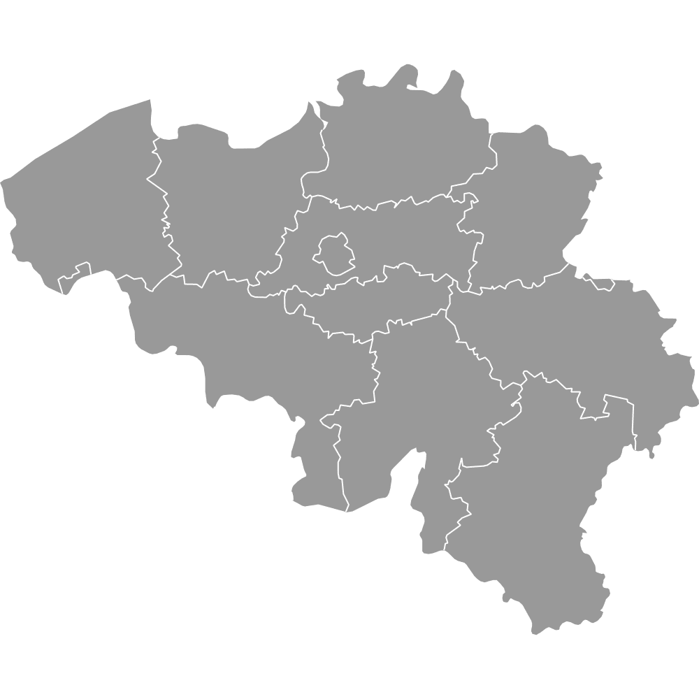
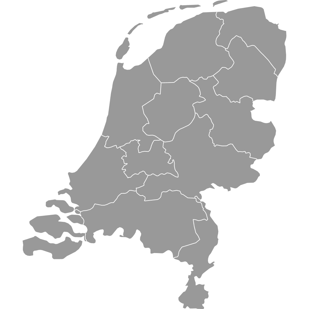
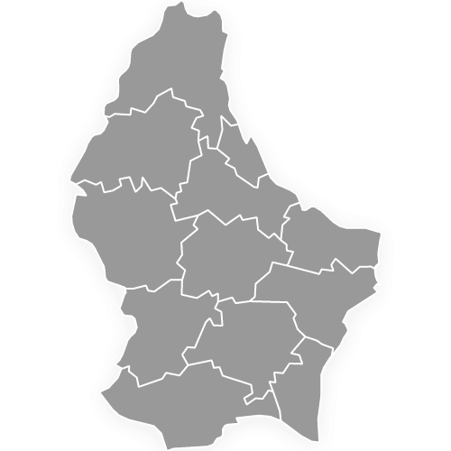
- What each country contributes: The Netherlands and Luxembourg give 12 units each, and Belgium gives 11, which are 10 provinces and the Brussels-Capital Region. Each country has its own page, Belgium Map with Provinces, Netherlands Map with Provinces and Luxembourg Cantons, and the whole-country version is the Benelux Map with Countries.
- Belgian provinces and seats: The Flemish Region has Antwerp (Antwerp), East Flanders (Ghent), West Flanders (Bruges), Flemish Brabant (Leuven) and Limburg (Hasselt). The Walloon Region has Hainaut (Mons), Liège (Liège), Luxembourg (Arlon), Namur (Namur) and Walloon Brabant (Wavre).
- Dutch provinces and seats: Drenthe (Assen), Flevoland (Lelystad), Fryslân (Leeuwarden), Gelderland (Arnhem), Groningen (Groningen), Limburg (Maastricht), Noord-Brabant ('s-Hertogenbosch), Noord-Holland (Haarlem), Overijssel (Zwolle), Utrecht (Utrecht), Zeeland (Middelburg) and Zuid-Holland (The Hague).
- Luxembourg cantons: Capellen, Clervaux, Diekirch, Echternach, Esch-sur-Alzette, Grevenmacher, Luxembourg, Mersch, Redange, Remich, Vianden and Wiltz.
- Population range: Zuid-Holland has 3,882,708 people, ahead of Noord-Holland with 3,009,386 and Noord-Brabant with 2,676,955 (CBS, 2026). Antwerp is the most populous Belgian province with 1,931,891 (Statbel, 2026). The canton of Vianden is the smallest unit with 5,808 people (STATEC, 2026).
- Area range: Gelderland is the largest unit with 4,956.06 km² of land (CBS), ahead of Noord-Brabant with 4,900.03 km² of land and the Belgian province of Luxembourg with 4,459.25 km² (Statbel). Vianden is the smallest at 78.52 km² (STATEC), and Brussels is the smallest Belgian unit at 162.42 km² (Statbel).
- Capitals: Amsterdam, the Dutch capital, lies in Noord-Holland, while the government sits in The Hague in Zuid-Holland. Brussels, Belgium's capital, lies in the Brussels-Capital Region, and Luxembourg City lies in the canton of Luxembourg.
- Reform dates: Flevoland became the 12th Dutch province in 1986, Belgium's provinces took their present number in the 1995 split of Brabant, and Luxembourg's cantons have been its first level since the law of 2 September 2015 abolished its three districts.
- Shared names: Limburg is both a Belgian and a Dutch province, and Luxembourg is a Belgian province, a canton and the country.
- Frontier units: Only two outside countries meet the map. Along the German frontier lie Liège, Groningen, Drenthe, Overijssel, Gelderland, Dutch Limburg and the cantons of Remich, Vianden, Echternach, Diekirch, Clervaux and Grevenmacher. The French frontier runs along West Flanders, Hainaut, Namur, the Belgian province of Luxembourg and the cantons of Remich and Esch-sur-Alzette.
- Edges: The map leaves out the Dutch Caribbean municipalities of Bonaire, Sint Eustatius and Saba, and the small enclaves of Baarle. The IJsselmeer and Lauwersmeer are not colored, so Flevoland, Noord-Holland, Fryslân and Groningen show water inside their outlines.
Interesting Facts
- Cantons without a government: Luxembourg's cantons have no administration of their own. They are the building blocks of Luxembourg's four electoral constituencies and of its judicial districts.
- Brussels as an island: On this map Brussels touches only Flemish Brabant, so it is wholly surrounded by one province.
Free Downloads
Free for personal and commercial use with a credit to Ultimaps. See the license terms for details.
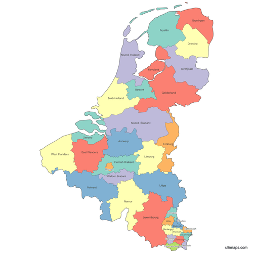 Colored Benelux Map with Provinces and Cantonspng642 KB
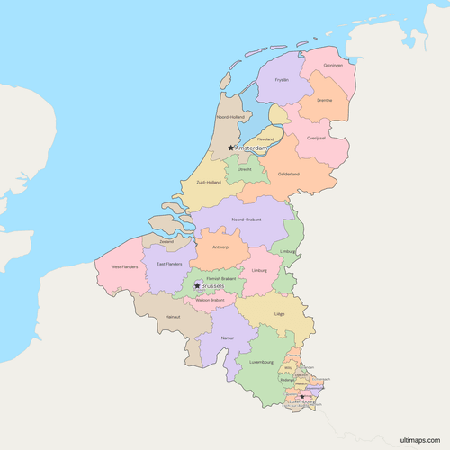 Political Map of the Benelux with Provinces and Cantonspng671 KB
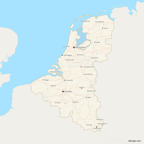 Map of the Benelux with Cities and Roadspng835 KB
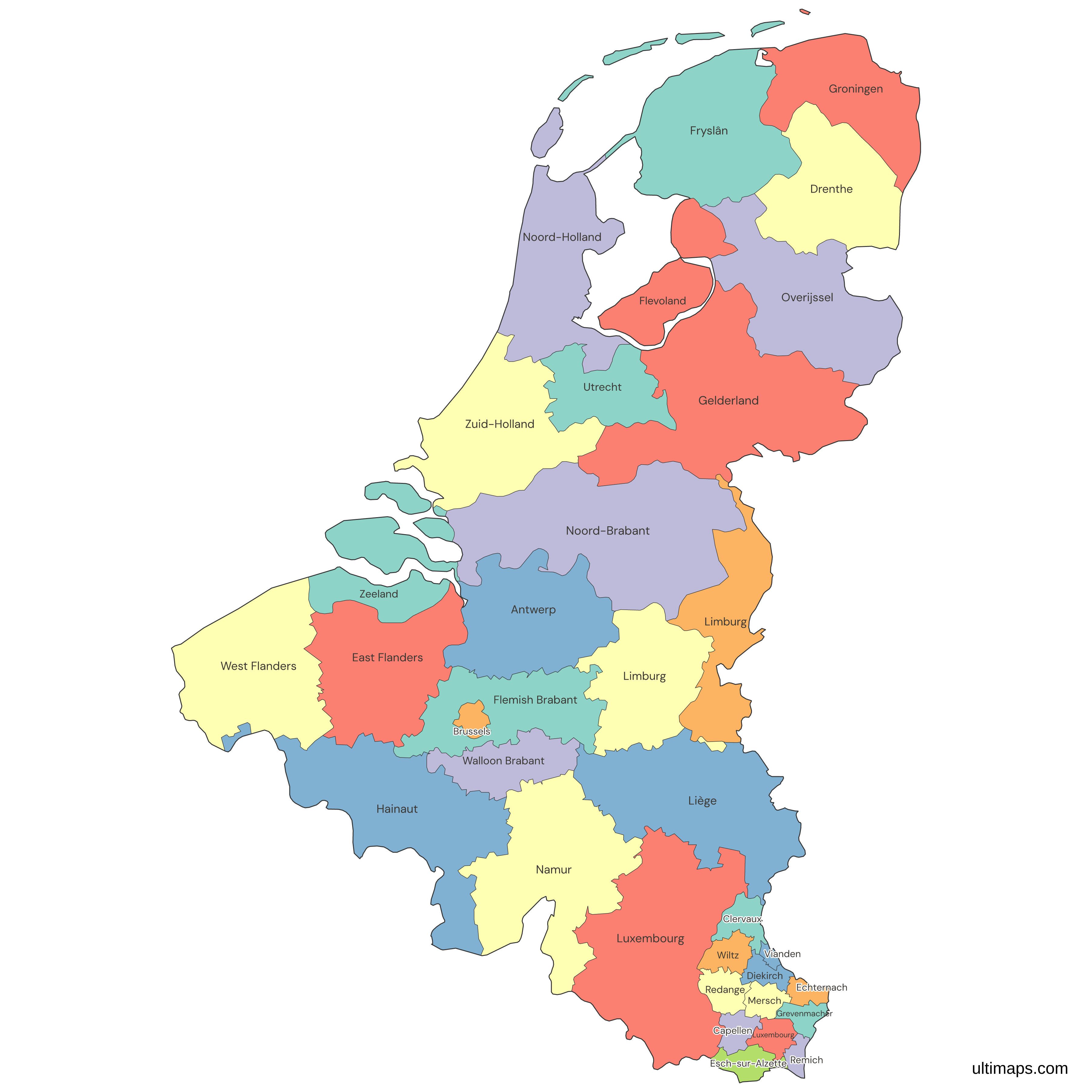
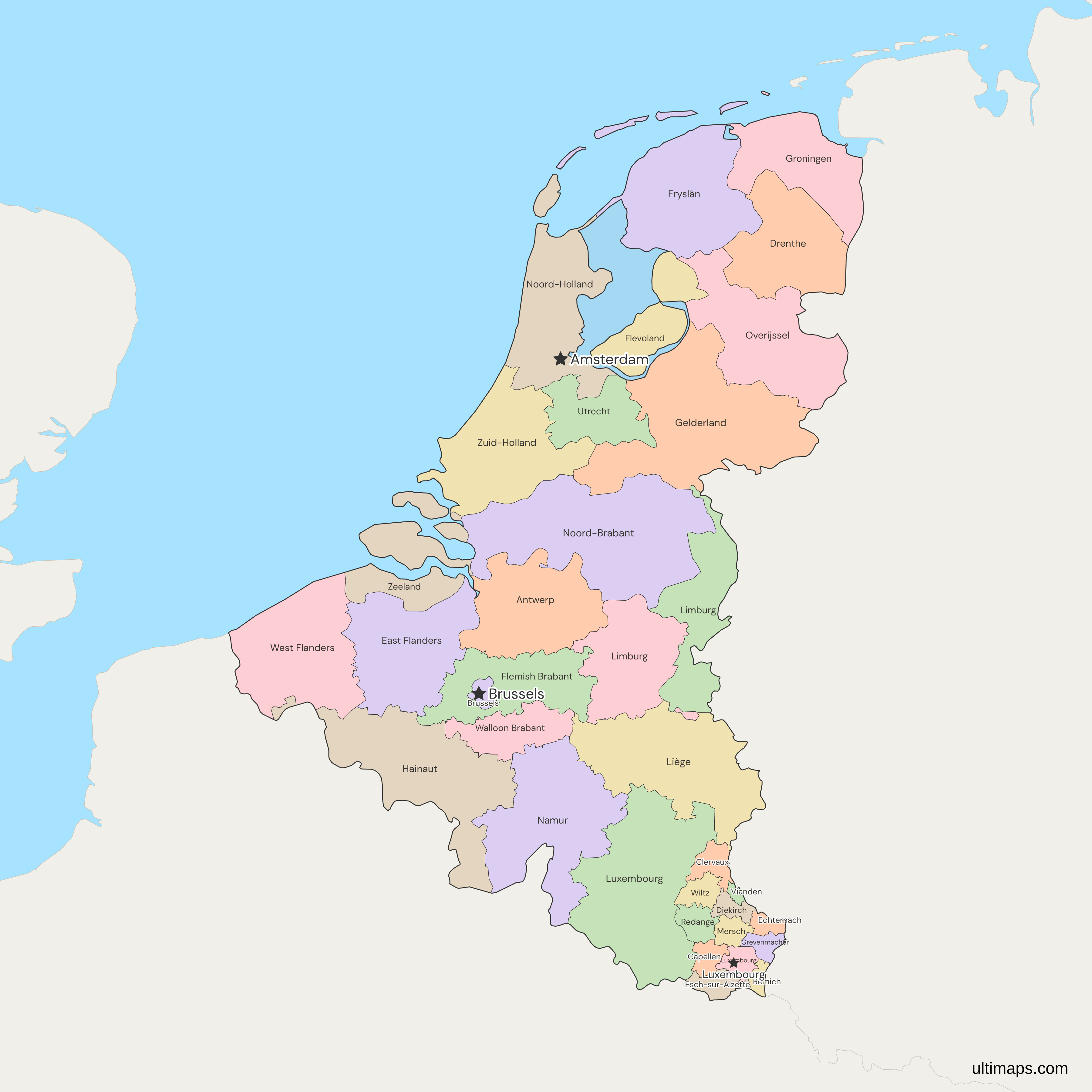
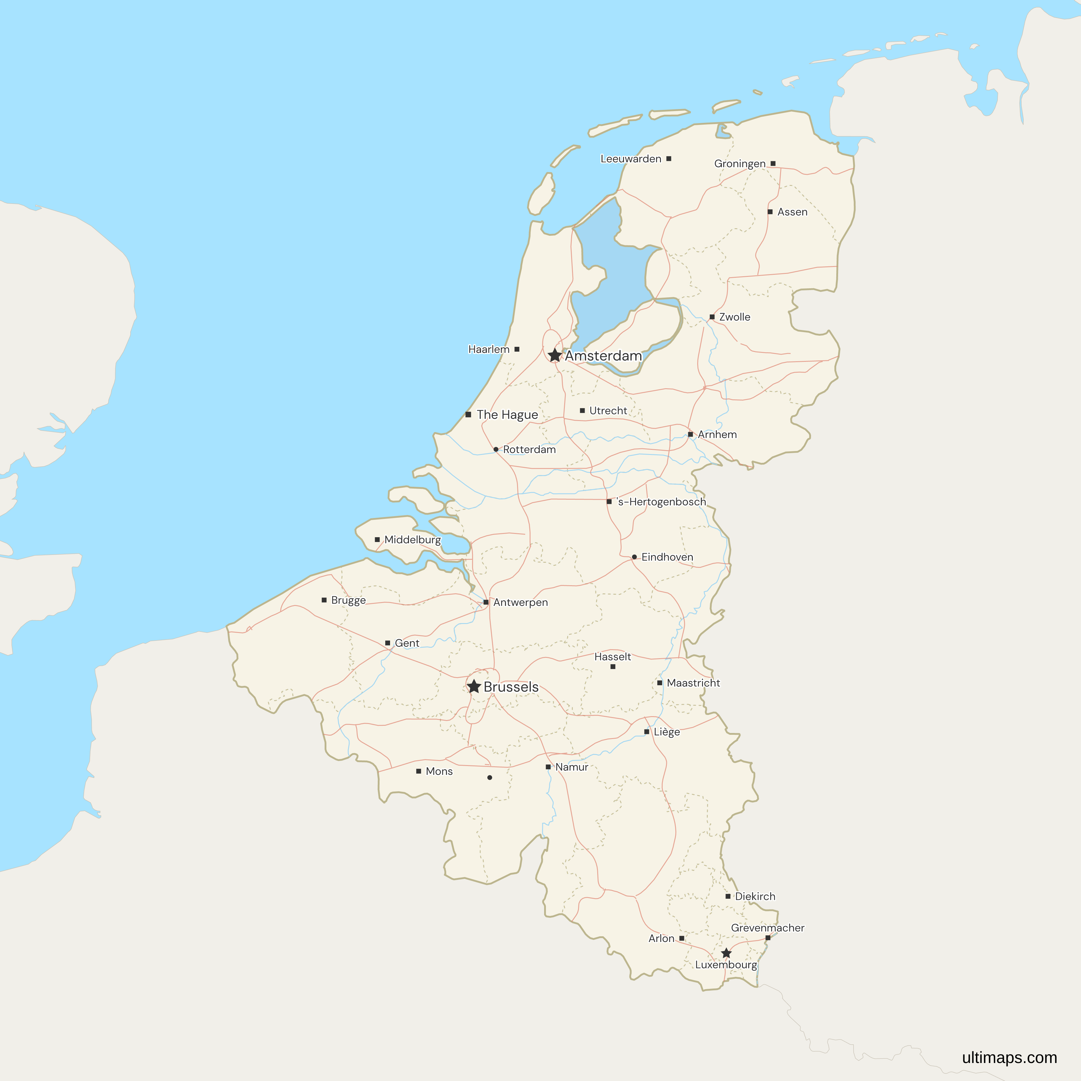
Need it without colors? The blank version of this map comes as a print-ready PDF (A4 and US Letter), a PNG and an editable SVG.
Custom Map Features
This map supports labels.
This map supports surrounding areas, roads, rivers and cities. New
This map is divided into 35 provinces/cantons.
Updates
Nov 5, 2026:
- Added map of Benelux provinces and cantons
Frequently Asked Questions
The Benelux map has 22 provinces and 12 cantons, plus the Brussels-Capital Region, which makes 35 units. Brussels has no provinces of its own, so the map draws it as a single unit beside Belgium's 10 provinces. By country that gives 11 Belgian units, 12 Dutch provinces and 12 Luxembourg cantons. Flevoland became the 12th Dutch province in 1986, and the Luxembourg cantons became the country's first level when the districts were abolished by the law of 2 September 2015.
Holland is the region made up of two of the 12 Dutch provinces, Noord-Holland and Zuid-Holland, while the Netherlands is the whole country. Both provinces are on the Benelux map, with Amsterdam in Noord-Holland and The Hague in Zuid-Holland. Together they hold about 6.9 million of the Dutch population (CBS, 2026). The other ten provinces, among them Utrecht, Zeeland and Fryslân, are not part of Holland, and neither are Brabant or Limburg, which are often mistaken for it. A map of Holland alone would color just those two units, and the map of the whole country colors all 12.
The Benelux map has two Limburgs and two Luxembourgs because each name is shared across a border or a level. Limburg is a Belgian province (BE-VLI) with 908,582 people (Statbel, 2026) and a Dutch province (NL-LI) with 1,138,374 (CBS, 2026), and the two touch each other. Luxembourg is a Belgian province (BE-WLX) with 296,370 people (Statbel, 2026), a canton of the Grand Duchy (LU-LU) with 213,766 (STATEC, 2026) and the name of the country itself. Use the codes when you match a table to the map.
Luxembourg has cantons because it is one small state with no provinces, and its cantons became the first level when the three districts were abolished in 2015. Eurostat counts the whole Grand Duchy as a single region at NUTS 1, 2 and 3, so the 12 cantons sit below the NUTS levels, while the Belgian and Dutch provinces are NUTS 2 regions. The gap shows in population: Zeeland, the smallest Dutch province, has 394,538 people (CBS, 2026), against 5,808 in Vianden (STATEC, 2026). Compare cantons with cantons and provinces with provinces.
Zuid-Holland has about 670 times as many people as Vianden, 3,882,708 against 5,808 (CBS and STATEC, 2026). By area, Gelderland is the largest unit with 4,956.06 km² of land (CBS), and Vianden the smallest with 78.52 km² (STATEC). Counting inland and tidal water, Fryslân is larger at 5,753.26 km² (CBS). Among Belgian provinces, Luxembourg is the largest at 4,459.25 km² (Statbel), and Brussels is the smallest Belgian unit at 162.42 km² (Statbel). The Dutch land and total figures differ most in Fryslân, where inland water adds more than 2,400 km² to the 3,325.35 km² of land (CBS).
Belgium's first-level units are the 10 provinces and the Brussels-Capital Region, and the country has no states or counties. It is a federation of three regions, the Flemish Region, the Walloon Region and the Brussels-Capital Region, alongside three language communities. Five provinces lie in each of the Flemish and Walloon regions, and Brussels has none. Statbel publishes the Brussels-Capital Region as a single administrative district, which is how the Benelux map draws it, as one unit beside the 10 provinces.
The free Ultimaps editor opens this map with no account needed. Click a province or canton to color it, or upload a table with one row per unit and its value. Key the two Limburgs and the two Luxembourgs by code, BE-VLI and NL-LI, BE-WLX and LU-LU, because the plain names match neither unit. Brussels takes a row of its own. Add pins and labels, then share the finished map by link or embed it on a website. A free export is a standard PNG with a small Ultimaps credit. High-resolution PNG, SVG and PDF export are Pro features.