Luxembourg Map with Cantons
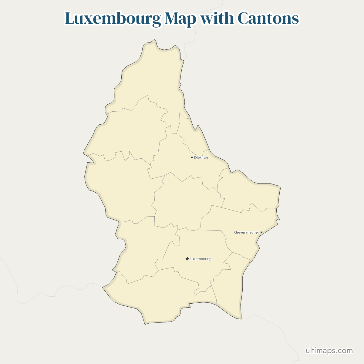
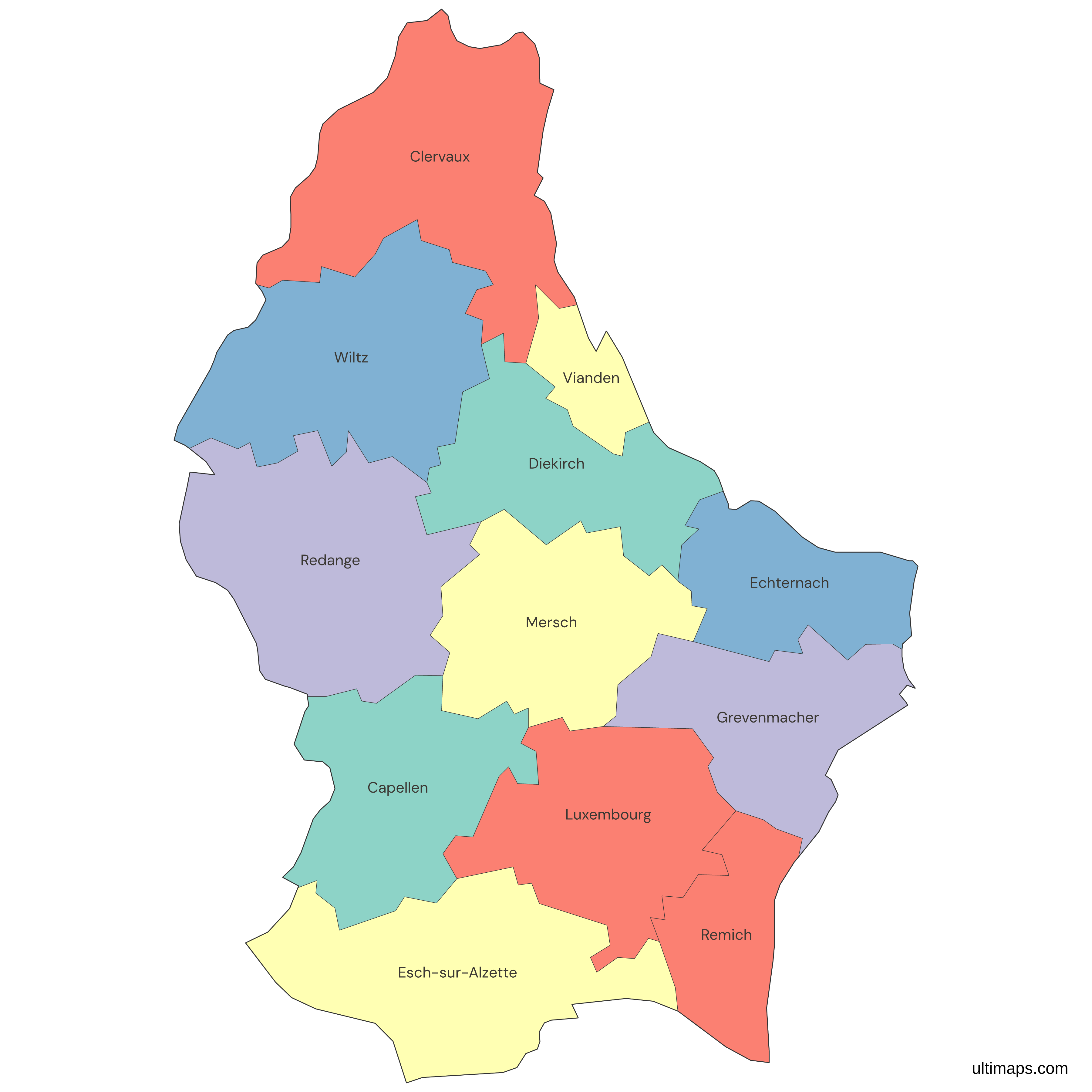
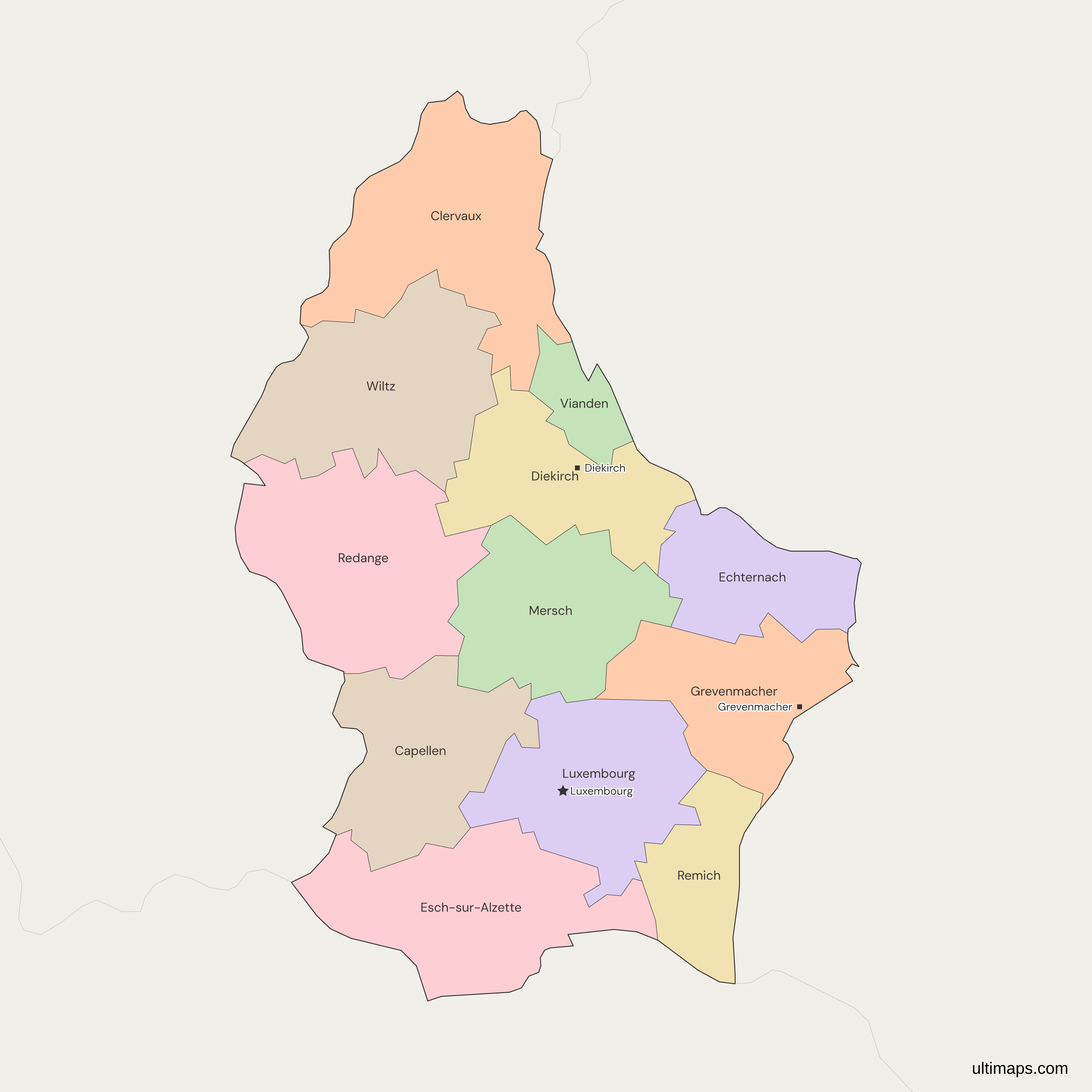
This map of Luxembourg shows all 12 cantons, which group the country's 100 communes and have been its largest territorial subdivision since 3 October 2015, when the three districts were abolished. Luxembourg, the national capital, lies in the canton of the same name, the most populous at 213,766 residents (STATEC, 1 January 2026). Clervaux is the largest canton at 342.17 km² (STATEC, 1 January 2018), and Vianden the smallest at 78.52 km². The map draws the cantons only, with no communes and no districts.
Open the map in the free Ultimaps editor to make your own custom map of Luxembourg. You can color the cantons by your data, add pins and labels, and share or embed the finished map.
Interactive Luxembourg Map with Cantons
List of Cantons (12)
| # | Canton | Capital | Population (2026) | Area (km², 2018) |
|---|---|---|---|---|
| 1 | Capellen | Capellen | 56,562 | 199.21 |
| 2 | Clervaux | Clervaux | 22,179 | 342.17 |
| 3 | Diekirch | Diekirch | 36,530 | 204.51 |
| 4 | Echternach | Echternach | 20,683 | 185.54 |
| 5 | Esch-sur-Alzette | Esch-sur-Alzette | 197,314 | 242.77 |
| 6 | Grevenmacher | Grevenmacher | 34,007 | 211.37 |
| 7 | Luxembourg | Luxembourg | 213,766 | 238.46 |
| 8 | Mersch | Mersch | 37,191 | 223.90 |
| 9 | Redange | Redange | 21,701 | 267.49 |
| 10 | Remich | Remich | 24,827 | 127.87 |
| 11 | Vianden | Vianden | 5,808 | 78.52 |
| 12 | Wiltz | Wiltz | 20,391 | 264.55 |
Data sources:
- Capital: STATEC, LUSTAT DF_X010 Subdivisions territoriales (canton chefs-lieux). License: facts compiled by Ultimaps, CC BY 4.0.
- Population: STATEC, LUSTAT DF_X021, population on 1 January 2026. License: CC0 1.0.
- Area: STATEC, LUSTAT DF_X010 Subdivisions territoriales (1 January 2018). License: CC0 1.0.
Luxembourg Cantons: Key Facts
- Number of cantons: 12, all of the same type. They group the country's 100 communes.
- Capital: Luxembourg City is the national capital and lies in the canton of Luxembourg. Cantons carry no administrative structure of their own.
- Largest canton by area: Clervaux, 342.17 km² (STATEC, 1 January 2018), followed by Redange at 267.49 km² and Wiltz at 264.55 km².
- Smallest canton by area: Vianden, 78.52 km² (STATEC, 1 January 2018), then Remich at 127.87 km².
- Most populous canton: Luxembourg, 213,766 residents, then Esch-sur-Alzette with 197,314 (STATEC, 1 January 2026).
- Least populous canton: Vianden, 5,808 residents (STATEC, 1 January 2026). The 12 cantons add up to 690,959.
- Borders: Belgium touches Redange, Esch-sur-Alzette, Wiltz, Clervaux and Capellen. Germany touches Remich, Vianden, Echternach, Diekirch, Clervaux and Grevenmacher. France touches only Remich and Esch-sur-Alzette.
- Coast: none. Luxembourg is landlocked, and the map shows no lake.
- Former grouping: three districts (Diekirch, Grevenmacher and Luxembourg) sat above the cantons until the law of 2 September 2015 abolished them. Their ISO 3166-2 codes LU-D, LU-G and LU-L were replaced by the 12 canton codes.
- Codes: LU-CA for Capellen to LU-WI for Wiltz, 12 ISO 3166-2 codes in all.
- Last boundary change: the Parc Hosingen merger of 1 January 2012, which moved the former commune of Hoscheid from canton Diekirch to canton Clervaux.
Interesting Facts
- Only two cantons, Luxembourg and Mersch, have no border with another country. The other 10 each touch Belgium, Germany or France.
- The Diekirch and Vianden line moved in 2006, when the commune of Tandel was formed from Bastendorf (Diekirch) and Fouhren (Vianden) and placed in Vianden.
- The lines between the cantons come from ACT, the national mapping agency (release of 5 October 2026), and the national outline comes from Natural Earth.
Free Downloads
Free for personal and commercial use with a credit to Ultimaps. See the license terms for details.
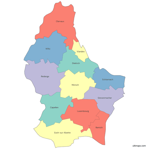 Colored Luxembourg Map with Cantonspng393 KB
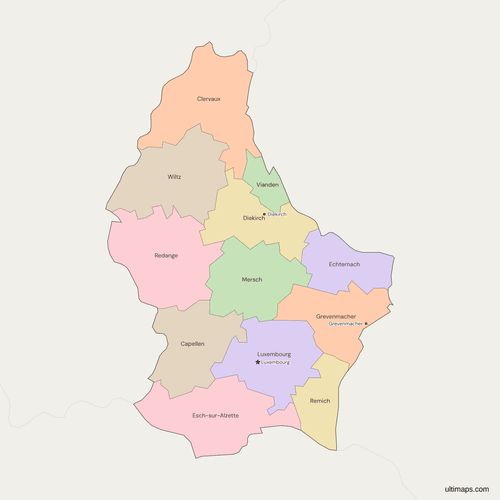 Political Map of Luxembourg with Cantonspng393 KB
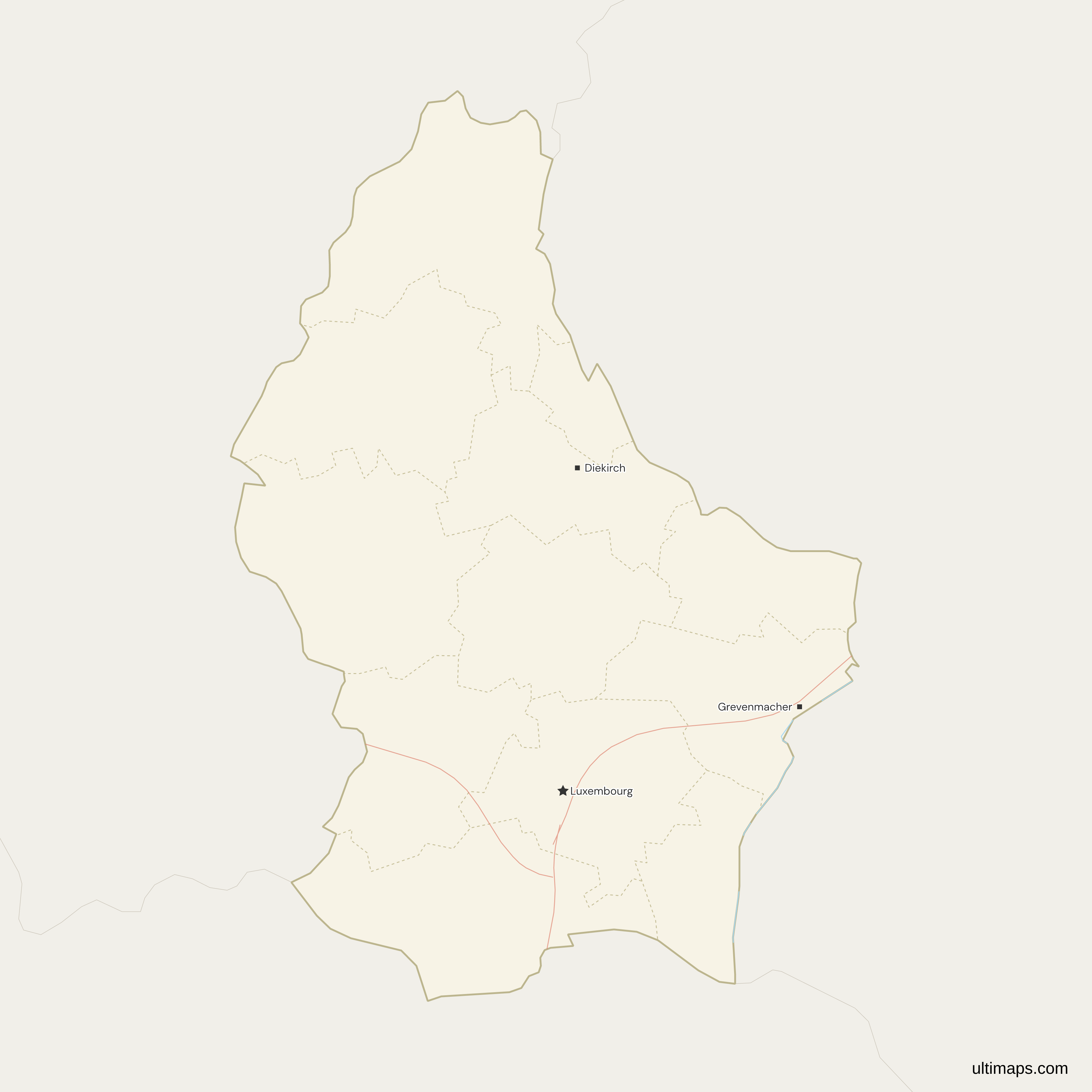
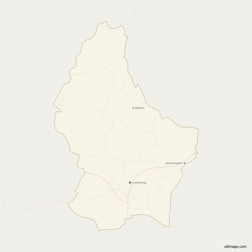 Map of Luxembourg with Cities and Roadspng351 KB
Need it without colors? The blank version of this map comes as a print-ready PDF (A4 and US Letter), a PNG and an editable SVG.
Custom Map Features
This map supports labels.
This map supports surrounding areas, roads, rivers and cities. New
This map is divided into 12 cantons.
Updates
Nov 5, 2026:
- Added map of Luxembourg cantons
Frequently Asked Questions
Luxembourg has 12 cantons: Capellen, Clervaux, Diekirch, Echternach, Esch-sur-Alzette, Grevenmacher, Luxembourg, Mersch, Redange, Remich, Vianden and Wiltz. The canton has been the largest territorial subdivision of the Grand Duchy since 3 October 2015. Each canton groups several of the country's 100 communes, and each has an ISO 3166-2 code from LU-CA to LU-WI. Together they hold 690,959 residents (STATEC, 1 January 2026), and the cantons of Luxembourg and Esch-sur-Alzette are the two most populous. The list runs alphabetically from Capellen to Wiltz, and the codes follow the same order.
No. Luxembourg has no provinces, regions or states as administrative units, so searches for those words lead to the cantons. The country is divided into 12 cantons, and the cantons are divided into 100 communes. The 12 cantons are also grouped into four electoral constituencies: North, East, Centre and South. The Gutland in the south and the Éislek in the north are natural regions, not administrative ones. The Belgian province of Luxembourg is a separate place in another country. On this map, the units you color are the 12 cantons.
The Luxembourg map shows the 12 cantons and does not draw the 100 communes inside them. Communes are the level below the cantons, and they are the units behind searches such as communes or Gemeinden in Luxembourg. Most commune mergers stayed inside a single canton, and the most recent ones, Groussbus-Wal and Bous-Waldbredimus in September 2023, left the country with 100. You can still mark individual communes or towns on the map with pins and labels. If your data is by commune, total it by canton first and color the 12 cantons.
Luxembourg's three districts were abolished by the law of 2 September 2015, effective 3 October 2015. They were Diekirch, Grevenmacher and Luxembourg, and each grouped several cantons. ISO 3166-2:LU replaced the district codes LU-D, LU-G and LU-L with the 12 canton codes. Older maps and image collections still show the districts, so the three-district layout seen there is outdated. The canton lines themselves were untouched, and only the level above them disappeared, so a search for the districts now leads to the cantons.
No. The Belgian province of Luxembourg is part of Belgium and lies on the western side of the Grand Duchy. This map covers the Grand Duchy of Luxembourg only and draws its 12 cantons, with Belgium shown as a neighboring country. Five cantons touch Belgium: Redange, Esch-sur-Alzette, Wiltz, Clervaux and Capellen. For the Belgian province of Luxembourg, open the Belgium provinces map. To see both countries together, use the Benelux provinces map, which draws the 12 cantons beside the provinces of Belgium and the Netherlands. To see Luxembourg as one country beside Belgium and the Netherlands, open the Benelux map.
With a total area of 342.17 km² (STATEC, 1 January 2018), Clervaux is the largest canton. It lies in the north of the country and touches both Belgium and Germany. Redange follows with 267.49 km², then Wiltz with 264.55 km². The figures are total area as published by STATEC. Clervaux has 22,179 residents (STATEC, 1 January 2026), so it is large in area but not in population. Esch-sur-Alzette, at 242.77 km², ranks fourth. Redange, in second place, lies on the Belgian border.
Vianden is the smallest canton of Luxembourg, with a total area of 78.52 km² (STATEC, 1 January 2018). It lies in the northeast, borders Germany, and shares its other edges with Diekirch and Clervaux. Remich is the next smallest at 127.87 km². Vianden is also the least populous canton, with 5,808 residents (STATEC, 1 January 2026), so it is the smallest by both measures. At 78.52 km², it is less than a quarter of the size of Clervaux. Echternach, at 185.54 km², is third smallest.
Residents of the canton of Luxembourg number 213,766 (STATEC, 1 January 2026), the highest count of the 12, and the canton contains the national capital, Luxembourg City. Esch-sur-Alzette comes second with 197,314, and Capellen is third with 56,562. The first two cantons hold about 60 percent of the country's 690,959 residents. The least populous, Vianden, has 5,808, a factor of about 37 below the first. Mersch is fourth with 37,191, and Remich, the second smallest by area, has 24,827. Capellen, in third, borders Belgium.
Luxembourg can be mapped in the free Ultimaps editor, which opens from this page with the 12 cantons already drawn. No account is needed. Paste or import a table with one row per canton, or click cantons to color them by hand. Rows match on the canton name, with or without the word Canton, or on an ISO code such as LU-CL. Pins mark places the map leaves out, such as Dudelange or Differdange. A free account lets you save and publish the map, then share a link or embed it. A free export is a standard PNG with a small Ultimaps credit. High-resolution PNG, SVG and PDF files need Ultimaps Pro.