Serbia Map with Districts
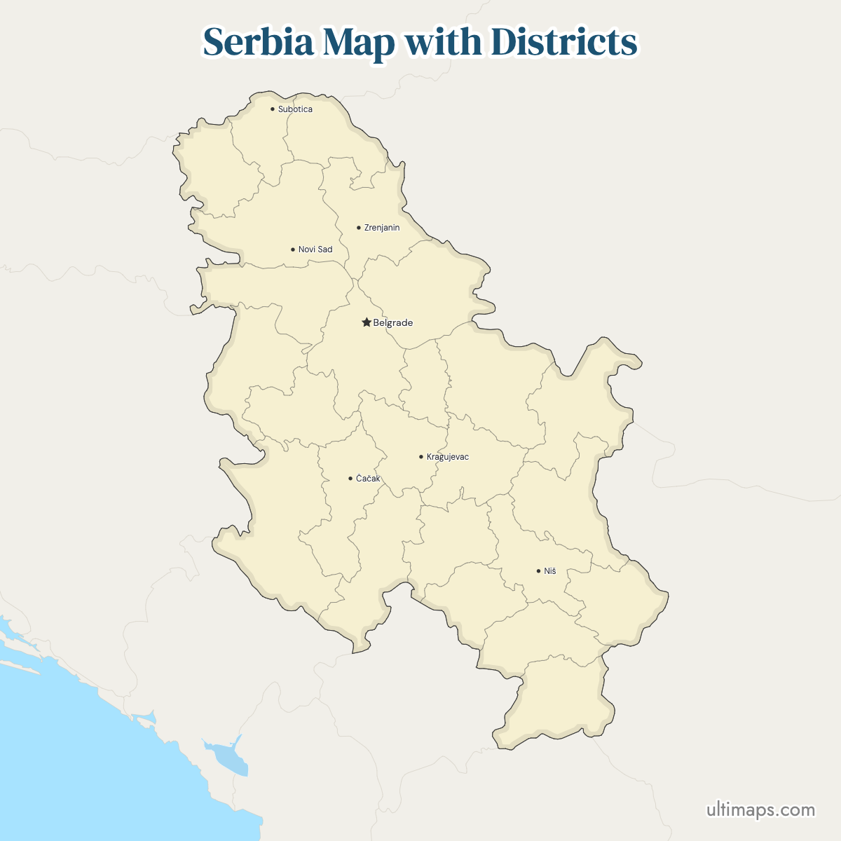
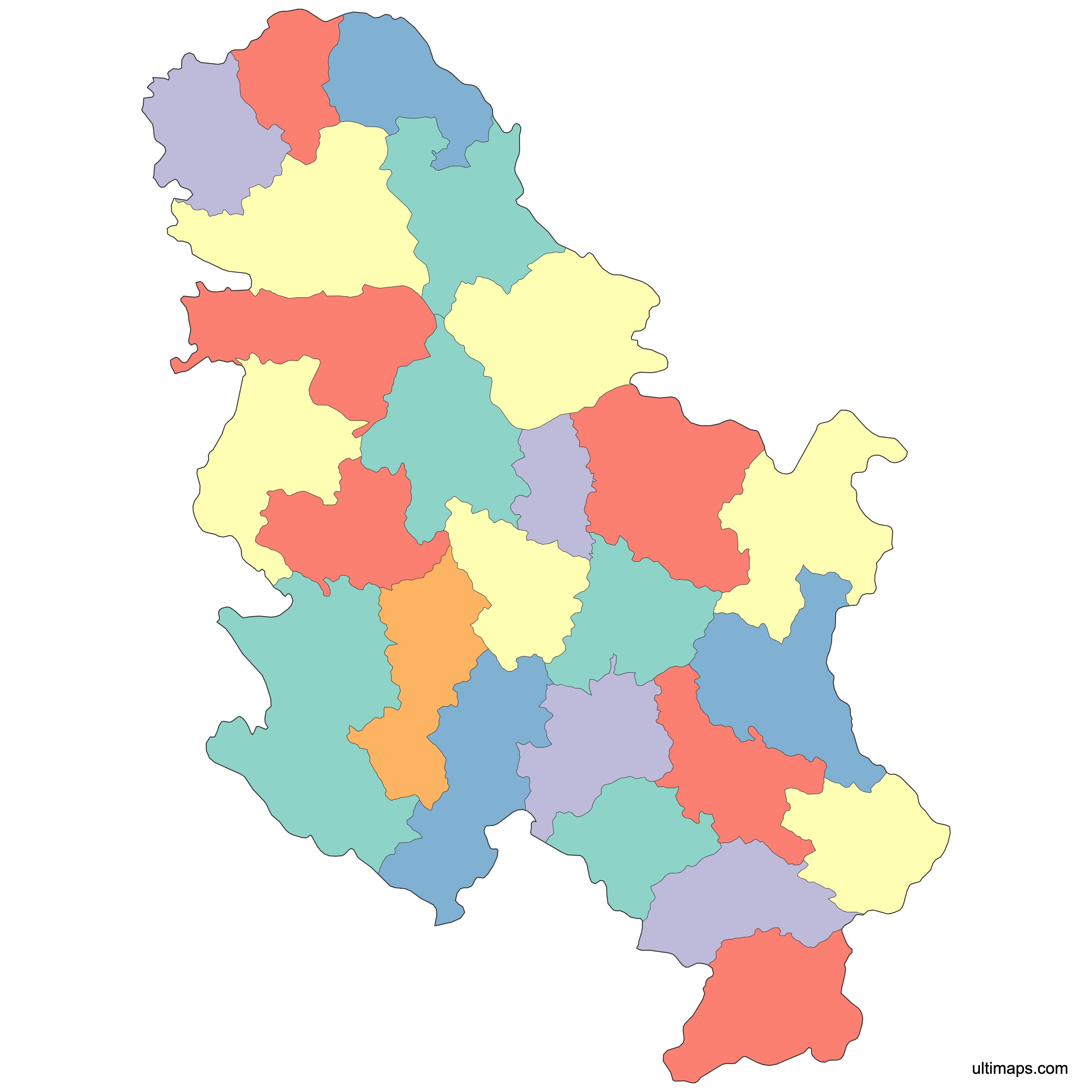
Serbia's district map on this page carries 25 units: the 24 okruzi (districts) covering Serbia proper, plus the City of Belgrade, which holds district-level status of its own. Districts are not local governments themselves. They group municipalities and cities and host the seats of state administration outside the capital, sitting as the first-level layer on official maps. Several names come from historical and geographic regions rather than from an administrative seat, including Raška, Zlatibor, Moravica and Pčinja. Where other references quote 29 districts, they are adding the five district units in Kosovo, which this map does not show. Zoom in wherever you need to check a boundary or a district seat. You can download the plain map for free, or apply your own numbers to the 25 units so each district is colored by your data.
Interactive Serbia Map with Districts
List of Districts (25)
| # | District |
|---|---|
| 1 | Belgrade |
| 2 | Bor |
| 3 | Braničevo |
| 4 | Central Banat |
| 5 | Jablanica |
| 6 | Kolubara |
| 7 | Mačva |
| 8 | Moravica |
| 9 | Nišava |
| 10 | North Bačka |
| 11 | North Banat |
| 12 | Pčinja |
| 13 | Pirot |
| 14 | Podunavlje |
| 15 | Pomoravlje |
| 16 | Rasina |
| 17 | Raška |
| 18 | South Bačka |
| 19 | South Banat |
| 20 | Srem |
| 21 | Šumadija |
| 22 | Toplica |
| 23 | West Bačka |
| 24 | Zaječar |
| 25 | Zlatibor |
Serbia Districts: Key Facts
- Total number of districts: 25 shown on this map, being 24 districts (okruzi) plus the City of Belgrade; sources that include the five district units in Kosovo list 29
- Most populous district: City of Belgrade, 1,681,405 (2022 Census, Statistical Office of the Republic of Serbia), up from 1,659,440 in the 2011 Census
- Least populous districts: Pirot, 76,700, and Toplica, 77,341 (both 2022 Census, Statistical Office of the Republic of Serbia); both were already below 92,000 in the 2011 Census
- Largest district by area: Zlatibor District, 6,140 km² (2,371 sq mi) in the official district areas published by the Statistical Office of the Republic of Serbia, seat Užice
- Smallest district by area: Podunavlje District, 1,248 km² (482 sq mi) in the official district areas published by the Statistical Office of the Republic of Serbia, seat Smederevo
- Districts with major urban centers: Belgrade; South Bačka (Novi Sad); Nišava (Niš); Šumadija (Kragujevac); North Bačka (Subotica); Central Banat (Zrenjanin); Moravica (Čačak); Raška (Kraljevo); Jablanica (Leskovac); Mačva (Šabac); Srem (Sremska Mitrovica); Kolubara (Valjevo); West Bačka (Sombor); Braničevo (Požarevac)
- Capital and administrative center: Belgrade, national capital and a district-level unit in its own right
- Borders: landlocked, with neighbors Hungary to the north, Romania to the northeast, Bulgaria to the southeast, North Macedonia to the south, Albania to the southwest in the Kosovo context, Montenegro and Bosnia and Herzegovina to the west, and Croatia to the northwest; the Danube is the main waterway, forming part of the Romanian border
- Time zone: Central European Time (UTC+1), switching to Central European Summer Time (UTC+2)
- Historical note: the present district framework dates from the reorganization of the Republic of Serbia's territory in the 1990s after the break-up of Yugoslavia; the current register of districts, municipalities and cities is kept by the Ministry of Public Administration and Local Self-Government
Interesting Facts
- Zlatibor at 6,140 km² (2,371 sq mi) is close to five times the size of Podunavlje at 1,248 km² (482 sq mi), the widest area gap on the map (official district areas, Statistical Office of the Republic of Serbia).
- North Bačka, 1,784 km² (689 sq mi) in the same official series, is often mislabeled as Serbia's smallest district. It is the smallest only within Vojvodina.
- Publishers issue two versions of this map: one for Serbia proper, one that also draws Kosovo district units, because the territory's status is disputed.
- Fortresses mark out four different districts: Kalemegdan in Belgrade, Petrovaradin in South Bačka, Niš Fortress in Nišava and Smederevo Fortress in Podunavlje.
- National parks split along district lines too, with Tara and the Uvac reserve in Zlatibor and Đerdap running along the Danube through Bor and Braničevo.
Free Downloads
Free for personal and commercial use with a credit to Ultimaps. See the license terms for details.
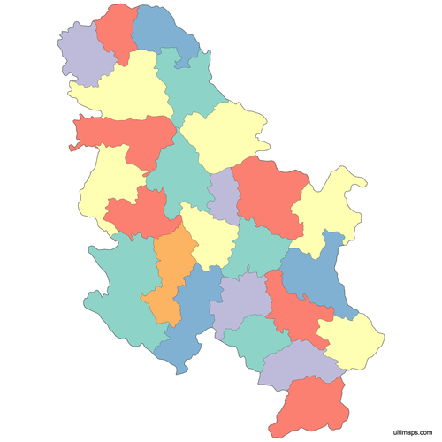 Colored Serbia Map with Districtspng595 KB
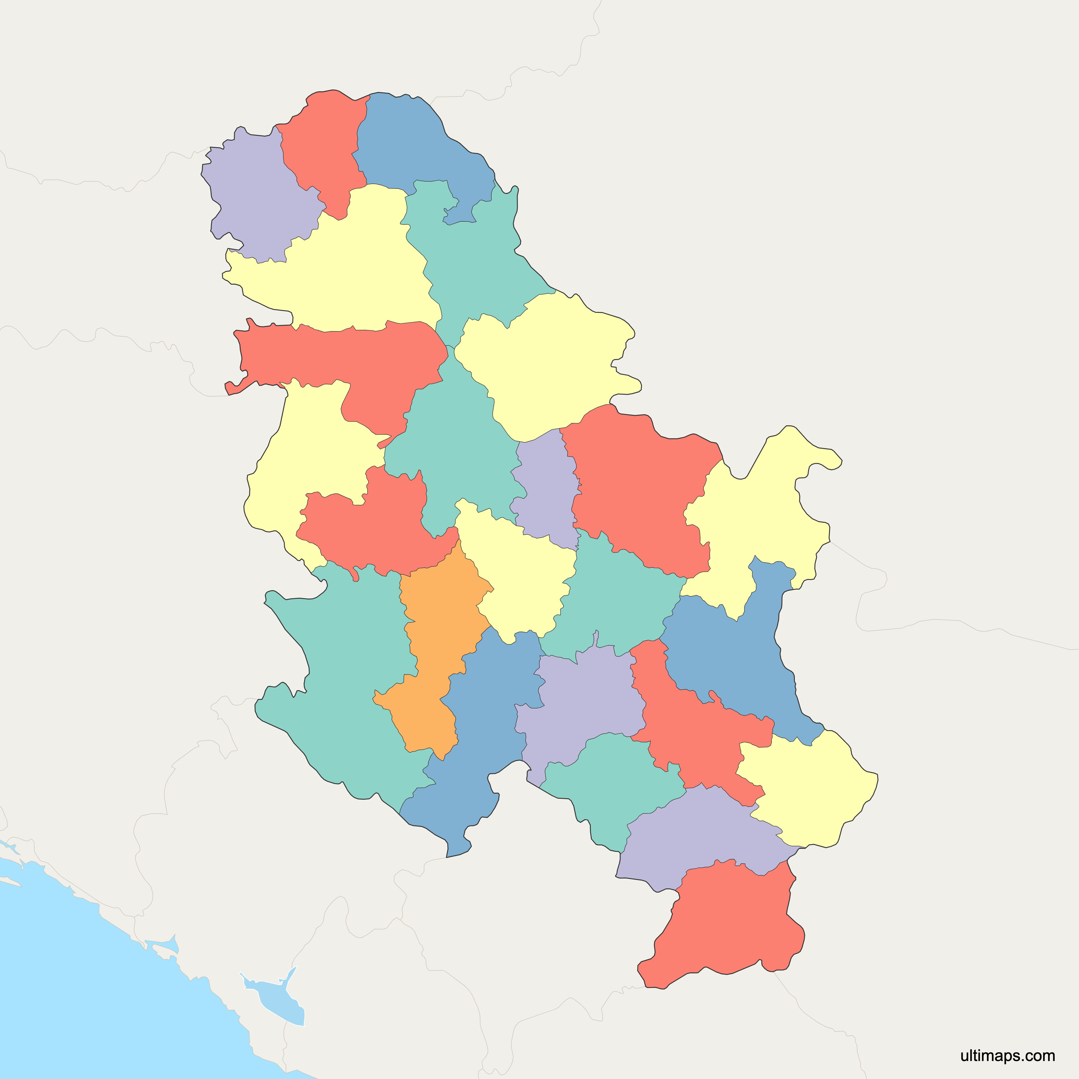
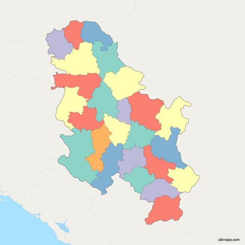 Political Map of Serbia with Districtspng658 KB
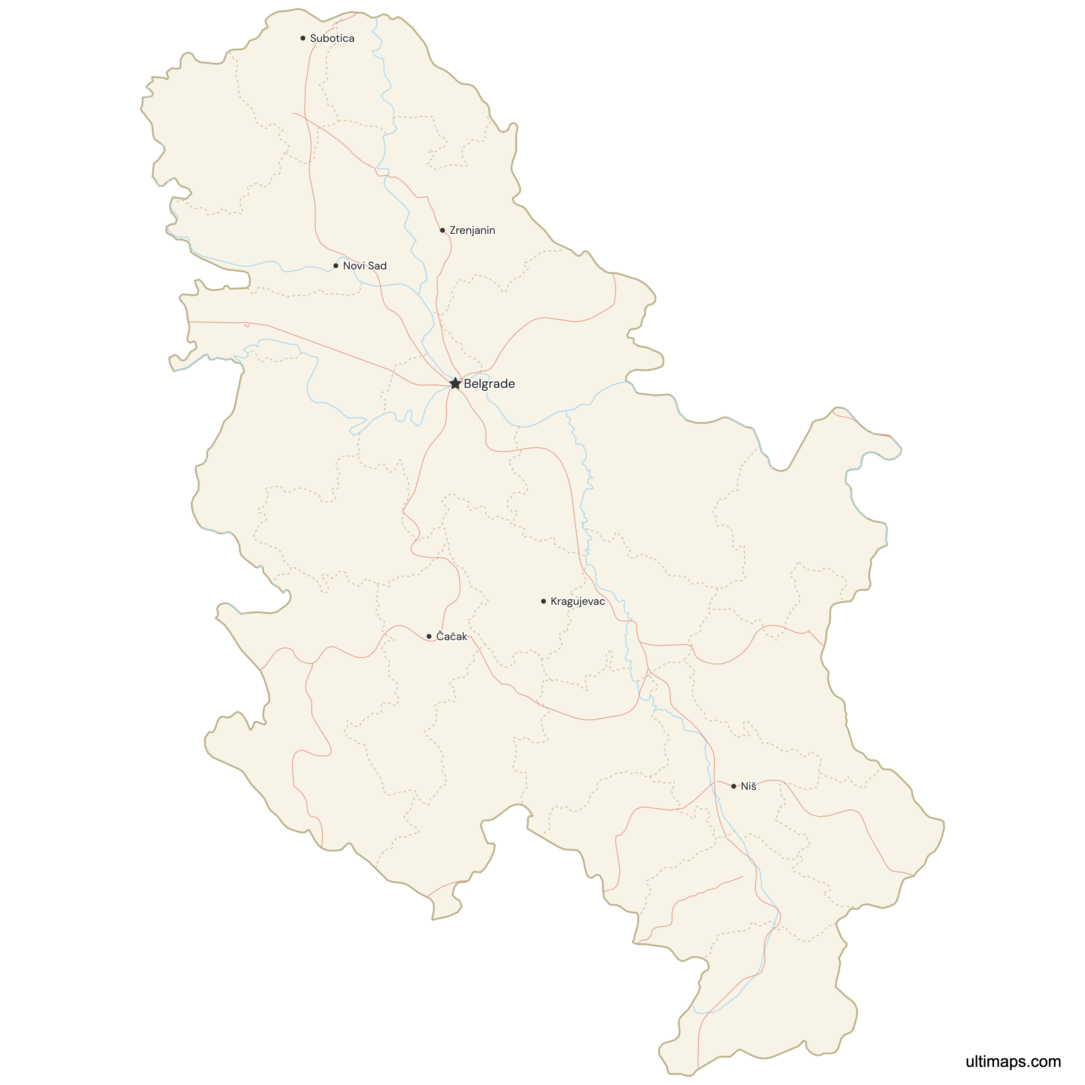
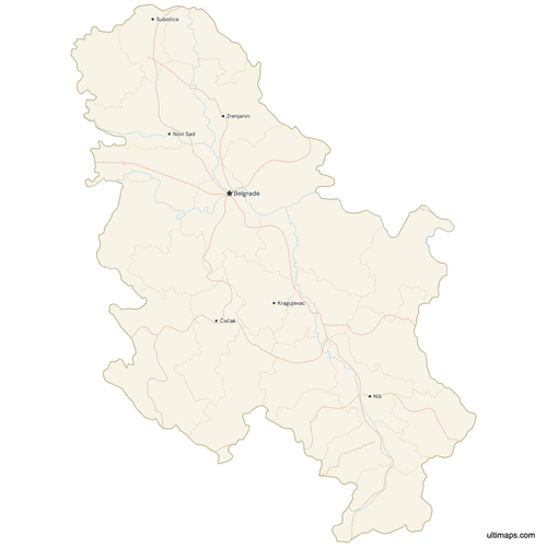 Map of Serbia with Cities and Roadspng809 KB
Need it without colors? The blank version of this map comes as a print-ready PDF (A4 and US Letter), a PNG and an editable SVG.
Custom Map Features
This map supports surrounding areas, roads, rivers and cities. New
This map is divided into 25 districts.
Updates
May 14, 2026:
- Added map of Serbia Districts with surrounding countries, cities, roads, rivers and lakes
Frequently Asked Questions
Serbia has 24 districts (okruzi) plus the City of Belgrade, which carries district-level status, so this map displays 25 units in total. References that also count the five district units in Kosovo, a territory Serbia disputes, give a figure of 29. Districts are the first-level administrative layer above Serbia's 145 municipalities and cities (117 municipalities and 28 cities, excluding Kosovo), used for state administration, statistics and courts rather than for elected local government. Familiar examples include South Bačka around Novi Sad, Nišava around Niš, Šumadija around Kragujevac and Zlatibor, the largest of them at 6,140 km² (2,371 sq mi).
Zlatibor District is Serbia's largest district by area at 6,140 km² (2,371 sq mi) in the official district areas published by the Statistical Office of the Republic of Serbia, covering the mountainous southwest with its seat at Užice. It contains Tara National Park, the Uvac Special Nature Reserve with its river meanders and griffon vulture colony, and the Šargan Eight narrow-gauge railway at Mokra Gora. The district takes its name from the Zlatibor mountain region rather than from any administrative center. For comparison, Zlatibor is nearly five times the size of Podunavlje District, which measures 1,248 km² (482 sq mi), and it borders Bosnia and Herzegovina and Montenegro.
The City of Belgrade is the most populated district-level unit in Serbia, with 1,681,405 residents recorded in the 2022 Census by the Statistical Office of the Republic of Serbia, compared with 1,659,440 in the 2011 Census. That is roughly a quarter of the country's population inside a single unit. Belgrade sits at the confluence of the Sava and Danube, and Kalemegdan Fortress stands above the confluence. The next largest concentrations appear in South Bačka, home to Novi Sad, and Nišava, home to Niš. Belgrade is administered separately from the surrounding districts of Srem, Podunavlje and Šumadija.
Podunavlje District is Serbia's smallest district by area at 1,248 km² (482 sq mi) in the official district areas published by the Statistical Office of the Republic of Serbia, with its seat at Smederevo on the right bank of the Danube. Its name translates roughly as the Danube region, and Smederevo Fortress, built in the 15th century, is the main landmark. North Bačka is often listed in this position by mistake, but its 1,784 km² (689 sq mi) makes it the smallest district only within the province of Vojvodina, not nationally. Podunavlje covers just three municipalities and cities, yet lies within commuting distance of Belgrade.
Pirot District and Toplica District are the least populated districts in Serbia, recorded at 76,700 and 77,341 respectively in the 2022 Census by the Statistical Office of the Republic of Serbia. Both were already below 92,000 in the 2011 Census, and both sit in the south of the country, Pirot near the Bulgarian border and Toplica inland around Prokuplje. Bor District in eastern Serbia is another sparsely populated unit, recorded at 101,100 in the 2022 Census. The contrast with the City of Belgrade at 1,681,405 (2022 Census) shows how unevenly population is spread across the 25 units on this map.
Maps of Serbia's districts appear in two versions, and the difference is Kosovo. Some publishers draw five additional district units in Kosovo, bringing the total to 29, because Serbia's constitution treats the territory as part of the republic. Others exclude those units or place them in a separate inset, reflecting Kosovo's declaration of independence in 2008 and its partial international recognition. The Ultimaps map on this page shows 25 units covering Serbia proper only: 24 districts plus the City of Belgrade. If your project needs the Kosovo units, check that count and boundary set before you start coloring data.
Belgrade is drawn as its own unit on Serbia district maps because the City of Belgrade holds a special administrative status defined in law, standing at the same level as a district rather than sitting inside one. It runs 17 city municipalities, has its own assembly and mayor, and holds powers that ordinary Serbian cities do not. That is why English-language sources usually phrase the count as "24 districts plus the City of Belgrade" instead of simply saying 25 districts. On this map you color and label Belgrade like any other region. It occupies the area where the Sava meets the Danube.
Novi Sad is the seat of South Bačka District in Vojvodina, and Niš is the seat of Nišava District in southern Serbia. South Bačka is Serbia's second most populated district-level unit and includes Petrovaradin Fortress on the Danube, the site of the EXIT festival. Nišava is built around Niš, the country's third largest city, where the Ottoman-era Niš Fortress stands beside the Nišava river. Other district seats that people search for include Subotica in North Bačka, Zrenjanin in Central Banat, Kikinda in North Banat, Požarevac in Braničevo and Kraljevo in Raška District.
Ultimaps runs in your browser, so you need no account and no software. You can color the 25 units two ways: upload a spreadsheet whose district names match the map, and a graduated scale is applied across the 24 districts and Belgrade, or click individual districts and set each fill yourself. Palette, label text, font, border weight and background are all adjustable. Add markers on Belgrade, Novi Sad, Niš, Užice, Subotica or any coordinates you type in. Export the finished map as a PNG for slides, a print-ready PDF, or an SVG that stays editable in vector software.