Belarus Map with Regions
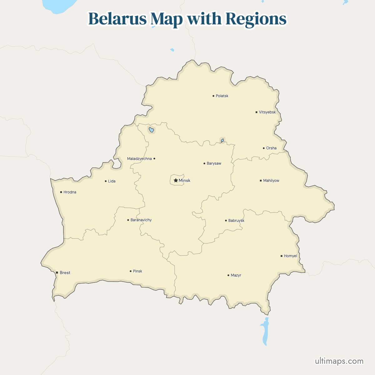
Belarus is split into six oblasts, Brest, Gomel, Grodno, Minsk, Mogilev and Vitebsk, plus the City of Minsk, which sits outside any oblast and carries equal region-level status. That gives 7 top-level units, and this map shows all 7. Vitebsk lies in the north, Grodno in the northwest, Brest in the southwest, Gomel in the southeast, Mogilev in the east, and Minsk Oblast wraps around the capital in the center. One tier down, the country contains 118 raions, with a further 9 inside Minsk City.
Follow the oblast boundaries on the interactive map below, or jump straight to a regional capital. A download of the empty base map is free. Once a value is attached to each of the seven units, Ultimaps converts the outline into a thematic map.
Interactive Belarus Map with Regions
List of Regions (7)
Belarus Regions: Key Facts
- Total number of regions: 7 top-level units, made up of 6 oblasts (Brest, Gomel, Grodno, Minsk, Mogilev, Vitebsk) and the City of Minsk, which is administered separately from the oblast that surrounds it
- Most populous region: City of Minsk, 1,992,862 (2024)
- Least populous region: Mogilev Oblast, 981,174 (2024), with Grodno Oblast next at 992,556 (2024)
- Largest region by area: sources disagree. 2024 figures put Gomel Oblast first at 40,361.66 km² (15,584.86 sq mi), just ahead of Vitebsk Oblast at 40,049.99 km² (15,463.66 sq mi) and Minsk Oblast at 39,912.35 km² (15,407.10 sq mi). The official Belarusian presidential site describes Minsk Oblast as the largest administrative region.
- Smallest region by area: City of Minsk, 305.50 km² (117.95 sq mi)
- Regions with major urban centers: every oblast takes its name from its administrative capital, so the six regional centers are Brest, Gomel, Grodno, Minsk, Mogilev and Vitebsk. Minsk is the largest city in the country.
- Capital / administrative center: Minsk, the national capital, a separate top-level unit, and the seat of Minsk Oblast's administration
- Subdivisions: 118 raions (districts) across the six oblasts, plus 9 raions inside Minsk City
- Borders: Lithuania and Latvia to the northwest and north, Russia to the north and east, Ukraine to the south, Poland to the west. Belarus is landlocked with no sea coast.
- Time zone: UTC+3 (Moscow Time) across the whole country, with no daylight saving changes
- Boundary history: the six-oblast structure is the one in force today, and current official administrative maps show these same regional lines together with the raions inside them
Interesting Facts
- Gomel Oblast could hold the City of Minsk about 132 times over by area, yet Minsk City has roughly 530,000 more residents than any oblast (2024 figures).
- Two regions hold fewer than one million people: Mogilev Oblast at 981,174 and Grodno Oblast at 992,556 (2024).
- English sources spell the same regions two ways depending on whether they transliterate from Russian or Belarusian: Grodno or Hrodna, Gomel or Homyel, Mogilev or Mahilyow, Vitebsk or Vitsebsk.
- Major landmarks by region: Brest Fortress and most of Belovezhskaya Pushcha lie in Brest Oblast, Nesvizh Castle in Minsk Oblast, the historic city of Polotsk in Vitebsk Oblast, and the Gomel Palace and Park Ensemble in Gomel.
- The physical geography shifts north to south: lakes and forest in the north, farmland in the west, an elevated plain in the east, and the Polesye lowlands along the southern border.
Free Downloads
Free for personal and commercial use with a credit to Ultimaps. See the license terms for details.
 Colored Belarus Map with Regionspng466 KB
 Political Map of Belarus with Regionspng485 KB
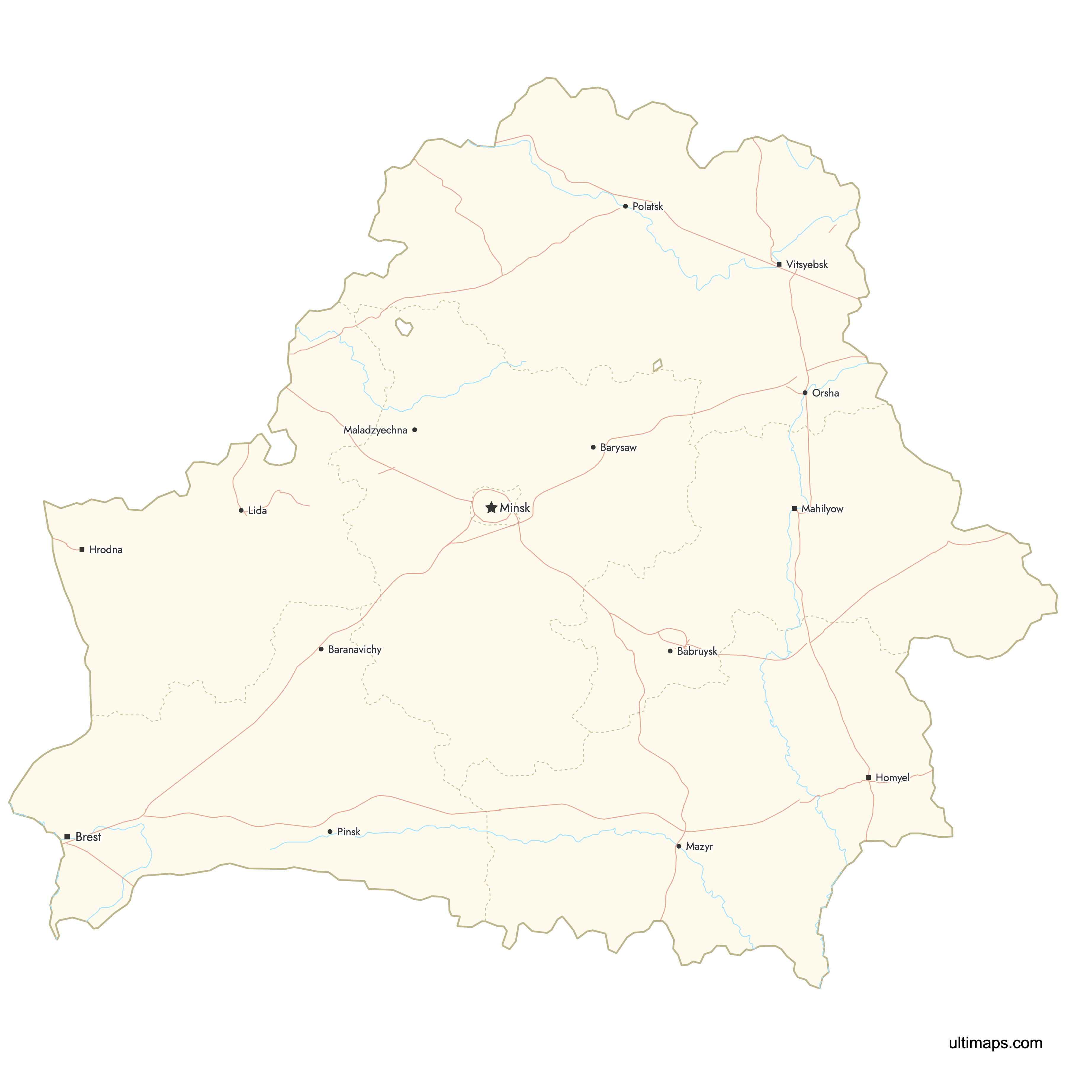
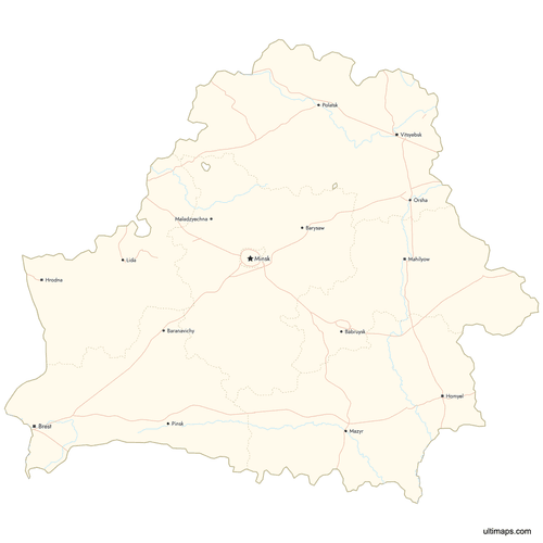 Map of Belarus with Cities and Roadspng763 KB


Need it without colors? The blank version of this map comes as a print-ready PDF (A4 and US Letter), a PNG and an editable SVG.
Custom Map Features
This map supports labels.
This map supports surrounding areas, roads, rivers and cities. New
This map is divided into 7 regions.
Updates
May 14, 2026:
- Added map of Belarus Regions with surrounding countries, cities, roads, rivers and lakes
Frequently Asked Questions
Belarus has 7 first-level administrative units: the six oblasts of Brest, Gomel, Grodno, Minsk, Mogilev and Vitebsk, plus the City of Minsk. Minsk City is not part of Minsk Oblast. It is run separately and ranks alongside the oblasts, which is why official descriptions usually say six regions and one special-status capital rather than seven regions. This map displays all seven shapes. Below that tier the oblasts hold 118 raions (districts), and Minsk City is divided into 9 more.
The largest region in Belarus depends on the source. By 2024 figures, Gomel Oblast ranks first at 40,361.66 km² (15,584.86 sq mi), with Vitebsk Oblast at 40,049.99 km² (15,463.66 sq mi) and Minsk Oblast at 39,912.35 km² (15,407.10 sq mi) close behind. The official Belarusian presidential site instead names Minsk Oblast as the country's largest administrative region. Only about 449 km² separate the top and third-placed figures, so different datasets and measurement dates flip the order. Whichever ranking you use, the three sit in the southeast, the north and the center of the country.
The City of Minsk is the most populated region of Belarus, with 1,992,862 residents in 2024. That is more than any oblast, and it sits inside just 305.50 km² (117.95 sq mi), the smallest area of the seven units, giving Minsk by far the highest population density in the country. Minsk Oblast ranks second at 1,460,289 (2024), followed by Gomel Oblast with 1,338,617 and Brest Oblast with 1,308,569. Vitebsk Oblast has 1,081,911, Grodno Oblast 992,556, and Mogilev Oblast the fewest at 981,174 (all 2024). Minsk City itself is administered through 9 urban raions.
Minsk is both a city with region-level status and the name of a separate oblast, and the two are distinct units. The City of Minsk covers 305.50 km² (117.95 sq mi) and had 1,992,862 residents in 2024. Minsk Oblast is the surrounding territory, covering 39,912.35 km² (15,407.10 sq mi) with 1,460,289 people in 2024. The city lies geographically inside the oblast but is not administered by it, and it still serves as the oblast's administrative center. On this map they appear as two shapes, which is why the total comes to seven.
Belarusian region names appear in two forms in English because some sources transliterate from Russian and others from Belarusian. Grodno is also written Hrodna, Gomel appears as Homyel or Homiel, Mogilev as Mahilyow, and Vitebsk as Vitsebsk. Brest and Minsk read the same either way. The Russian-based spellings dominate older atlases and much English news coverage, while the Belarusian-based forms turn up in UN place-name lists and newer cartography. Both sets point to the same six oblasts, and each oblast shares its name with its capital city, so the city spellings vary in exactly the same way.
Belarus borders five countries and has no coastline. Lithuania and Latvia lie to the northwest and north, Russia to the north and east, Ukraine to the south, and Poland to the west. The borders fall on specific oblasts: Vitebsk touches Latvia, Lithuania and Russia, Grodno meets Lithuania and Poland, Brest runs along Poland and Ukraine, Gomel faces Ukraine and Russia, and Mogilev borders Russia. Minsk Oblast and the City of Minsk are the only two of the seven units with no international frontier.
Belarus is divided into 118 raions, usually translated as districts, which form the tier directly below the six oblasts. The City of Minsk adds 9 urban raions of its own, administered as part of the capital rather than as part of Minsk Oblast. Raions handle local administration and most are named after their principal town. The Ultimaps map on this page covers the seven top-level units only, so it shows oblast and Minsk City boundaries rather than the 118 raion outlines.
Ultimaps needs only a browser tab to build a Belarus map — no installation, no account. Coloring can be manual or data-driven. Manually, you pick a unit — Vitebsk Oblast, say, or the City of Minsk — and set its fill. With data, a spreadsheet holding one value per region drives the shading of all seven units. Beyond the fills, you can switch the palette, restyle the background, adjust the border weight and edit the text and font of every label. Labeled markers go on Minsk, Brest, Polotsk or any spot you specify by coordinates. Finished maps export in PNG, PDF or SVG format.