Middle East Map
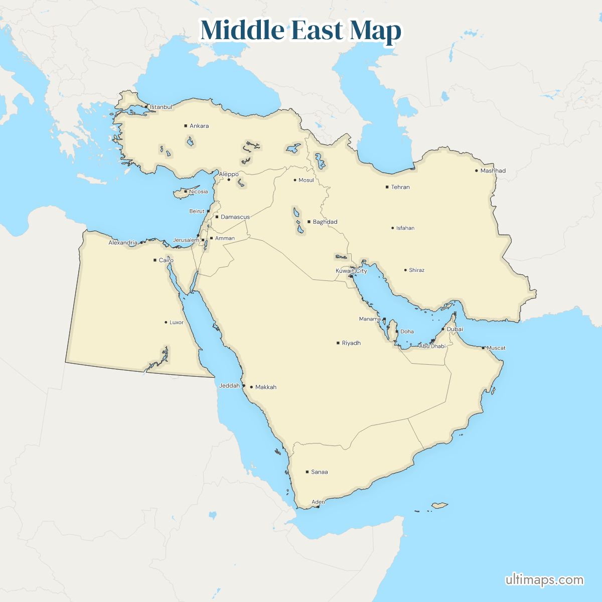
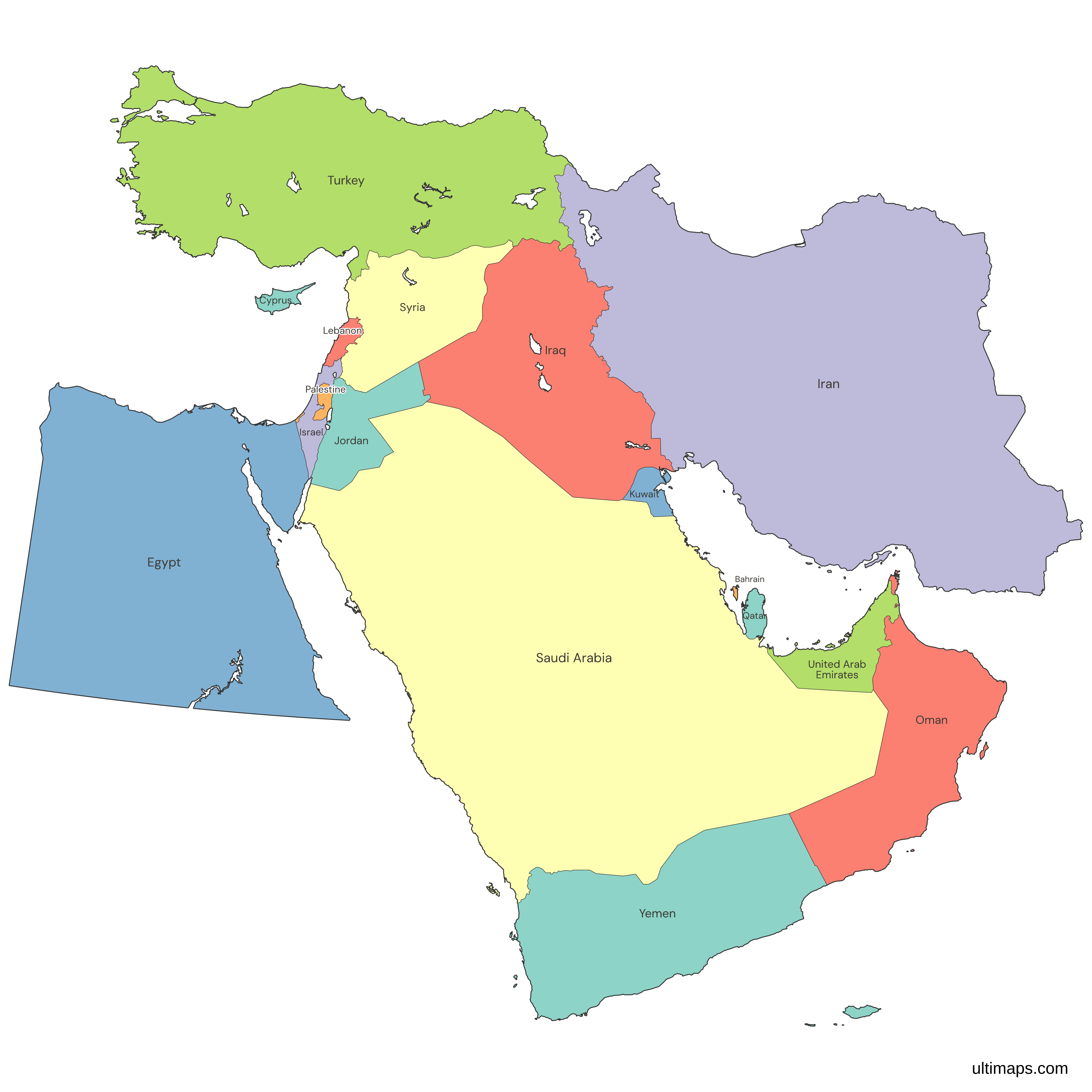
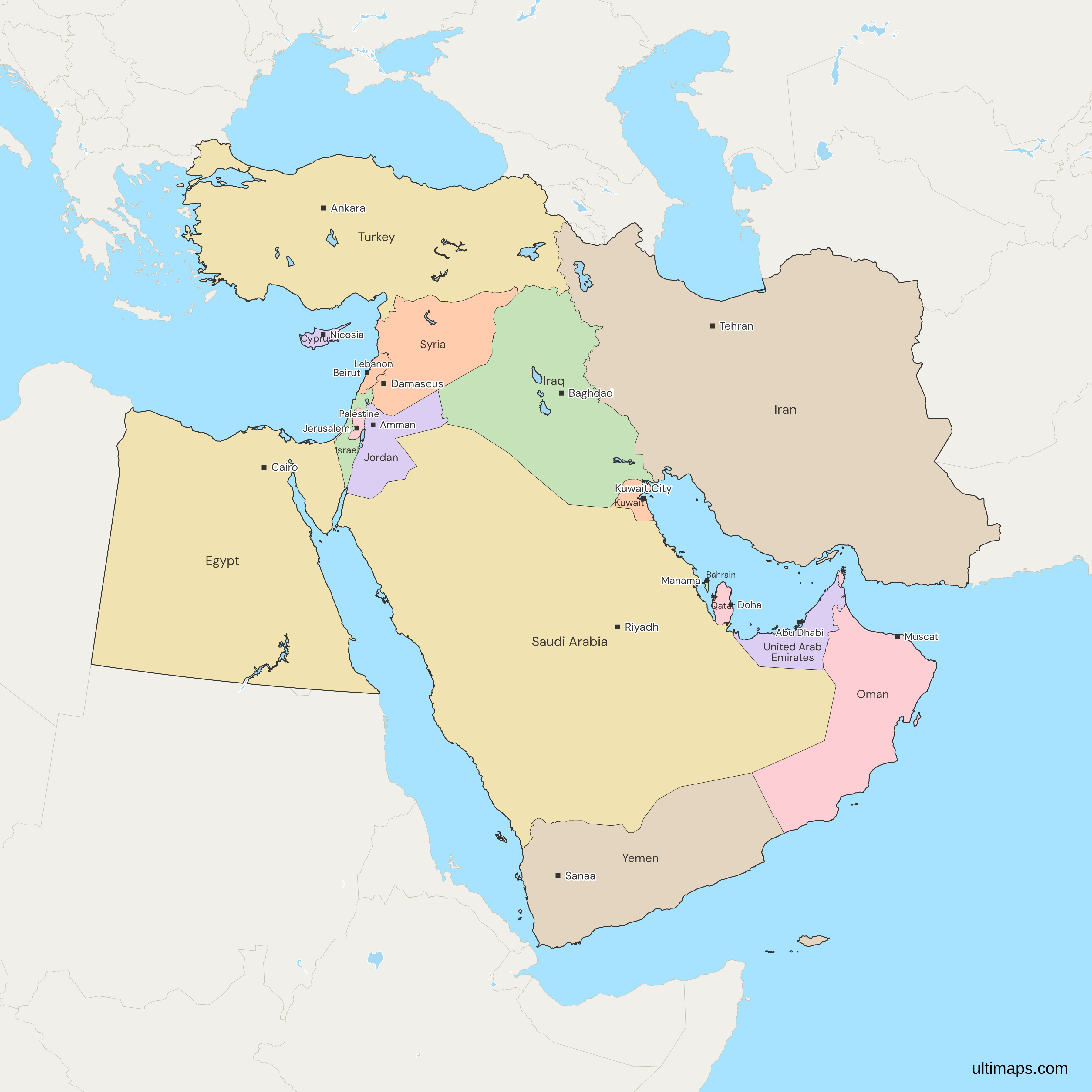
This map of the Middle East shows all 17 countries, Bahrain, Cyprus, Egypt, Iran, Iraq, Israel, Jordan, Kuwait, Lebanon, Oman, Palestine, Qatar, Saudi Arabia, Syria, Turkey, the United Arab Emirates and Yemen. No treaty defines the Middle East. Egypt, mostly in Africa, and Turkey, partly in Europe, are on its usual narrow list. Libya and Sudan in Africa, Afghanistan and Pakistan to the east and the South Caucasus to the north are in gray, as only wider definitions count them. The 17 countries had about 509 million people in 2025 (World Bank), with Egypt the most populous at about 118 million. Some East Jerusalem residents may be counted twice or missed.
Open the map in the free Ultimaps editor to make your own custom map of the Middle East. You can color the countries by your data, add pins and labels, and share or embed the finished map.
Interactive Middle East Map
List of Countries (17)
| # | Country | Capital | Population (2025) | GDP per capita (US$, 2024) | Land area (km², 2024) |
|---|---|---|---|---|---|
| 1 | Bahrain | Manama | 1,600,366 | 29,717 | 800 |
| 2 | Cyprus | Nicosia | 1,370,754 | 38,674 | 9,240 |
| 3 | Egypt | Cairo | 118,365,995 | 3,338 | 995,450 |
| 4 | Iran | Tehran | 92,417,681 | 5,190 | 1,622,500 |
| 5 | Iraq | Baghdad | 47,020,774 | 6,074 | 434,130 |
| 6 | Israel | Jerusalem | 10,122,800 | 54,217 | 21,640 |
| 7 | Jordan | Amman | 11,520,684 | 5,074 | 88,794 |
| 8 | Kuwait | Kuwait City | 4,865,298 | 32,856 | 17,820 |
| 9 | Lebanon | Beirut | 5,849,421 | 4,473 | 10,230 |
| 10 | Oman | Muscat | 5,494,691 | 20,285 | 309,500 |
| 11 | Palestine | Ramallah (seat of the Palestinian Authority); East Jerusalem (proclaimed) | 5,413,596 | 3,028 | 6,025 |
| 12 | Qatar | Doha | 2,972,215 | 75,685 | 11,490 |
| 13 | Saudi Arabia | Riyadh | 36,973,555 | 35,528 | 2,149,690 |
| 14 | Syria | Damascus | 25,620,427 | — | 183,630 |
| 15 | Turkey | Ankara | 85,878,556 | 15,893 | 769,630 |
| 16 | United Arab Emirates | Abu Dhabi | 11,513,149 | 50,274 | 71,020 |
| 17 | Yemen | Sanaa (constitutional); Aden (temporary capital of the recognised government) | 41,773,878 | — | 527,968 |
Data sources:
- Capital: Ultimaps, compiled from national constitutions and statutes (cross-checked against Natural Earth). License: facts compiled by Ultimaps, CC BY 4.0.
- Population: World Bank, World Development Indicators (SP.POP.TOTL). License: CC BY 4.0.
- GDP per capita: World Bank, World Development Indicators (NY.GDP.PCAP.CD). License: CC BY 4.0.
- Land area: World Bank, World Development Indicators (AG.LND.TOTL.K2). License: CC BY 4.0.
Middle East Countries: Key Facts
- Members: Bahrain, Cyprus, Egypt, Iran, Iraq, Israel, Jordan, Kuwait, Lebanon, Oman, Palestine, Qatar, Saudi Arabia, Syria, Turkey, the United Arab Emirates and Yemen, 17 in all.
- Definition: lists of Middle East countries agree on the Arabian Peninsula and the Levant and disagree about the neighbors. This map follows the common 17-country list.
- Edge members: Turkey and Egypt each lie partly outside Asia: Turkey's East Thrace is in Europe, and Egypt reaches Asia only in the Sinai Peninsula. The UN's statistical regions put Cyprus and Turkey in Western Asia, but Egypt in Northern Africa and Iran in Southern Asia.
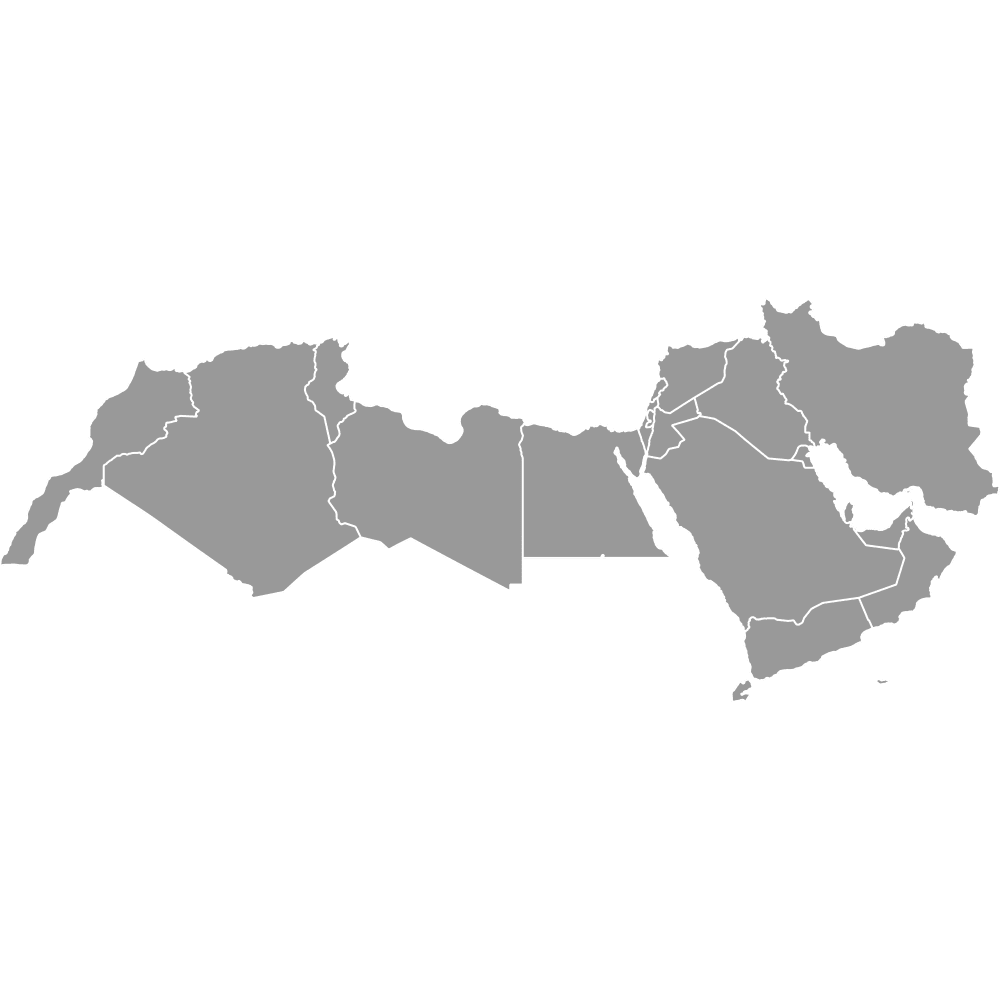
- Arab world: the Middle East is not the same as the Arab world. Thirteen of the 17 Middle East countries belong to the Arab League, and Cyprus, Iran, Israel and Turkey do not. The League's other nine members are all in Africa: Algeria, Comoros, Djibouti, Libya, Mauritania, Morocco, Somalia, Sudan and Tunisia. Morocco, Libya and Sudan are outside the Middle East on the usual definition. For the Middle East together with North Africa, from Morocco to Iran, use the MENA map, which adds Algeria, Djibouti, Libya, Morocco and Tunisia and leaves out Cyprus and Turkey. The EMEA map covers Europe, the Middle East and Africa as one business region.
- Largest and smallest by land: Saudi Arabia is the largest country in the Middle East, with 2,149,690 km² of land, and Iran is second with 1,622,500 km². Bahrain is the smallest at 800 km², up from 778 km² in 2015 through land reclamation (World Bank, 2024).
- Most and least populous: Egypt had 118,365,995 people in 2025, Iran 92,417,681 and Turkey 85,878,556, together more than half of the 17 countries' total (World Bank). Cyprus and Bahrain, the two island members, had the smallest populations in the Middle East, 1,370,754 and 1,600,366 in 2025 (World Bank).
- Combined population: about 509 million in 2025 (508,773,840, the sum of the 17 World Bank estimates). Israel's statistics office counts East Jerusalem, the Golan Heights and Israeli residents of the West Bank in Israel's population. The World Bank does not state how its Israel and Palestine figures treat these areas, so the sum may count some residents twice or not at all.
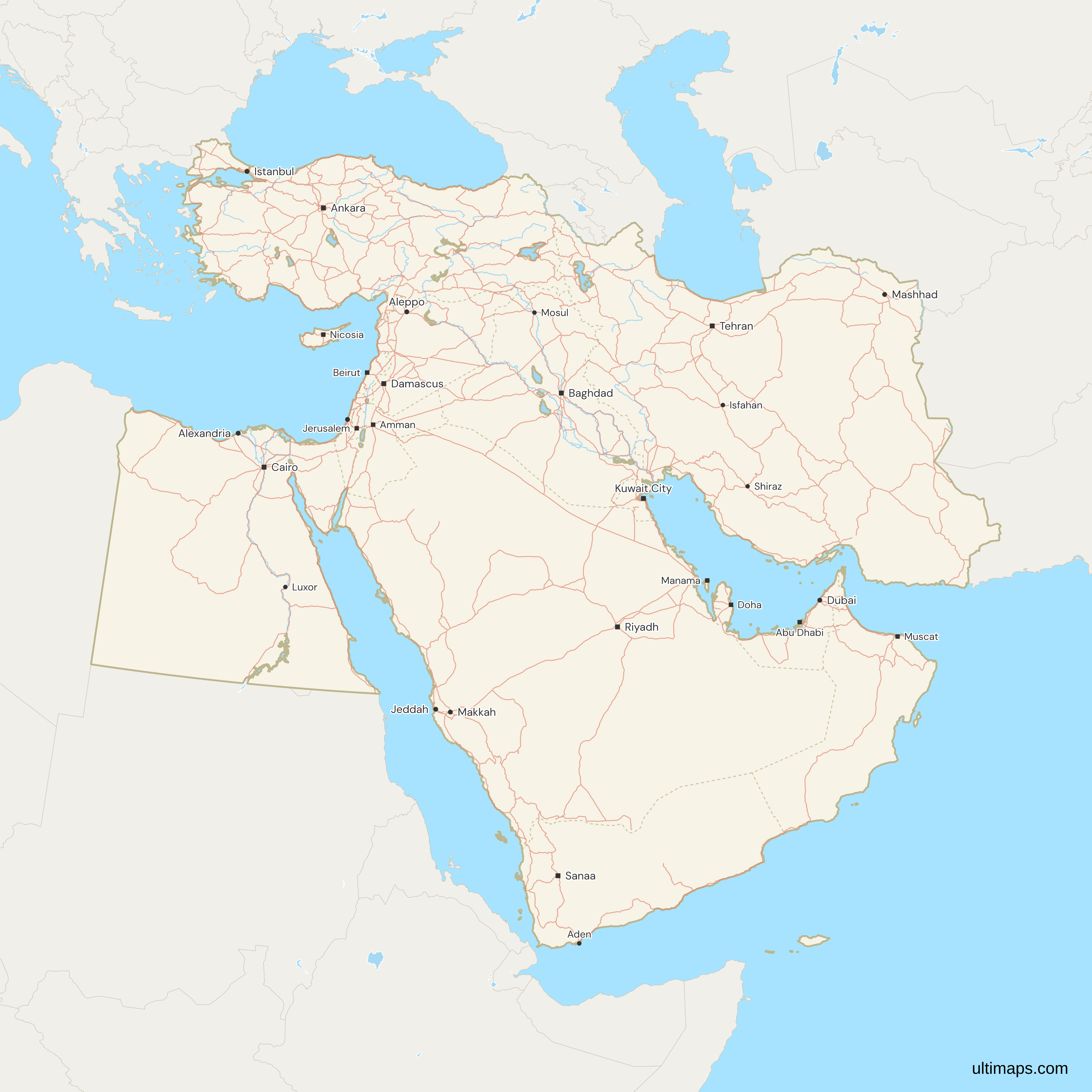
- Capitals: Manama (Bahrain), Nicosia (Cyprus), Cairo (Egypt), Tehran (Iran), Baghdad (Iraq), Jerusalem (Israel), Amman (Jordan), Kuwait City (Kuwait), Beirut (Lebanon), Muscat (Oman), Doha (Qatar), Riyadh (Saudi Arabia), Damascus (Syria), Ankara (Turkey) and Abu Dhabi (United Arab Emirates). Palestine proclaims East Jerusalem as its capital, and its government sits in Ramallah. Yemen's constitution names Sanaa, which the Houthis have held since 2014, and the recognized government has used Aden as its temporary capital since 2015. The map labels all 17 countries by name, with Palestine's label over the West Bank, and draws 16 capitals as squares, along with other major cities, roads, rivers and lakes. Palestine has no city marker: Natural Earth, the map's source, lists none of its cities as a national capital, and at this scale the names of Gaza City and Hebron overlap nearby city names.
- Borders: the 17 have land borders with 10 countries outside the group. Libya and Sudan touch only Egypt. The other eight border Turkey or Iran, and Armenia and Azerbaijan border both. Turkey's other outside neighbors are Greece, Bulgaria and Georgia, and Iran's are Turkmenistan, Afghanistan and Pakistan. Inside the group, Saudi Arabia borders 7 of the other 16, while Cyprus and Bahrain border none. Hatay appears on the map as part of Turkey, which made it a province in 1939, although Syria has claimed it.
- Egypt and Sudan: Egypt and Sudan both claim the Halaib triangle on the Red Sea, and the map puts it inside Egypt, which administers it. Bir Tawil, inland to its west, is claimed by neither country and is drawn as a separate gray area.
- Israel and Palestine: Palestine is one unit in two parts, the West Bank and the Gaza Strip. East Jerusalem and the Golan Heights, which Israel has administered since 1967, are drawn inside Israel, as the Natural Earth source data draws them. Palestine claims East Jerusalem, and Syria claims the Golan.
- Cyprus and the Gulf islands: Cyprus is one unit for the whole island, as on the Ultimaps map of Europe. It takes in the area the Republic of Cyprus governs, the north under a Turkish Cypriot administration that only Turkey recognizes, the UN buffer zone and the British bases at Akrotiri and Dhekelia. Iran administers Abu Musa, and the UAE claims it. The map draws it as Iran's. Greater and Lesser Tunb, also held by Iran and claimed by the UAE, are missing from the source data and do not appear, and neither do three small Abu Dhabi islets, among them Zirku and Sir Abu Nu'ayr.
Interesting Facts
- Hawar Islands: Bahrain is drawn in 7 parts, among them the Hawar Islands off Qatar's west coast, which the International Court of Justice awarded to Bahrain on 16 March 2001.
- Tiran and Sanafir: the Natural Earth source data lists these two islands at the mouth of the Gulf of Aqaba as Egypt's. This map draws them as Saudi Arabia's, following the agreement Egypt ratified on 24 June 2017.
- Enclave inside an enclave: Madha, a small piece of Oman surrounded by the UAE, itself surrounds Nahwa, a village that belongs to the UAE. The map draws both.
Free Downloads
Free for personal and commercial use with a credit to Ultimaps. See the license terms for details.
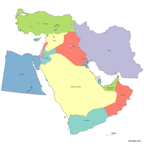 Colored Middle East Mappng546 KB
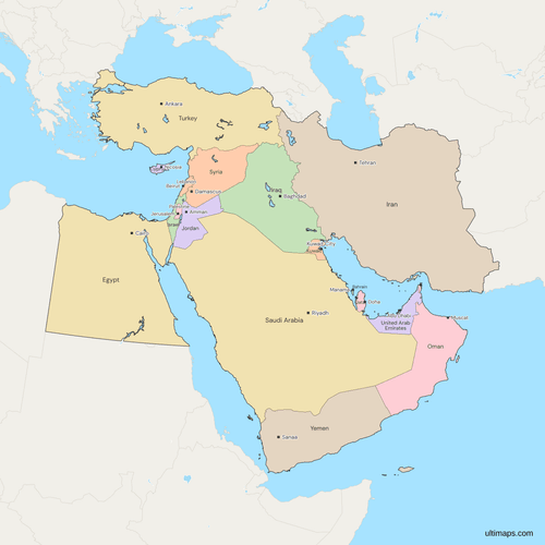 Political Map of the Middle East with Countriespng933 KB
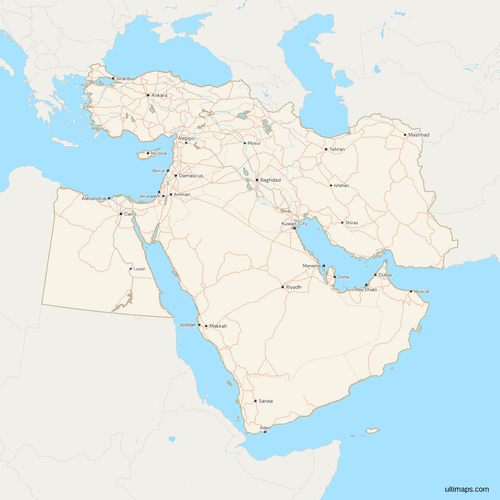 Map of the Middle East with Cities and Roadspng1434 KB
Need it without colors? The blank version of this map comes as a print-ready PDF (A4 and US Letter), a PNG and an editable SVG.
Custom Map Features
This map supports labels.
This map supports surrounding areas, roads, rivers and cities. New
This map is divided into 17 countries.
Updates
Nov 5, 2026:
- Added map of Middle East countries
Frequently Asked Questions
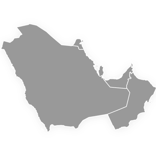
The Middle East on this map is 17 countries: Bahrain, Cyprus, Egypt, Iran, Iraq, Israel, Jordan, Kuwait, Lebanon, Oman, Palestine, Qatar, Saudi Arabia, Syria, Turkey, the United Arab Emirates and Yemen. There is no official list, since no treaty or organization fixes the membership, and these 17 make up the region's common narrow definition. Wider definitions reach north to Armenia, Azerbaijan and Georgia, east to Afghanistan and Pakistan, or deeper into Africa, to Libya and Sudan. Six of the 17, Bahrain, Kuwait, Oman, Qatar, Saudi Arabia and the United Arab Emirates, founded the Gulf Cooperation Council in 1981. The Gulf States map shows those six on their own.
The Middle East has 17 countries on this map: 16 UN member states and Palestine, a non-member observer state at the United Nations since 2012. Palestine counts once, for the West Bank and the Gaza Strip together. Northern Cyprus, which only Turkey recognizes as a state, is not counted as a separate country: the map draws the whole island as Cyprus. Adding Armenia, Azerbaijan and Georgia, as some lists do, makes 20, and the Greater Middle East adds Afghanistan and Pakistan as well.
Yes, most lists of Middle East countries include Turkey, though East Thrace, about 3% of the country, lies in Europe, west of the Bosporus and the Dardanelles. The rest is Anatolia, in Asia, where the capital, Ankara, stands. Istanbul, the largest city, spans the Bosporus and so sits on both continents. Turkey borders three other members, Syria, Iraq and Iran, and on the European side it borders Greece and Bulgaria. In UN statistics the whole country, East Thrace included, counts as Western Asia.
Yes, Egypt is one of the 17 Middle East countries on this map, although most of Egypt lies in Africa. Its Asian part is the Sinai Peninsula, across the Suez Canal from Cairo and the Nile valley. In the Sinai, Egypt borders Israel and the Gaza Strip, part of Palestine. Lists built on the UN's statistical regions leave Egypt out, because the UN counts it in Northern Africa. Its other two land neighbors, Libya to the west and Sudan to the south, are not counted in the Middle East.
No, most definitions of the Middle East put Pakistan in South Asia and Afghanistan in South or Central Asia. Iran, to their west, is the only Middle East country that either of them borders. They belong to the South Asian Association for Regional Cooperation, Pakistan as a founding member in 1985 and Afghanistan since 2007. The Greater Middle East, a term used in US foreign policy in the 2000s, includes both, and some university area-studies lists add Afghanistan together with North African states.
Yes, Iran appears on the narrow lists of Middle East countries and on the wider ones that add Afghanistan and Pakistan. It is the easternmost of the 17 countries on this map. Turkmenistan, Afghanistan and Pakistan, its neighbors to the north-east and east, are outside the group. Iraq and Turkey, which are both members, share its western border. The UN's statistical regions place it elsewhere, in Southern Asia with Afghanistan, Pakistan and India. Its 31 provinces are drawn on the Iran provinces map.
The Middle East is Southwest Asia plus Egypt, a region with no official borders. Its name describes the region as seen from Western Europe. Western writers once split the East into a Near East nearest Europe, a Middle East from the Persian Gulf toward India and a Far East of China and Japan. The US naval strategist Alfred Thayer Mahan popularized the term in 1902 for the area between Arabia and India. In the 20th century the name spread west over the Near East, and politicians and reporters use the two interchangeably. The older name, Near East, survives in archaeology and in the US State Department's Bureau of Near Eastern Affairs. UN statistics call most of the area Western Asia.
Armenia, Azerbaijan and Georgia are outside the Middle East on most lists. Together they form the South Caucasus, the land between the Black Sea and the Caspian Sea. Some longer lists take them in, and Western Asia, a UN statistical region, groups them with 15 of the 17 Middle East countries. All three were Soviet republics until the Soviet Union dissolved in 1991, when each became an independent state. No country on the usual Middle East list was ever part of the Soviet Union.
Open the Middle East map in the free Ultimaps editor, no account needed, and paste a table with one row per country. English names, World Bank forms such as "Iran, Islamic Rep.", UAE and ISO codes such as SAU all match. Coloring the 17 countries by hand works too. Place a pin on a city the map leaves out, such as Basra, and type labels where you need text. When the map is ready, create a free account to save and publish it, then use its share link or embed code. Exports on the free plan are a standard PNG with a small Ultimaps credit. On Ultimaps Pro, you can export high-resolution PNG, SVG and PDF files.